MyTopo
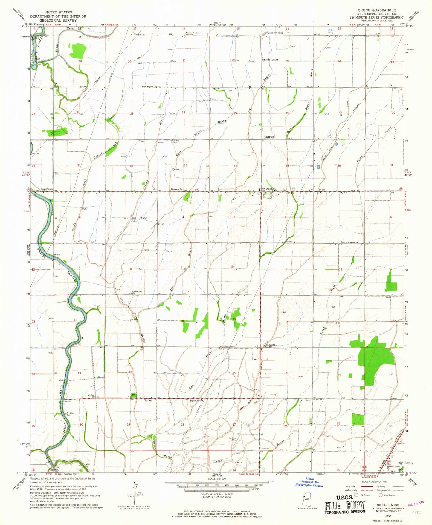
Classic USGS Skene Mississippi 7.5'x7.5' Topo Map
Couldn't load pickup availability
Historical USGS topographic quad map of Skene in the state of Mississippi. Map scale may vary for some years, but is generally around 1:24,000. Print size is approximately 24" x 27"
This quadrangle is in the following counties: Bolivar.
The map contains contour lines, roads, rivers, towns, and lakes. Printed on high-quality waterproof paper with UV fade-resistant inks, and shipped rolled.
Contains the following named places: Bear Pen Canal, Bear Pen Park, Brushy Bayou, Camp Slough Canal, Chesterfield Church, Cleveland Crossing, Damascus Church, Ditch Number E-3, Ditch Number E-5, Ditch Number E-7, Ditch Number Four, Ditch Number Nine, Ditch Number One, Ditch Number Seventeen, Ditch Number Ten, Ditch Number Three, Ditch Number Twenty, Ditch Number Twentyeight, Ditch Number Twentynine, Ditch Number Twentysix, East Bogue Hasty, El Bethel Church, Gospel Temple, Grassy Lake, Icy Bayou, Judge Brizzell Pond Dam, Laughlin, Litton, Mission Bautista Mexicana, Mount Olive Church, Mount Pilgrim Church, Mount Zion Cemetery, Mount Zion Church, New Saint James Church, Pecan Bayou, Pleasant Grove Church, Poplar Grove Church, Saint John Church, Saint Paul Church, Sandy Slough, Skene, Skene Census Designated Place, Skene School, Snake Creek, Supervisor District 5, West Bogue Hasty, ZIP Code: 38730