MyTopo
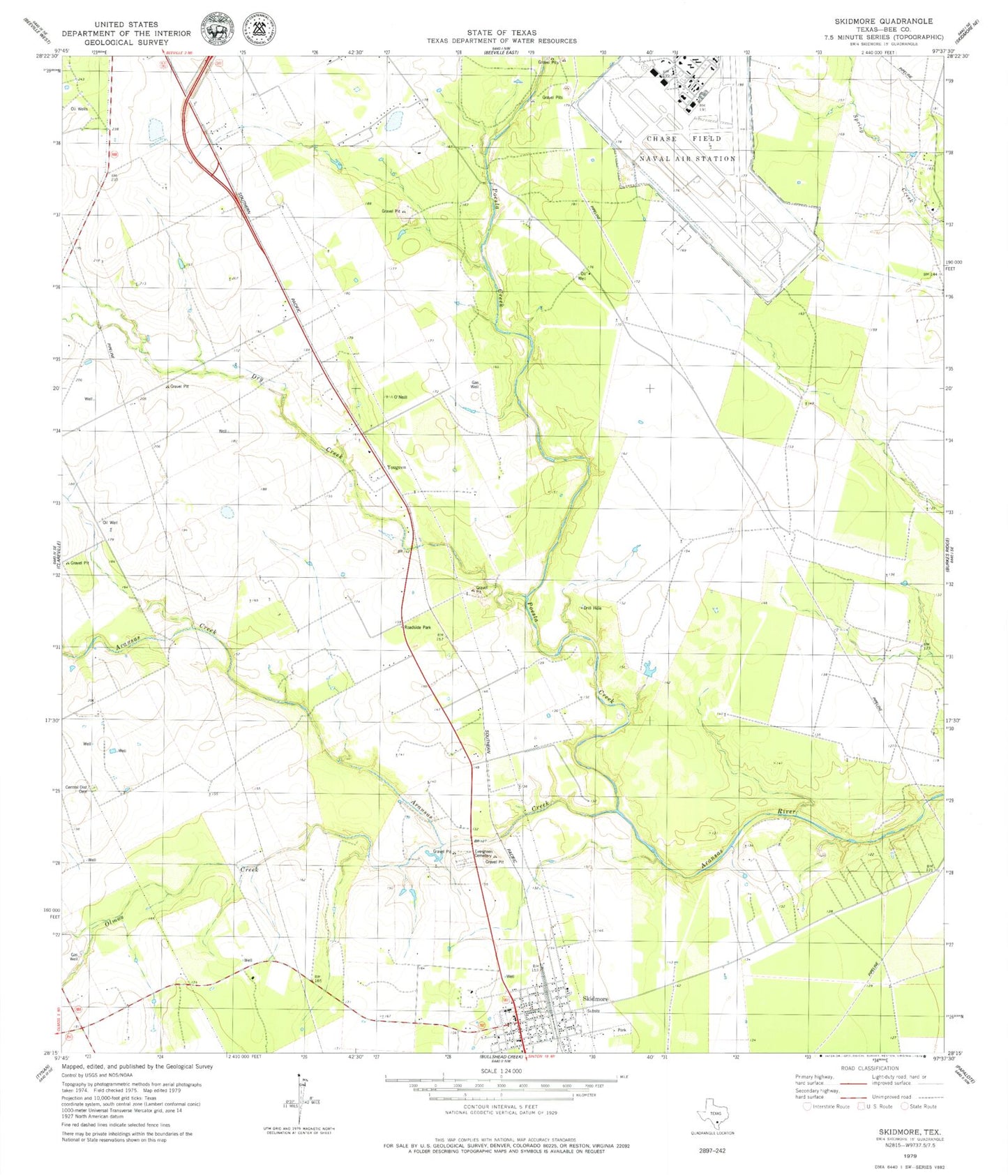
Classic USGS Skidmore Texas 7.5'x7.5' Topo Map
Couldn't load pickup availability
Historical USGS topographic quad map of Skidmore in the state of Texas. Map scale may vary for some years, but is generally around 1:24,000. Print size is approximately 24" x 27"
This quadrangle is in the following counties: Bee.
The map contains contour lines, roads, rivers, towns, and lakes. Printed on high-quality waterproof paper with UV fade-resistant inks, and shipped rolled.
Contains the following named places: Aransas Creek, Chase Field Industrial Airport, Dry Creek, Evergreen Cemetery, Little Dry Creek, Olmos Creek, Poesta Creek, Salt Branch, Skidmore, Skidmore - Tynan Elementary School, Skidmore - Tynan High School, Skidmore - Tynan Junior High School, Skidmore Census Designated Place, Skidmore Post Office, Skidmore Volunteer Fire Department, Texas Department of Criminal Justice William G McConnell Unit, Yougeen