MyTopo
Classic USGS Skitwish Peak Idaho 7.5'x7.5' Topo Map
Couldn't load pickup availability
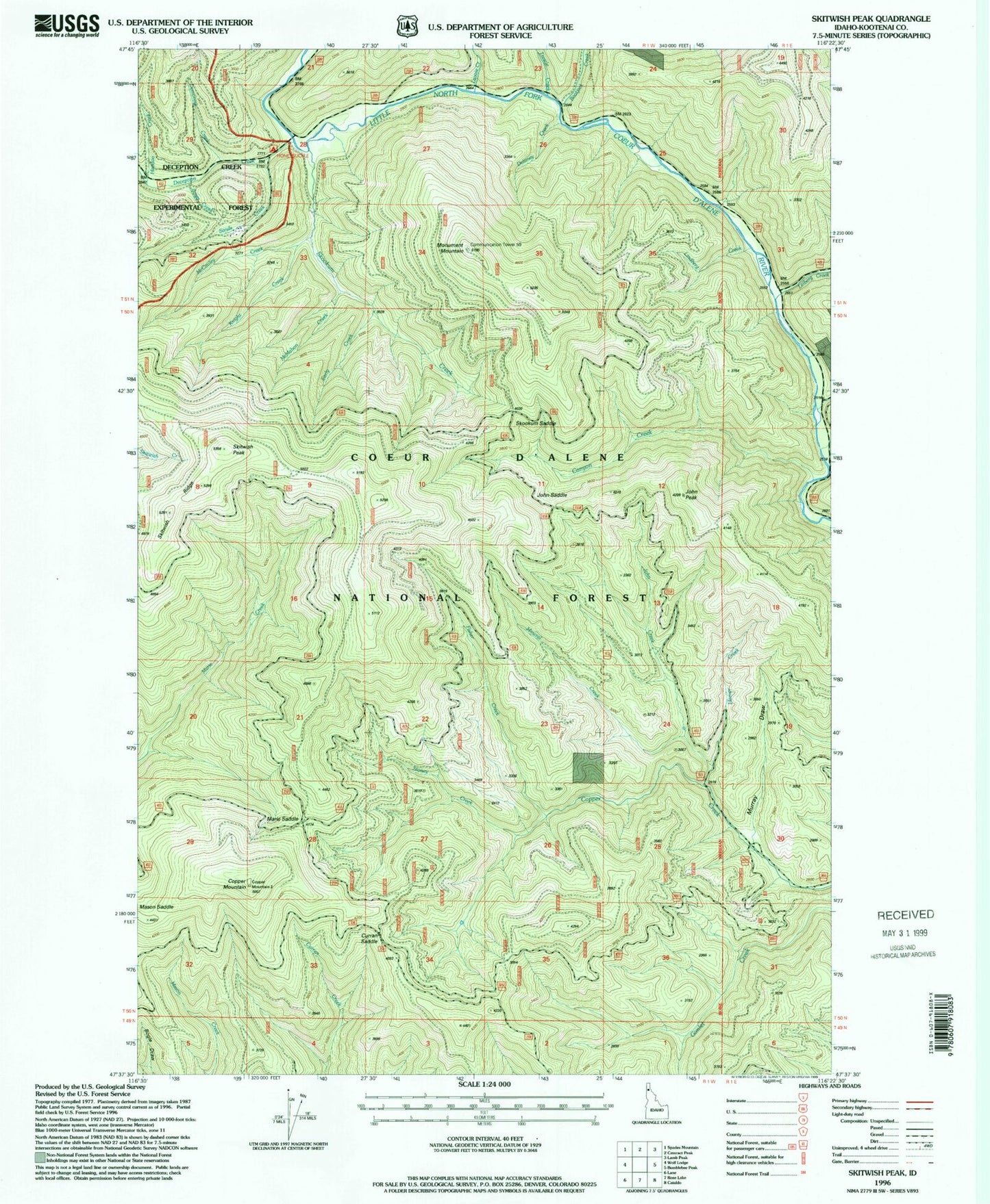
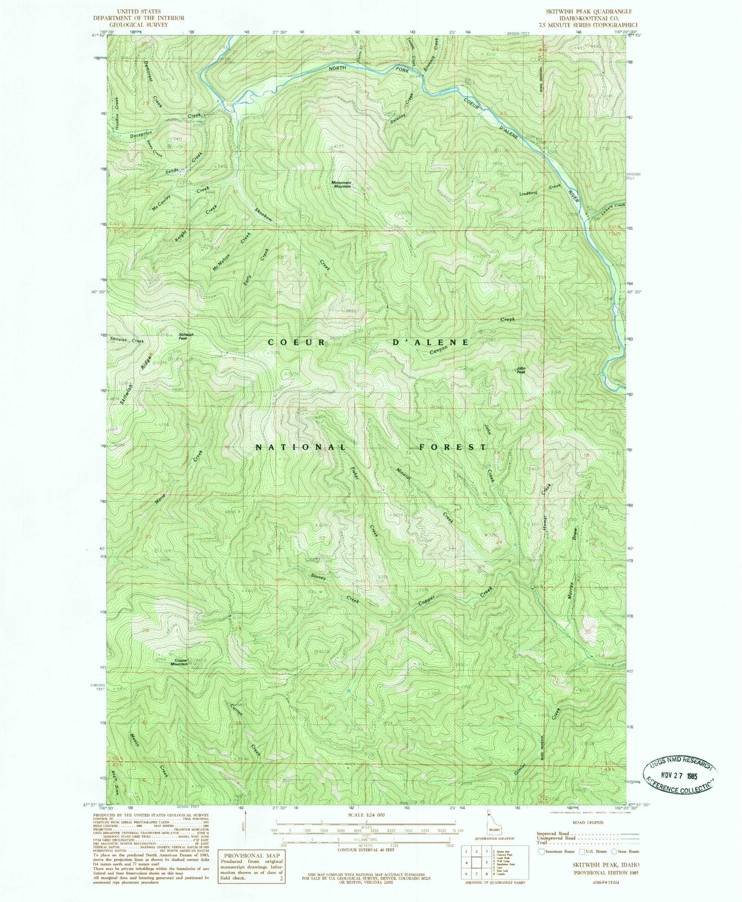
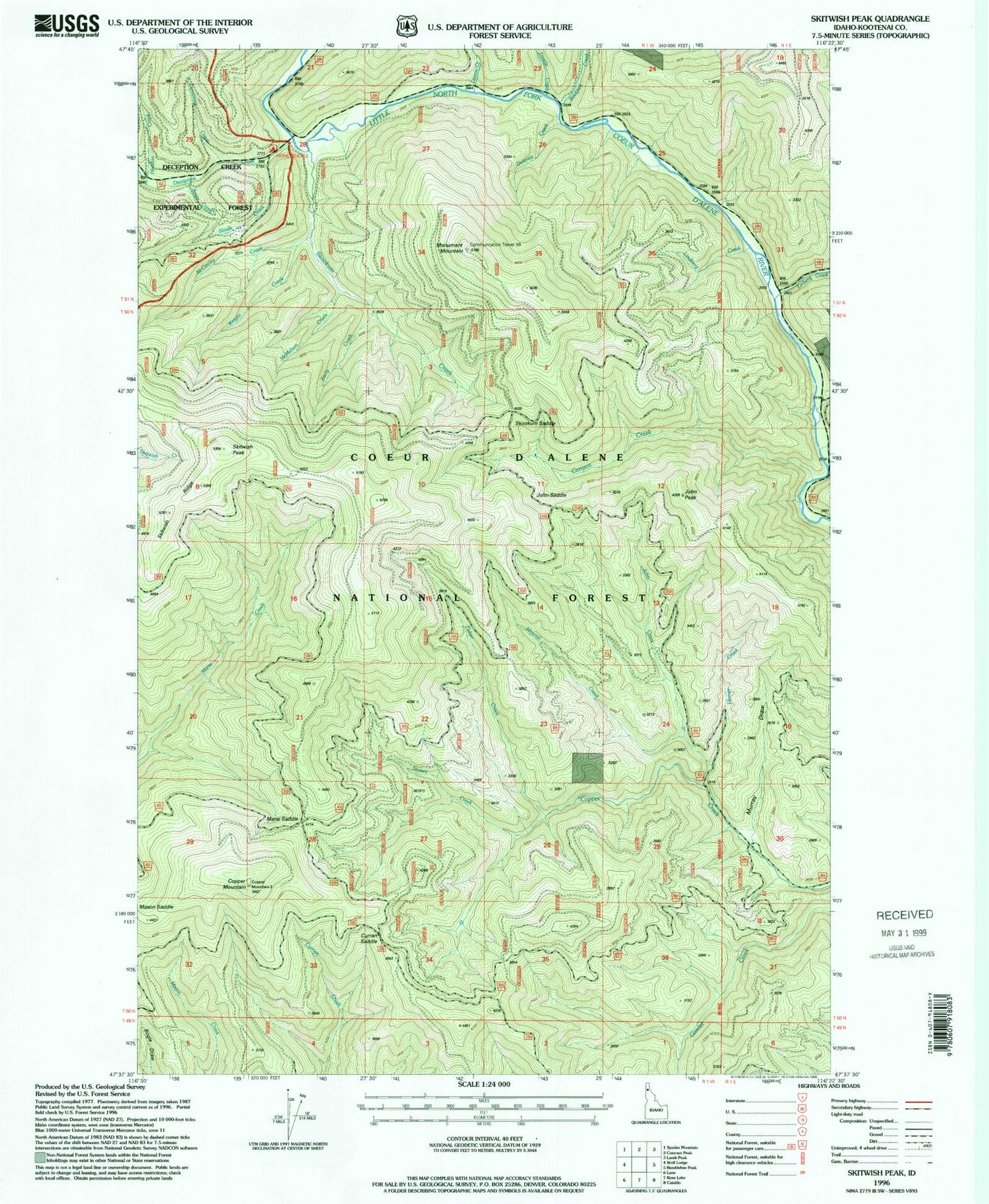
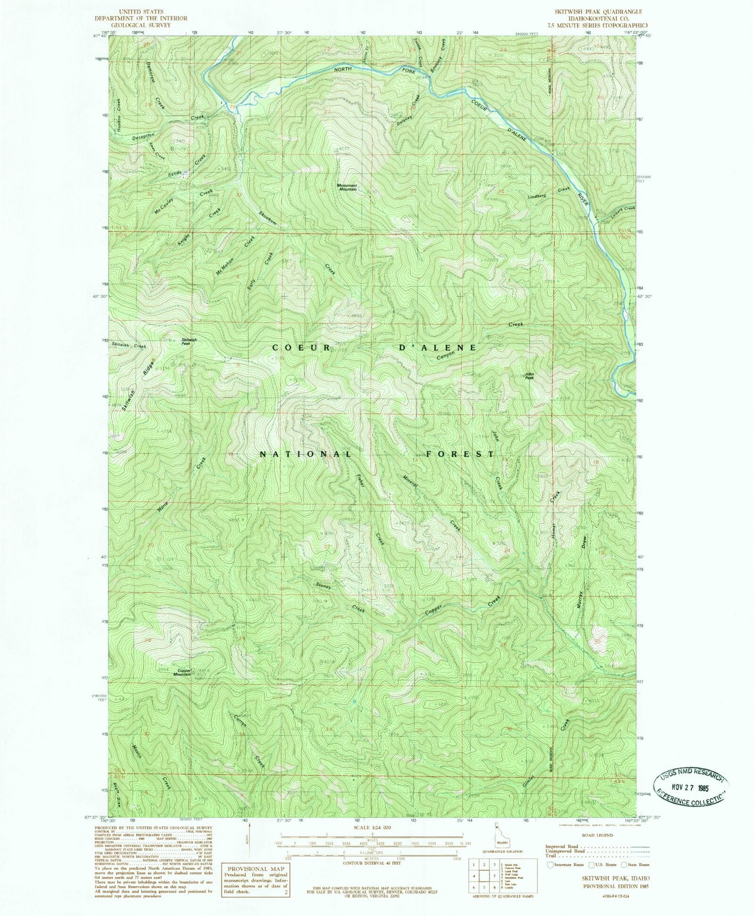
Historical USGS topographic quad map of Skitwish Peak in the state of Idaho. Map scale may vary for some years, but is generally around 1:24,000. Print size is approximately 24" x 27"
This quadrangle is in the following counties: Kootenai.
The map contains contour lines, roads, rivers, towns, and lakes. Printed on high-quality waterproof paper with UV fade-resistant inks, and shipped rolled.
Contains the following named places: Ames Creek, Bootjack Creek, Canyon Creek, Copper Mountain, Curran Saddle, Deception Creek, Delaney Creek, Demorest Creek, Early Creek, Fisher Creek, Homer Creek, Honeysuckle Campground, Hoodoo Creek, John Creek, John Peak, John Saddle, Knight Creek, Laverne Creek, Lavoie Creek, Leiberg Creek, Lindberg Creek, Marie Saddle, Mason Saddle, McCauley Creek, McMahon Creek, Mineral Creek, Monument Mountain, Murray Draw, Sands Creek, Skitwish Peak, Skitwish Ridge, Skookum Creek, Skookum Saddle, Stoney Creek, Trestle Creek