MyTopo
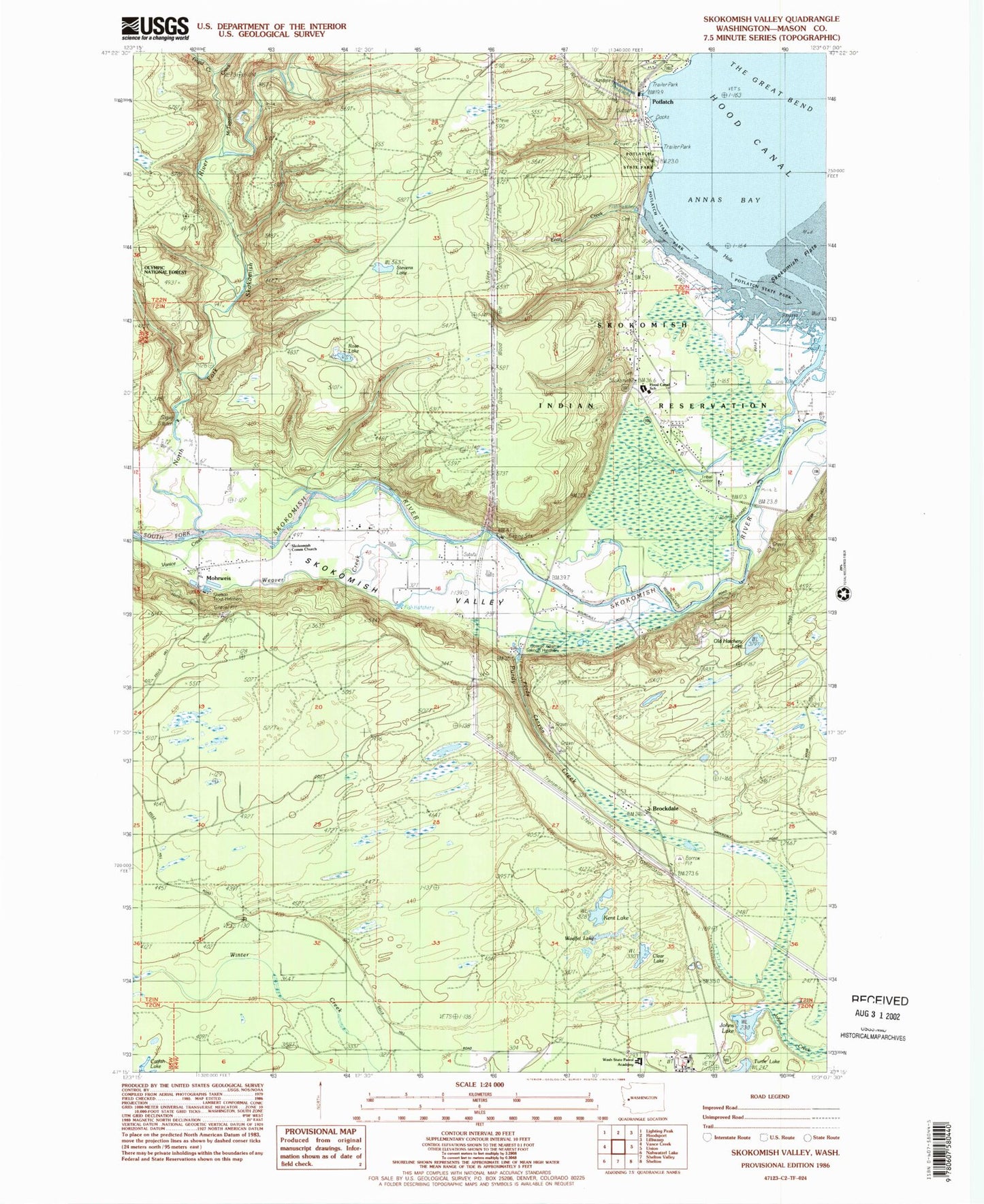
Classic USGS Skokomish Valley Washington 7.5'x7.5' Topo Map
Couldn't load pickup availability
Historical USGS topographic quad map of Skokomish Valley in the state of Washington. Map scale may vary for some years, but is generally around 1:24,000. Print size is approximately 24" x 27"
This quadrangle is in the following counties: Mason.
The map contains contour lines, roads, rivers, towns, and lakes. Printed on high-quality waterproof paper with UV fade-resistant inks, and shipped rolled.
Contains the following named places: Annas Bay, Brockdale, Church of Christ, Clear Lake, Frigid Creek, George Adams Salmon Hatchery, Hood Canal Elementary - Junior High School, Hood Canal Recreation Park Picnic Area, Hunter Creek, Indian Hole, Indian School, Johns Lake, Kent Lake, Mason County, Mason County Fire District 9, Mason County Medic One Ambulance Service, McTaggert Creek, Minerva Beach Mobile Village Resort, Mohrweis, Mussel Shell Creek, North Fork Skokomish River, Old Hatchery Lake, Potlatch State Park, Potlatch State Park Campground, Purdy Canyon, Purdy Creek, Rose Lake, Shelton Trout Hatchery, Skokomish, Skokomish Census Designated Place, Skokomish Community Church, Skokomish Reservation, Skokomish Reservation Division, Skokomish Valley School, South Fork Skokomish River, Stevens Lake, Turtle Lake, Washington State Patrol Academy, Weaver Creek, Woelfel Lake