MyTopo
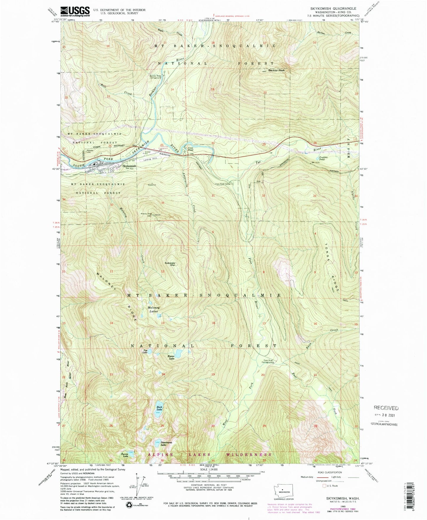
Classic USGS Skykomish Washington 7.5'x7.5' Topo Map
Couldn't load pickup availability
Historical USGS topographic quad map of Skykomish in the state of Washington. Typical map scale is 1:24,000, but may vary for certain years, if available. Print size: 24" x 27"
This quadrangle is in the following counties: King.
The map contains contour lines, roads, rivers, towns, and lakes. Printed on high-quality waterproof paper with UV fade-resistant inks, and shipped rolled.
Contains the following named places: Alpine Creek, Anthracite Creek, Beckler Peak, Beckler River, Beckler River Campground, Bolt Creek, Burn Creek, Cass Pond, Eagle Creek, East Fork Foss River, Evans Lake, Foss River, Foss River Camp, Foss River Campground, Malaney Creek, Maloney Lakes, Maloney Ridge, Panorama Lake, Profitts Pond, Purvis Lake, Rock Lake, Skykomish, Sobieski Mountain, Top Lake, Tye River, West Fork Foss River, Skykomish District Ranger Office, Alturas Lake, Skykomish School, Skykomish High School, Skykomish State Airport, Town of Skykomish, Foss River Road Bridge, South Fork Skykomish River Bridge, Skykomish Fire Department King County Fire Protection District Number 50 Station Number 195, Skykomish Police Department, Skykomish Post Office