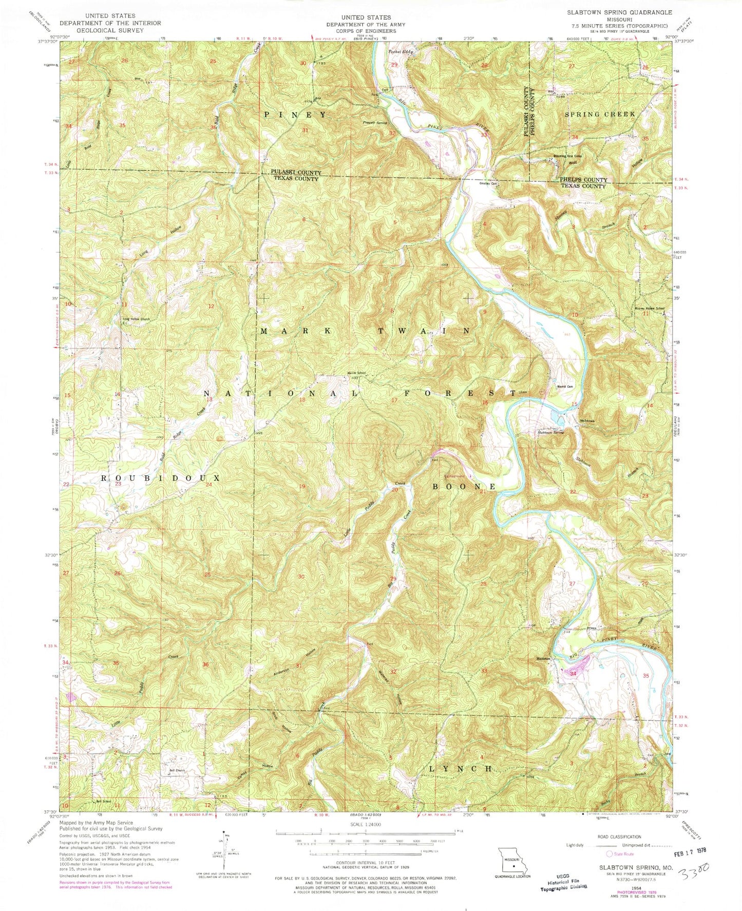
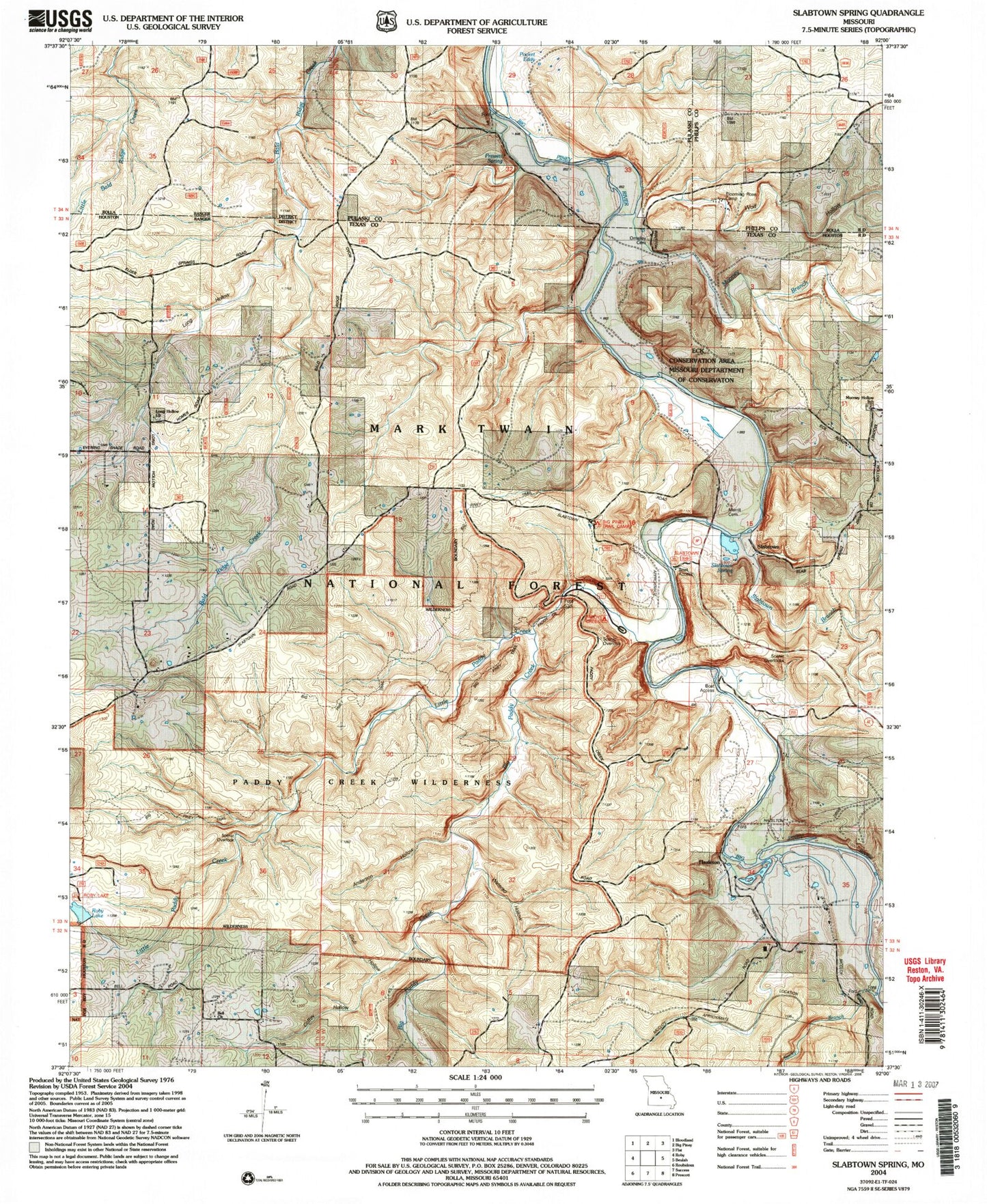
MyTopo
USGS Classic Slabtown Spring Missouri 7.5'x7.5' Topo Map
Couldn't load pickup availability
Historical USGS topographic quad map of Slabtown Spring in the state of Missouri. Scale: 1:24000. Print size: 24" x 27"
This quadrangle is in the following counties: Phelps, Pulaski, Texas.
The map contains contour lines, roads, rivers, towns, lakes, and grids including latitude / longitude and UTM / MGRS. Printed on high-quality waterproof paper with UV fade-resistant inks.
Contains the following named places: Harmon Valley School, Edanville, Hazleton Mill, Long Hollow School (historical), Ladd, Anderson Hollow, Bell Church, Bell School, Big Paddy Creek, Blooming Rose Camp, Coffey Hollow, Grub Hollow, Hazleton, Little Paddy Creek, Long Hollow, Long Hollow Church, Merrill Cemetery, Merrill School, Mooney Branch, Mooney Hollow School, O'Malley Cemetery, Pocket Eddy, Prewett Spring, Rocky Branch, Slabtown, Slabtown Branch, Slabtown Spring, Watered Hollow, Wolf Hollow, Baldridge School (historical), Haley Bend School (historical), Big Piney Train Camp, Paddy Creek Wilderness, Paddy Creek Picnic Area, Slabtown Picnic Area, Slabtown Bluff Trail, Paddy Creek Campground, Paddy Creek Trail, Big Piney Trail, Roby Lake Picnic Area and Wilderness Trail Head, Cave Eddy Campground, Big Piney Campground, Slabtown Dam, Slabtown Lake, Roby Lake, Roby Number 1 Dam, Township of Boone, Cabbage Head, Paddy Creek Natural Arch