
MyTopo
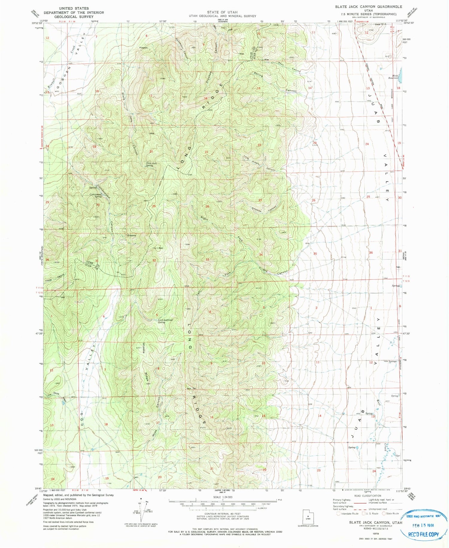
Classic USGS Slate Jack Canyon Utah 7.5'x7.5' Topo Map
Couldn't load pickup availability
Historical USGS topographic quad map of Slate Jack Canyon in the state of Utah. Map scale may vary for some years, but is generally around 1:24,000. Print size is approximately 24" x 27"
This quadrangle is in the following counties: Juab, Utah.
The map contains contour lines, roads, rivers, towns, and lakes. Printed on high-quality waterproof paper with UV fade-resistant inks, and shipped rolled.
Contains the following named places: Cottonwood Canyon, Cottonwood Spring, Crooked Canyon, Left Fork Old Canyon, Long Ridge, Long Ridge Canyon, Lunt-Lattimer Spring, Middle Ridge, Old Canyon, Pass Canyon, Right Fork Old Canyon, Slate Jack Canyon, Slate Jack Spring, Spring Canyon, Swasey Family Cemetery, West Creek, Wide Canyon


