MyTopo
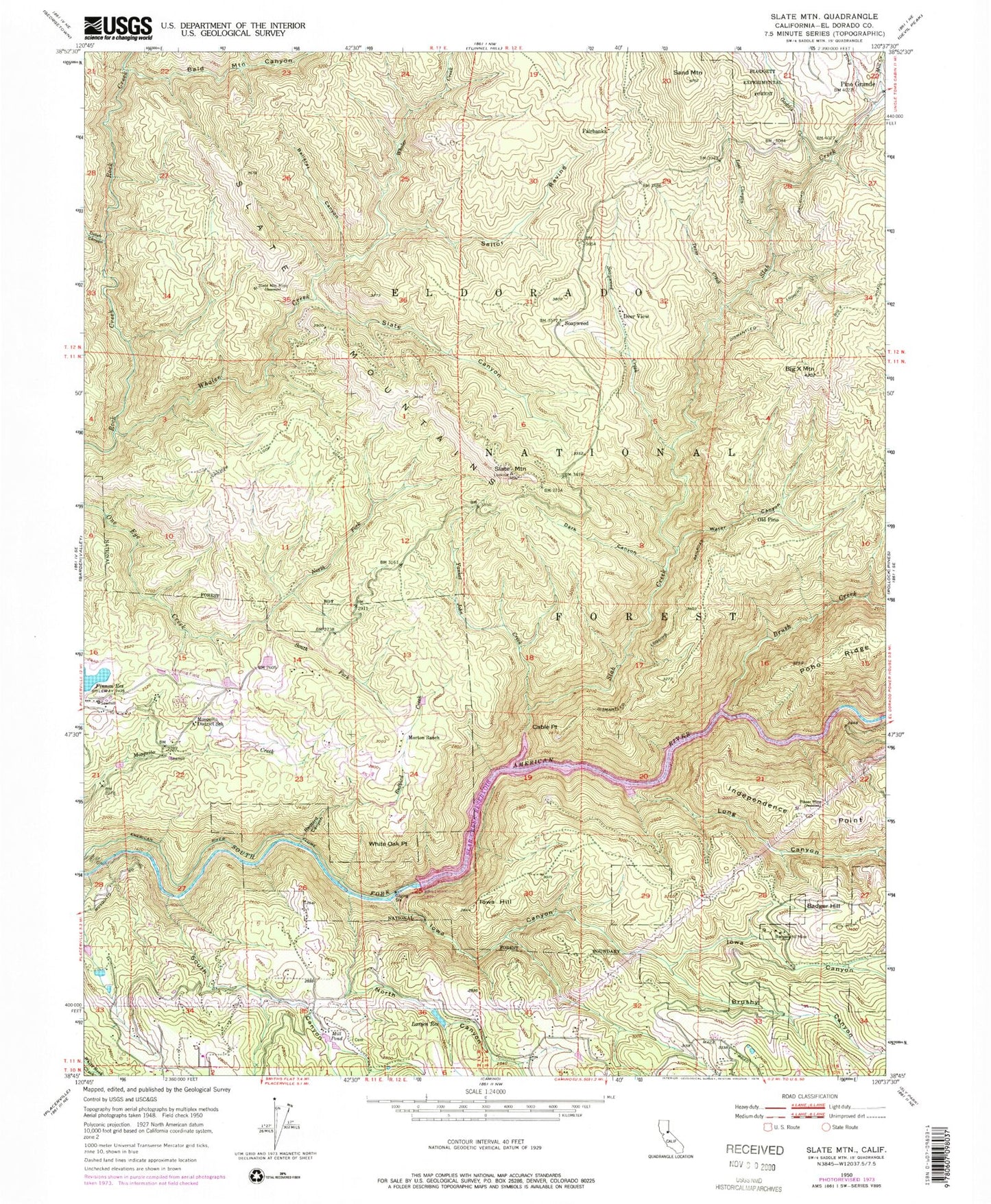
Classic USGS Slate Mountain California 7.5'x7.5' Topo Map
Couldn't load pickup availability
Historical USGS topographic quad map of Slate Mountain in the state of California. Typical map scale is 1:24,000, but may vary for certain years, if available. Print size: 24" x 27"
This quadrangle is in the following counties: El Dorado.
The map contains contour lines, roads, rivers, towns, and lakes. Printed on high-quality waterproof paper with UV fade-resistant inks, and shipped rolled.
Contains the following named places: American River Flume, Badger Hill Mine, Bald Mountain Canyon, Ballarat Canyon, Big Mountain, Brush Creek, Brushy Canyon, Cable Point, Dark Canyon, Dutch Canyon, Gaddis Creek, Independence Point, Iowa Canyon, Iowa Hill, Larsen Reservoir, Long Canyon, Lost Canyon Creek, Mill Creek, Mill Pond, Morton Ranch, Mosquito District School, North Canyon, North Fork One Eye Creek, Redbird Canyon, Redbird Creek, Sailor Ravine, Sand Mountain, Slab Creek, Slab Creek Reservoir, Slate Canyon, Slate Mountain, Slate Mountain Mine, Slate Mountains, Soapweed Creek, South Canyon, South Fork One Eye Creek, Texas Creek, Ticky Creek, Water Canyon, Whaler Creek, White Oak Point, Yankee John Creek, Pino Grande, Soapweed, Finnon Reservoir, Swansboro Country Airport, American River Flume, Deer View, Fairbanks, Old Pino, Castle Rock, Slab Creek 1009-011 Dam, Andersens Hidden Valley Farm, Barsotti Ranch, Bills Apple Orchard, Bolsters Hilltop Ranch, Cedar Grove, El Dorado Orchards, Long Canyon Creek, Mother Lode Orchards, O'Hallorans Apple Trail Ranch, Roberts Tree Farm, The Good Earth Apple Farm, Mosquito Fire Protection District Station 75, Blairs - Winkelman Cemetery, Nelsonville Cemetery