MyTopo
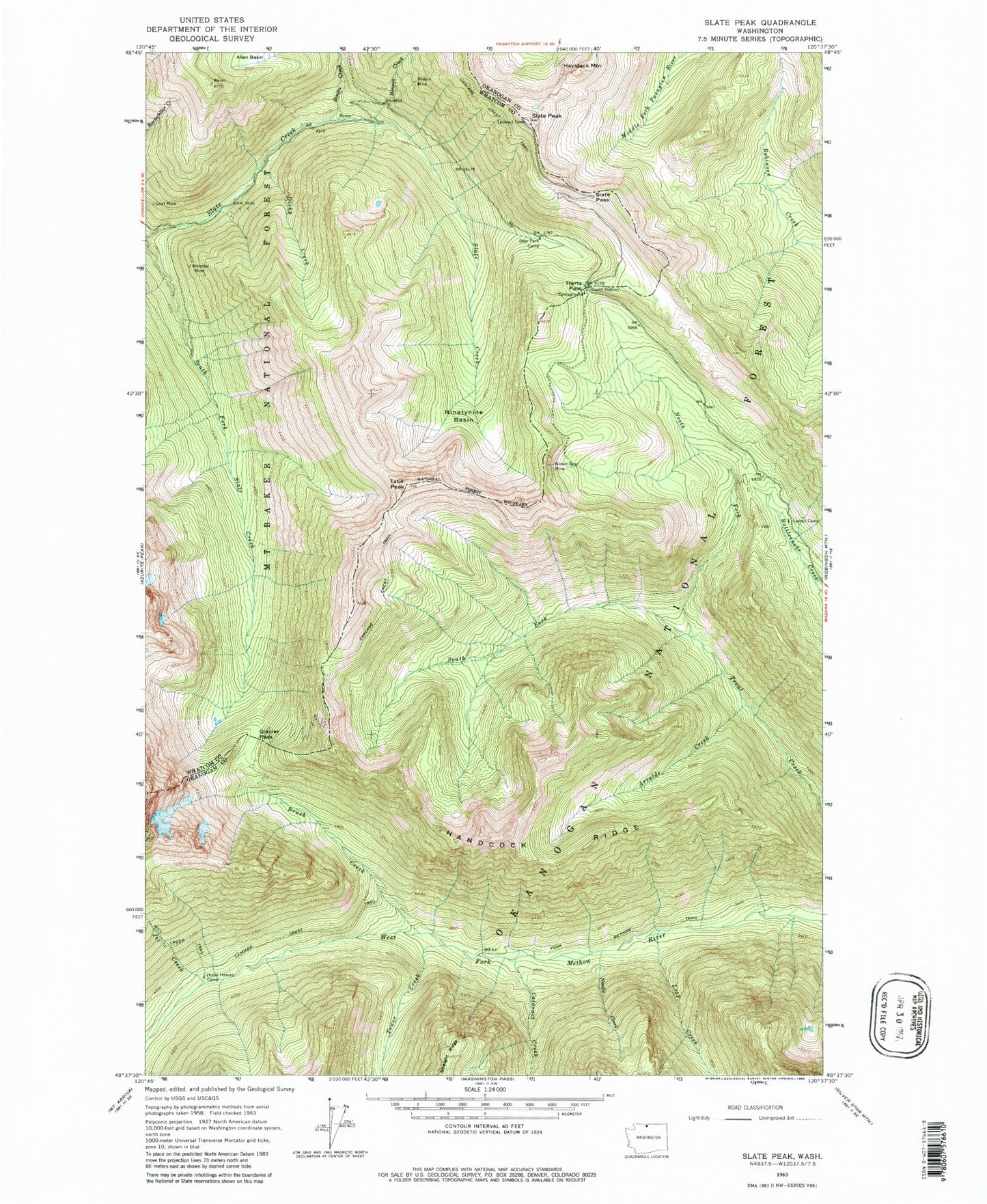
Classic USGS Slate Peak Washington 7.5'x7.5' Topo Map
Couldn't load pickup availability
Historical USGS topographic quad map of Slate Peak in the state of Washington. Typical map scale is 1:24,000, but may vary for certain years, if available. Print size: 24" x 27"
This quadrangle is in the following counties: Okanogan, Skagit, Whatcom.
The map contains contour lines, roads, rivers, towns, and lakes. Printed on high-quality waterproof paper with UV fade-resistant inks, and shipped rolled.
Contains the following named places: Arralde Creek, Brown Bear Mine, Brush Creek, Cataract Creek, Deer Park Camp, Dicky Creek, Glacier Pass, Goat Mine, Handcock Ridge, Harts Pass, Haystack Mountain, Horse Heaven Camp, Illinois Mine, Jet Creek, Layout Camp, Leap Creek, Needle Creek, Ninetynine Basin, North Fork Trout Creek, Rattlesnake Creek, Slate Pass, Slate Peak, South Fork Trout Creek, Tatie Peak, Tower Creek, West Fork Methow Trail, Whistler Mine, Harts Pass Trailhead, Meadows Campground, Horse Heaven, Grasshopper Pass