MyTopo
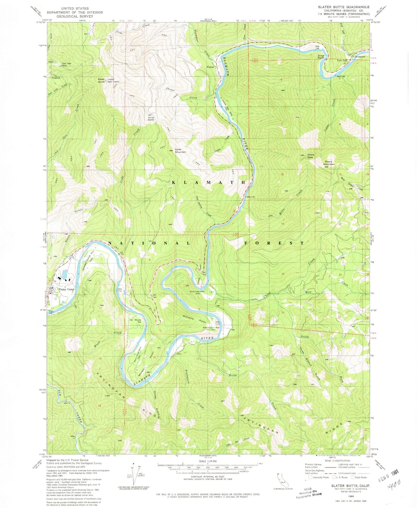
Classic USGS Slater Butte California 7.5'x7.5' Topo Map
Couldn't load pickup availability
Historical USGS topographic quad map of Slater Butte in the state of California. Map scale may vary for some years, but is generally around 1:24,000. Print size is approximately 24" x 27"
This quadrangle is in the following counties: Siskiyou.
The map contains contour lines, roads, rivers, towns, and lakes. Printed on high-quality waterproof paper with UV fade-resistant inks, and shipped rolled.
Contains the following named places: Bonetta Bee Mine, Cade Creek, Cade Mountain, China Creek, China Creek Mine, China Peak, China Point, Evans Mountain, Fort Goff, Fort Goff Campground, Fort Goff Cemetery, Fort Goff Creek, Fryingpan Creek, Fryingpan Ridge, Gordons Ferry, Grey Eagle Mine, Horse Creek, Joe Miles Creek, Klamath Wild and Scenic River, Ladds Creek, Morgan Point, Muck a Muck Mine, Nolton, Nolton School, Oak Hollow Creek, Ottley Gulch, Ranch Gulch, Reeves Mine, Reeves Ranch, Richardson Bedrock Mine, Savage Rapids, Seattle Creek, Shinar Creek, Shinar Saddle, Slater Butte, South Fork China Creek, Thompson Creek, Three Biscuit Gulch, Tims Creek, Williams Point, Williams Point Mine, Wolf Creek, Woods Bar, Woods Creek, ZIP Code: 96049