MyTopo
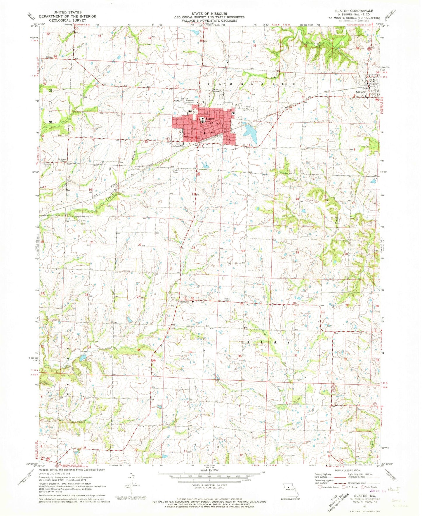
Classic USGS Slater Missouri 7.5'x7.5' Topo Map
Couldn't load pickup availability
Historical USGS topographic quad map of Slater in the state of Missouri. Map scale may vary for some years, but is generally around 1:24,000. Print size is approximately 24" x 27"
This quadrangle is in the following counties: Saline.
The map contains contour lines, roads, rivers, towns, and lakes. Printed on high-quality waterproof paper with UV fade-resistant inks, and shipped rolled.
Contains the following named places: Brick School, City of Gilliam, City of Slater, Clay Center School, George School, Gilliam, Gilliam Elementary School, Gilliam Post Office, Hickman Cemetery, Linn Grove School, Mount Horeb Cemetery, Mount Horeb School, Mount Moriah Cemetery, Only Way Lake Dam, Orearville, Orearville Elementary School, Potter School, Slater, Slater Alexander Elementary School, Slater City Cemetery, Slater City Fire Department, Slater High School, Slater Lake, Slater Memorial Airport, Slater Police Department, Slater Post Office, Township of Clay, ZIP Code: 65349