MyTopo
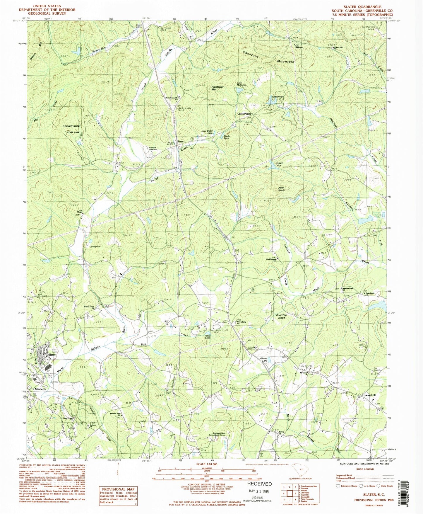
Classic USGS Slater South Carolina 7.5'x7.5' Topo Map
Couldn't load pickup availability
Historical USGS topographic quad map of Slater in the state of South Carolina. Map scale may vary for some years, but is generally around 1:24,000. Print size is approximately 24" x 27"
This quadrangle is in the following counties: Greenville.
The map contains contour lines, roads, rivers, towns, and lakes. Printed on high-quality waterproof paper with UV fade-resistant inks, and shipped rolled.
Contains the following named places: Allen Knob, Awanita Lake Dam D-2215, Beckydon Lake, Beckydon Lake Dam, Behtany CHurch, Belk Simpson Lake Dam D-2864, Bellvue, Bellvue School, Belvue Church, Bethany Baptist Church Graveyard, Bethany Church, Bull Creek, C Fink Pond Dam D-2217, Callahan School, Cherry Hill Church, Chestnut Mountain, Chinquapin Lake Dam, Church of God, Cool Springs Baptist Church Graveyard, Cool Springs Church, Coon Top Ridge, Cox Chapel, Cox Chapel Baptist Church Graveyard, Cross Plains, Cross Plains Baptist Church Graveyard, Cross Plains Church, Douglas Ranch Pond Dam D-2838, Dysart Lake, Dysart Lake Dam D-2851, Forty Niner Lake Dam D-2852, Glassy Mountain Fire Department Station 35, Glenns Lake, Golden Grove Baptist Church Memorial Gardens, Golden Grove Church, Hawkins Hightower Family Cemetery, Hightower Mountain, Howie Pond Dam D-1129, J Stooksburry Pond Dam D-1121, J Williams Pond Dam D-1173, Johnson Creek, King Field, L A Hendricks Pond, L A Hendricks Pond Dam, Lake Chinquapin, Lake Frances, Lake Mollirene, Lake Mollirene Dam D-1174, Lazy Water Lake, Lima, Lima Baptist Church Graveyard, Lima Church, Lima School, Lincoln School, Locust Hill, Locust Hill Baptist Church Graveyard, Locust Hill Church, Locust Hill School, Lookup Chapel, Maridell School, Marydell, McCarter Lake Dam D-1179, Meadow Fork Baptist Church Graveyard, Meadow Fork Church, Meadow Fork School, Mill Creek, Mount Ararat Baptist Church Graveyard, Mount Ararat Church, Mount Grove Church, Mount Zion School, Mountain Grove School, Mush Creek Baptist Church Graveyard, Mush Creek Church, N Morgan Pond Dam D-1172, New Liberty Baptist Church Graveyard, New Liberty Church, North Greenville Church, Paradise Camp, Pleasant Retreat School, Pleasant Ridge State Park, Pleasant View Church, Poplar Lake, Rice Pond Dam D-1373, Riverside Speedway, S Huffman Pond Dam D-2834, Scenic Hills Baptist Church Cemetery, Short Branch, Slater, Slater Marietta Fire Department Station 2, Slater-Marietta Census Designated Place, Slater-Marietta Elementary School, South Tyger River WCD Dam 2c D-2865, Sprigg Creek, Spring Lake Lodge, Stevens Lake Dam D-2837, Talley Creek, Terry, Terry Creek, Tigerville Division, Tigerville Fire Department Headquarters, Travelers Rest Correctional Center, Truth Tabernacle, Valley Lake, Walnut Grove Church, Watershed Lake Number 4c, ZIP Codes: 29683, 29690