MyTopo
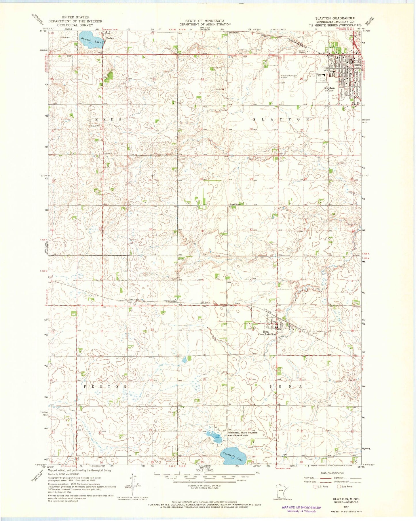
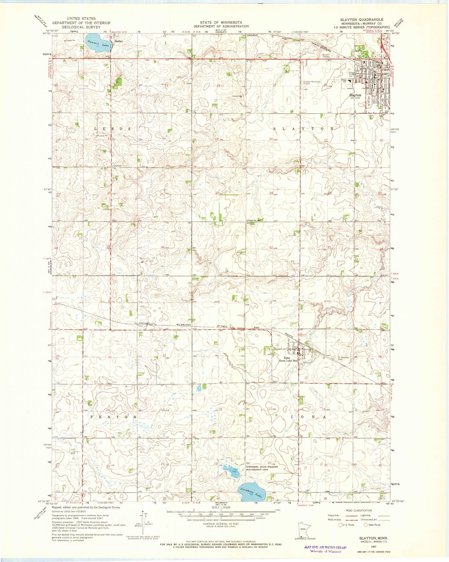
Classic USGS Slayton Minnesota 7.5'x7.5' Topo Map
Couldn't load pickup availability
Historical USGS topographic quad map of Slayton in the state of Minnesota. Map scale may vary for some years, but is generally around 1:24,000. Print size is approximately 24" x 27"
This quadrangle is in the following counties: Murray.
The map contains contour lines, roads, rivers, towns, and lakes. Printed on high-quality waterproof paper with UV fade-resistant inks, and shipped rolled.
Contains the following named places: Assembly of God Church, City of Hadley, City of Iona, City of Slayton, Corabelle Lake, First Presbyterian Church, First Reformed Church, Iona, Iona Fire Department, Iona Lake, Iona Post Office, Murray County Central High School, Murray County Courthouse, Murray County Medical Center, Murray County Museum, Murray County Sheriff's Office, Ruthton Farms, Saint Ann's Catholic Church, Saint Columba Cemetery, Schoeberl State Wildlife Management Area, School Number 1261, Slayton, Slayton Baptist Church, Slayton Clinic, Slayton Fire Department, Slayton Municipal Airport, Slayton Police Department, Slayton Post Office, Slayton Public Library, Summit Lake, Township of Iona, Township of Slayton, Trinity Lutheran Church, United Methodist Church, West School, Zion Lutheran Church Cemetery, ZIP Code: 56141