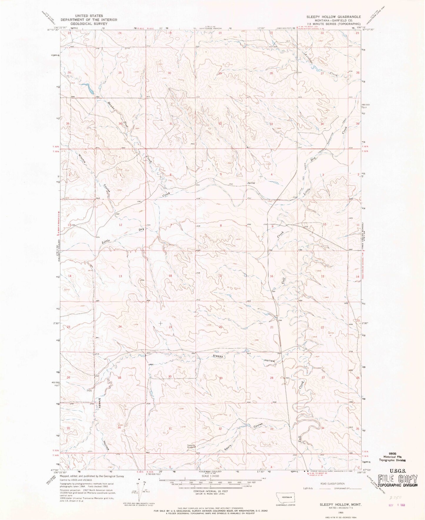
MyTopo
Classic USGS Sleepy Hollow Montana 7.5'x7.5' Topo Map
Regular price
$16.95
Regular price
Sale price
$16.95
Unit price
per
Couldn't load pickup availability
Historical USGS topographic quad map of Sleepy Hollow in the state of Montana. Map scale may vary for some years, but is generally around 1:24,000. Print size is approximately 24" x 27"
This quadrangle is in the following counties: Garfield.
The map contains contour lines, roads, rivers, towns, and lakes. Printed on high-quality waterproof paper with UV fade-resistant inks, and shipped rolled.
Contains the following named places: 15N42E35DCDB01 Well, Hawks Nest Creek, Hawks Nest Number 1 Dam, Little Dry Water Users Association Canal, Saurs Coulee, Sleepy Hollow, Stebbins Windmill, Uall Creek, Watson Flats, Watson Flats Post Office, Witchie Coulee