MyTopo
Classic USGS Slidy Mountain Nevada 7.5'x7.5' Topo Map
Couldn't load pickup availability
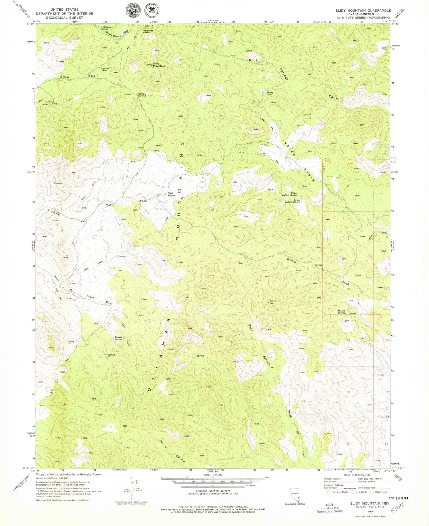
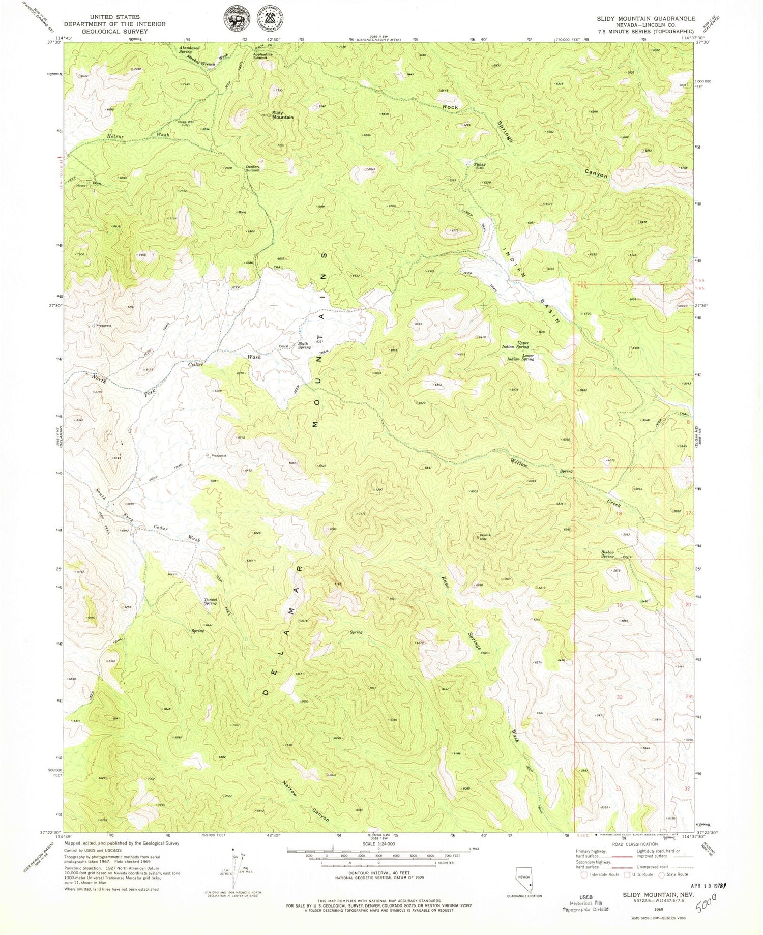
Historical USGS topographic quad map of Slidy Mountain in the state of Nevada. Map scale may vary for some years, but is generally around 1:24,000. Print size is approximately 24" x 27"
This quadrangle is in the following counties: Lincoln.
The map contains contour lines, roads, rivers, towns, and lakes. Printed on high-quality waterproof paper with UV fade-resistant inks, and shipped rolled.
Contains the following named places: Abandoned Spring, Applewhite Summit, Bishop Spring, Blyth Spring, Bull Spring, China Well, Denton Summit, Finlay, Gordon Spring, Horn Spring, Indian Basin, Joshua Spring, Lone Willow Spring, Lower Indian Spring, Lower Willow Creek Spring, Mona Spring, Robb Mine, Rock Springs Station, Slidy Mountain, Tunnel Number One Spring, Tunnel Number Three Spring, Tunnel Number Two Spring, Tunnel Spring, Upper Indian Spring, Upper Riggs Spring, Upper Willow Creek Spring, Willow Creek Spring