MyTopo
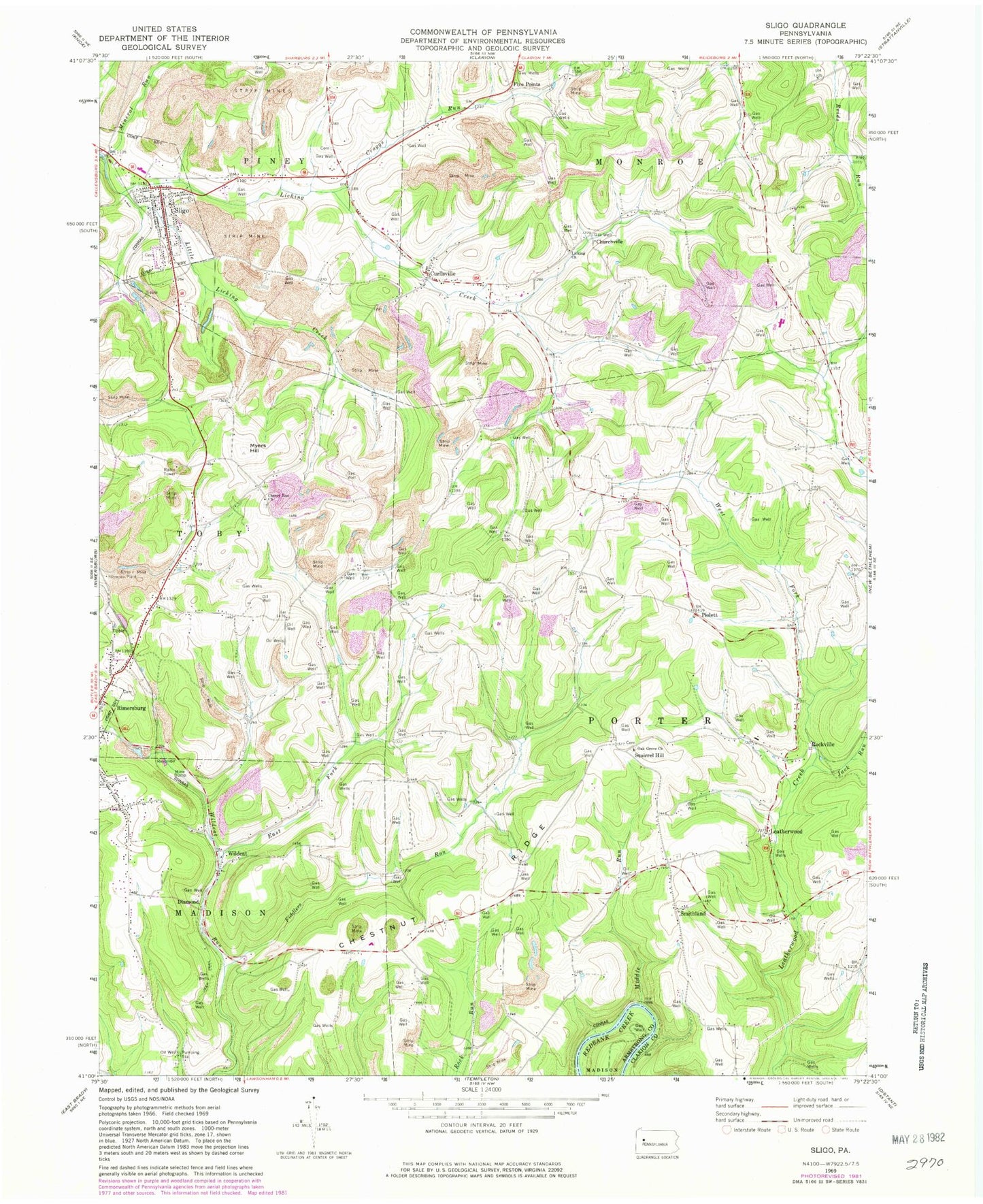
Classic USGS Sligo Pennsylvania 7.5'x7.5' Topo Map
Couldn't load pickup availability
Historical USGS topographic quad map of Sligo in the state of Pennsylvania. Map scale may vary for some years, but is generally around 1:24,000. Print size is approximately 24" x 27"
This quadrangle is in the following counties: Armstrong, Clarion.
The map contains contour lines, roads, rivers, towns, and lakes. Printed on high-quality waterproof paper with UV fade-resistant inks, and shipped rolled.
Contains the following named places: Acme Mines, Associated United Presbyterian Church Cemetery, Blair School, Borough of Sligo, Browns School, Cherry Run Church, Chestnut Ridge, Churchville, Churchville Cemetery, Clarion County Poorhouse Cemetery, Craggs Run, Curllsville, Curllsville Methodist Episcopal Cemetery, Curllsville Post Office, Diamond, Fiddlers Run, Five Points, Five Points School, Frostburg, Herman Cemetery, Independence School, Jack Run, Jocelyn Mine, Keystone Mine, Lawsonham Cemetery, Leatherwood, Leatherwood Station, Licking Cemetery, Licking Church, Little Licking Creek, Males School, McClays Peak, Middle Run, Mineral Run, Myers Hill, Oak Grove Cemetery, Oak Grove Church, Piolett, Reigle School, Rimersburg Cemetery, Rimersburg Station, Rockville, Saint Charles Furnace, Scrub Ridge School, Sharpsburg Church, Sligo, Sligo Cemetery, Sligo Post Office, Sligo Volunteer Fire Department Station 640, Smithland, Southern Clarion County Ambulance Service, Squirrel Hill, Squirrel Hill Cemetery, Township of Porter, Watson School, West Fork Leatherwood Creek, Wildcat, Wildcat Run East Fork