MyTopo
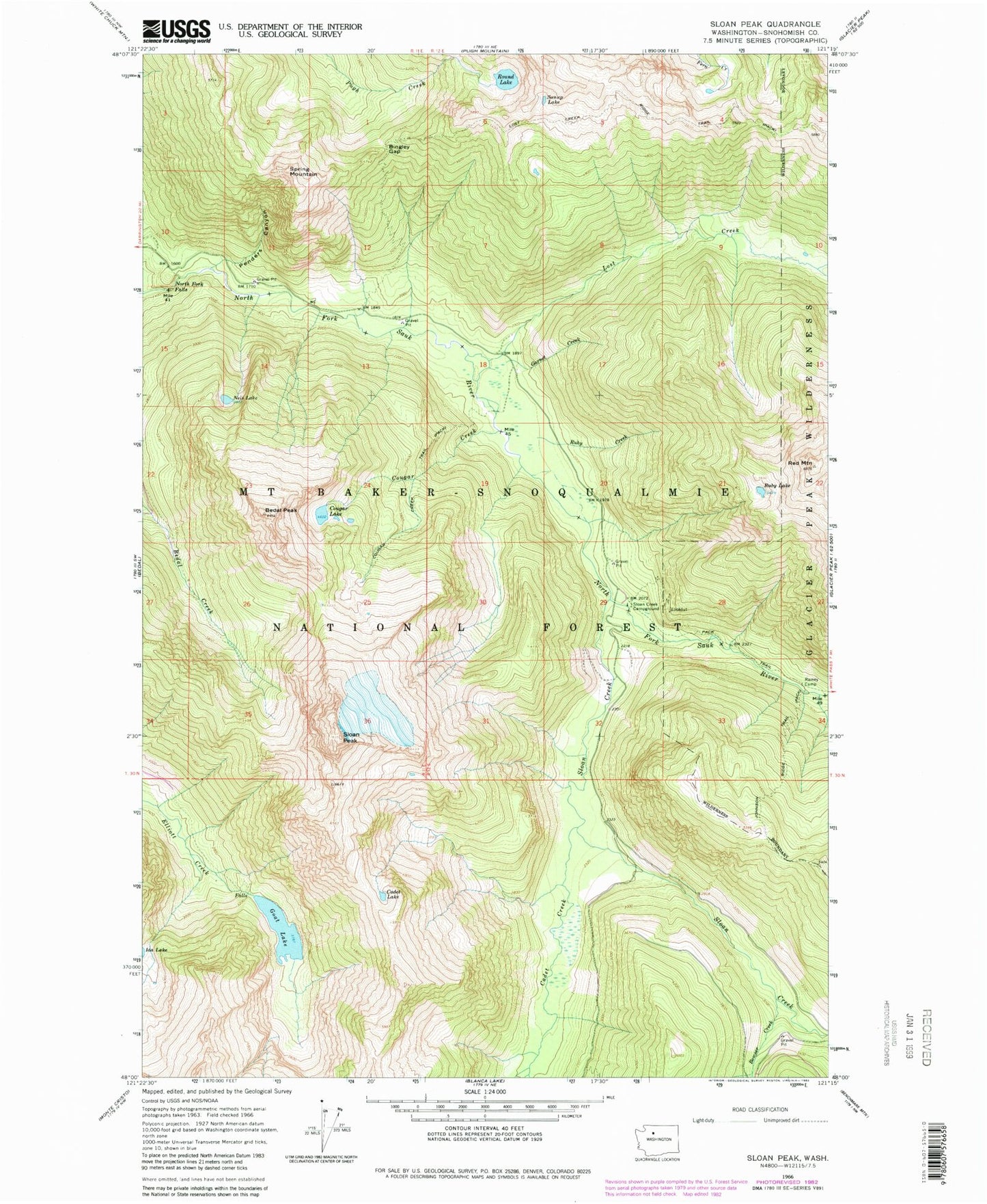
Classic USGS Sloan Peak Washington 7.5'x7.5' Topo Map
Couldn't load pickup availability
Historical USGS topographic quad map of Sloan Peak in the state of Washington. Typical map scale is 1:24,000, but may vary for certain years, if available. Print size: 24" x 27"
This quadrangle is in the following counties: Snohomish.
The map contains contour lines, roads, rivers, towns, and lakes. Printed on high-quality waterproof paper with UV fade-resistant inks, and shipped rolled.
Contains the following named places: Bedal Peak, Bingley Gap, Bowser Creek, Cadet Creek, Cadet Lake, Cougar Creek, Cougar Lake, Garnet Creek, Goat Lake, Lost Creek, Lost Creek Ridge Trail (historical), North Fork Falls, Penders Canyon, Painted Mountain, Round Lake, Ruby Creek, Ruby Lake, Sloan Creek, Sloan Creek Campground, Sloan Peak, Ira Spring Mountain, Sunup Lake, Red Mountain Lookout, Zi-iob Peak (not official), Nels Lake