MyTopo
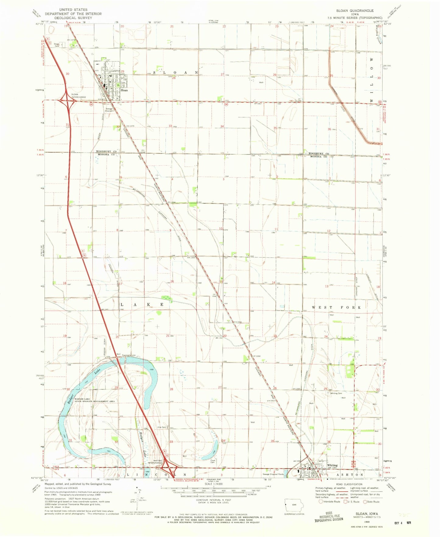
Classic USGS Sloan Iowa 7.5'x7.5' Topo Map
Couldn't load pickup availability
Historical USGS topographic quad map of Sloan in the state of Iowa. Map scale may vary for some years, but is generally around 1:24,000. Print size is approximately 24" x 27"
This quadrangle is in the following counties: Monona, Woodbury.
The map contains contour lines, roads, rivers, towns, and lakes. Printed on high-quality waterproof paper with UV fade-resistant inks, and shipped rolled.
Contains the following named places: Badger Lake, Badger Lake State Wildlife Management Area, Boyer Ditch, Burgess Family Clinic, Church of Christ, City of Sloan, City of Whiting, Clark Cemetery, Congregational Church, Covenant Church, First Christian Church, Hite Cemetery, Irish Lake, Kingdom Hall of Jehovahs Witnesses, Lossing Post Office, Pleasant View Care Center, Skunk Lake, Sloan, Sloan Cemetery, Sloan City Hall, Sloan City Police Department, Sloan Family Dentistry Center, Sloan Fire and Rescue, Sloan Golf Course, Sloan Post Office, Sloan Public Library, Swanson Ditch, Township of Lake, United Congregational Church, Westwood Elementary School, Westwood Secondary School, Whiting, Whiting Cemetery, Whiting Elementary School, Whiting Post Office, Whiting Public Library, Whiting Secondary School, Whiting Volunteer Fire Department, ZIP Code: 51063