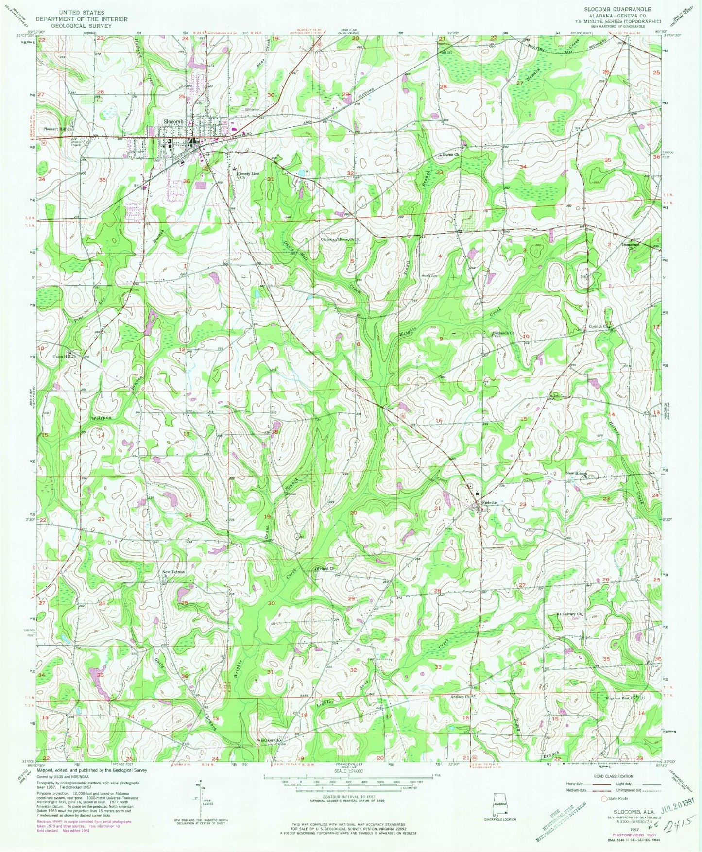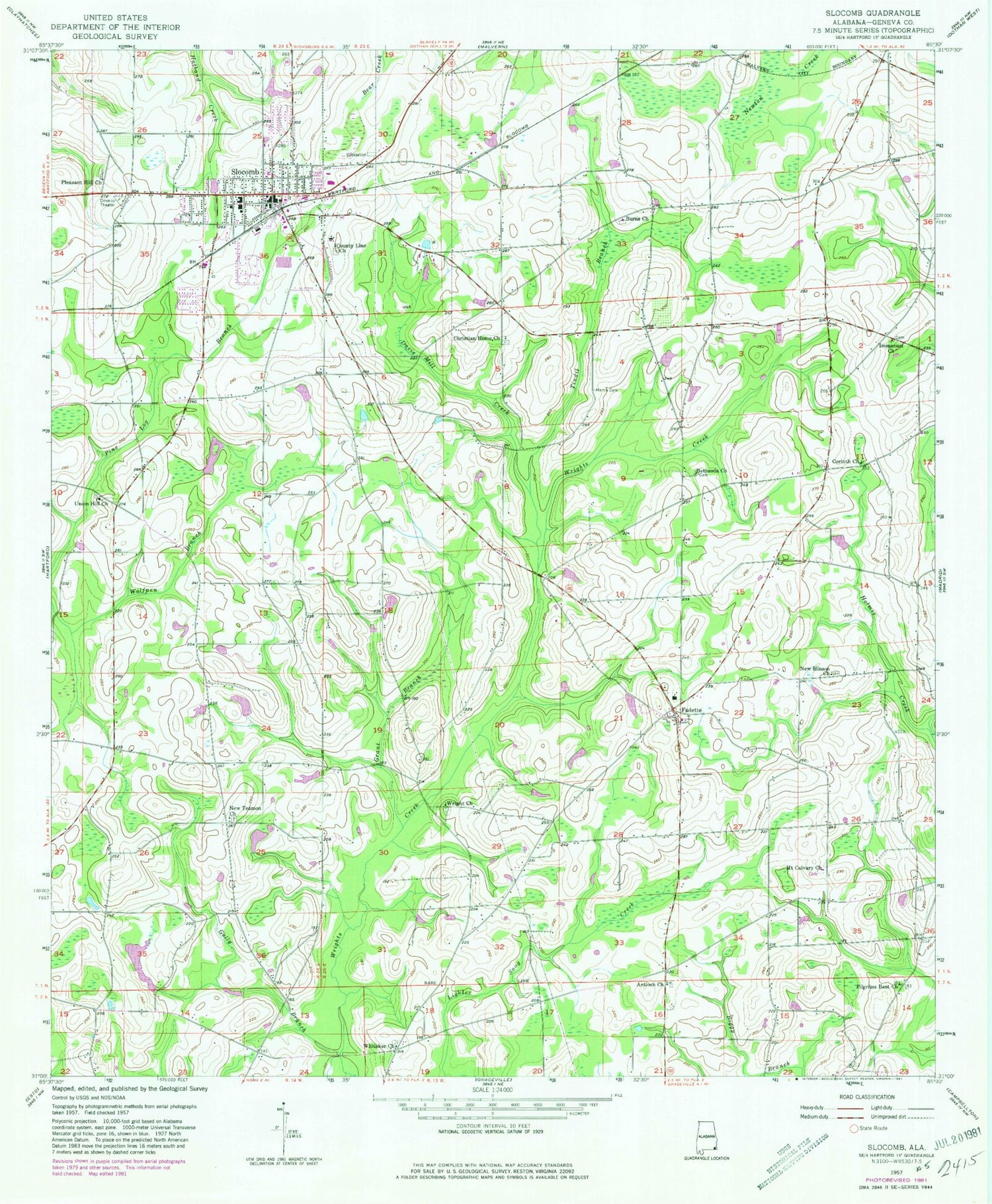
MyTopo
Classic USGS Slocomb Alabama 7.5'x7.5' Topo Map
Couldn't load pickup availability
Historical USGS topographic quad map of Slocomb in the state of Alabama. Map scale may vary for some years, but is generally around 1:24,000. Print size is approximately 24" x 27"
This quadrangle is in the following counties: Geneva.
The map contains contour lines, roads, rivers, towns, and lakes. Printed on high-quality waterproof paper with UV fade-resistant inks, and shipped rolled.
Contains the following named places: Adoniram Baptist Church, Antioch Church, Bell School, Bethesda Church, Bullock School, Burns Church, Burns School, Canal Swamp, Carver Junior High School, Christian Home Baptist Church, Christian Home Cemetery, City of Slocomb, City of Slocomb Wastewater Sewage Lagoon, Corinth Church, Countyline Missionary Baptist Church, Davis Mill Creek, Eato Highway Church, Fadette, Fadette Church, Fadette School, Fadette Volunteer Fire Department, First Baptist Church of Slocomb, Freedom Field, Geneva County Training School, Grant Branch, Gully Branch, Hinsons Store, Holiness Chapel, Immanuel Baptist Church, Mack Snell Dam, Marrith School, Martin Cemetery, Mount Calvary Church, New Hinson Church, New Teamon Church, Pilgrims Rest Church, Pine Lilly School, Pleasant Hill Baptist Church, Robins School, Saint Johns Church, Slocomb, Slocomb Division, Slocomb Fire Rescue Department, Slocomb High School, Slocomb Police Department, Slocomb Post Office, Slocomb Public Library, Tindil Branch, Union Hill Church, Whitaker, Whitaker Church, Wright Church, ZIP Code: 36375