MyTopo
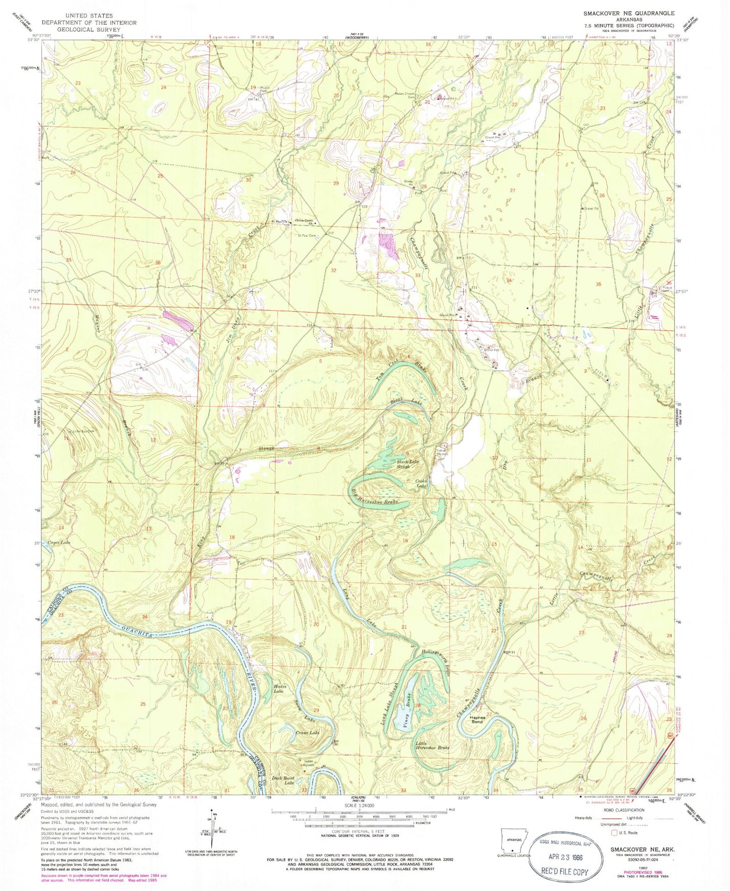
Classic USGS Smackover NE Arkansas 7.5'x7.5' Topo Map
Couldn't load pickup availability
Historical USGS topographic quad map of Smackover NE in the state of Arkansas. Map scale may vary for some years, but is generally around 1:24,000. Print size is approximately 24" x 27"
This quadrangle is in the following counties: Calhoun, Ouachita.
The map contains contour lines, roads, rivers, towns, and lakes. Printed on high-quality waterproof paper with UV fade-resistant inks, and shipped rolled.
Contains the following named places: Big Horseshoe Brake, Black Lake, Black Lake Slough, Boones Mound, China Grove Church, Cooks Lake, Crane Lake, Dry Branch, Duck Roost Lake, Hades Lake, Haidee Shoals, Hampton Oil Field, Haynes Bend, Hollingsworth Brake, Jim Dunn Creek, King Slough, Little Bay Cemetery, Little Champagnolle Creek, Little Horseshoe Brake, Long Lake, Long Lake Slough, Mayner Branch, Moses Chapel Cemetery, Pickett Cemetery, Primm Cemetery, Saint Paul Cemetery, Saint Paul Church, Slim Island Shoal, Snow Lake, Tom Cook Brake, Township of Champagnolle, Viney Brake