MyTopo
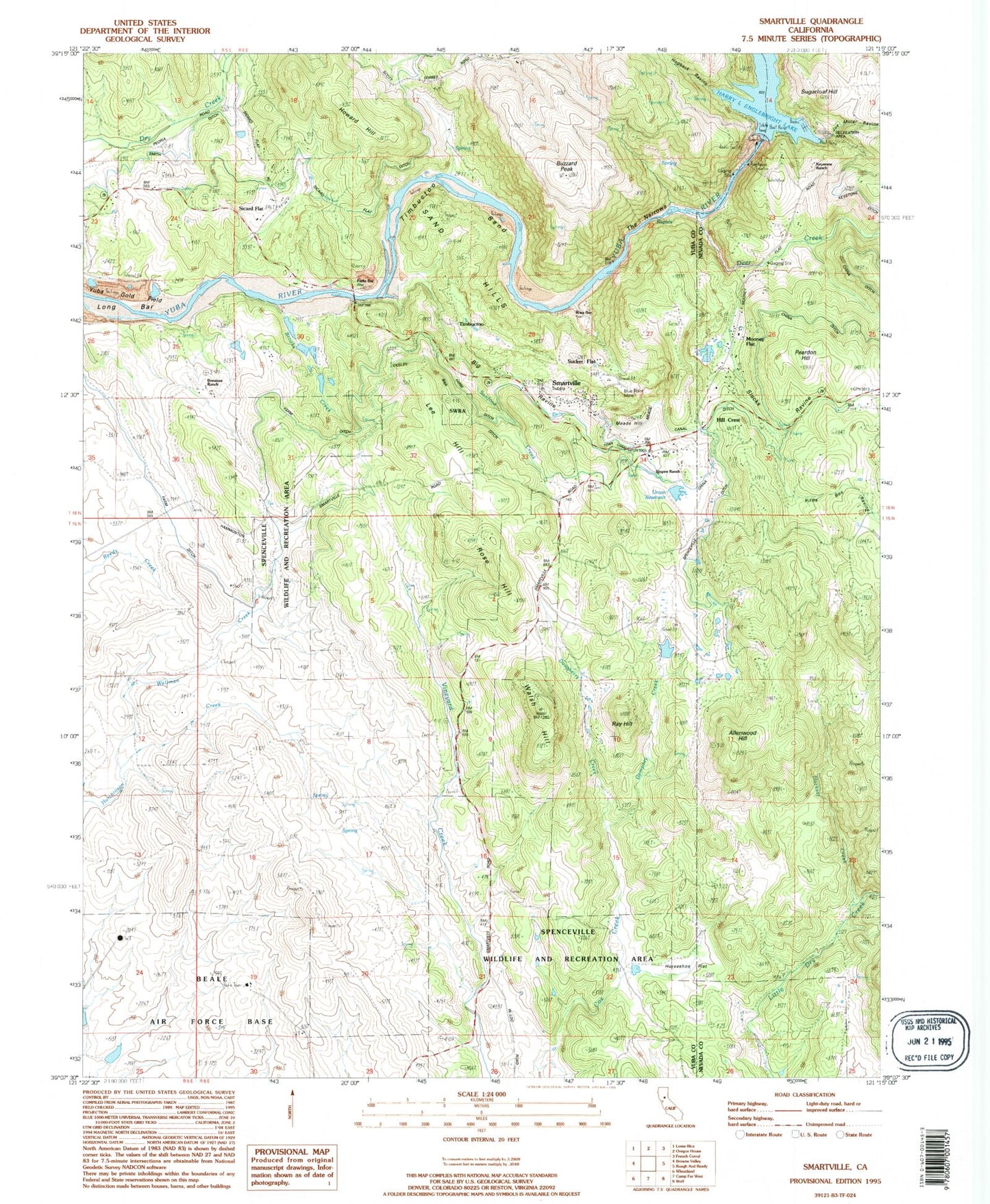
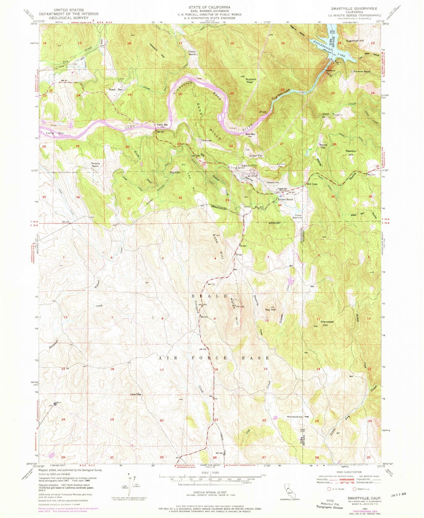
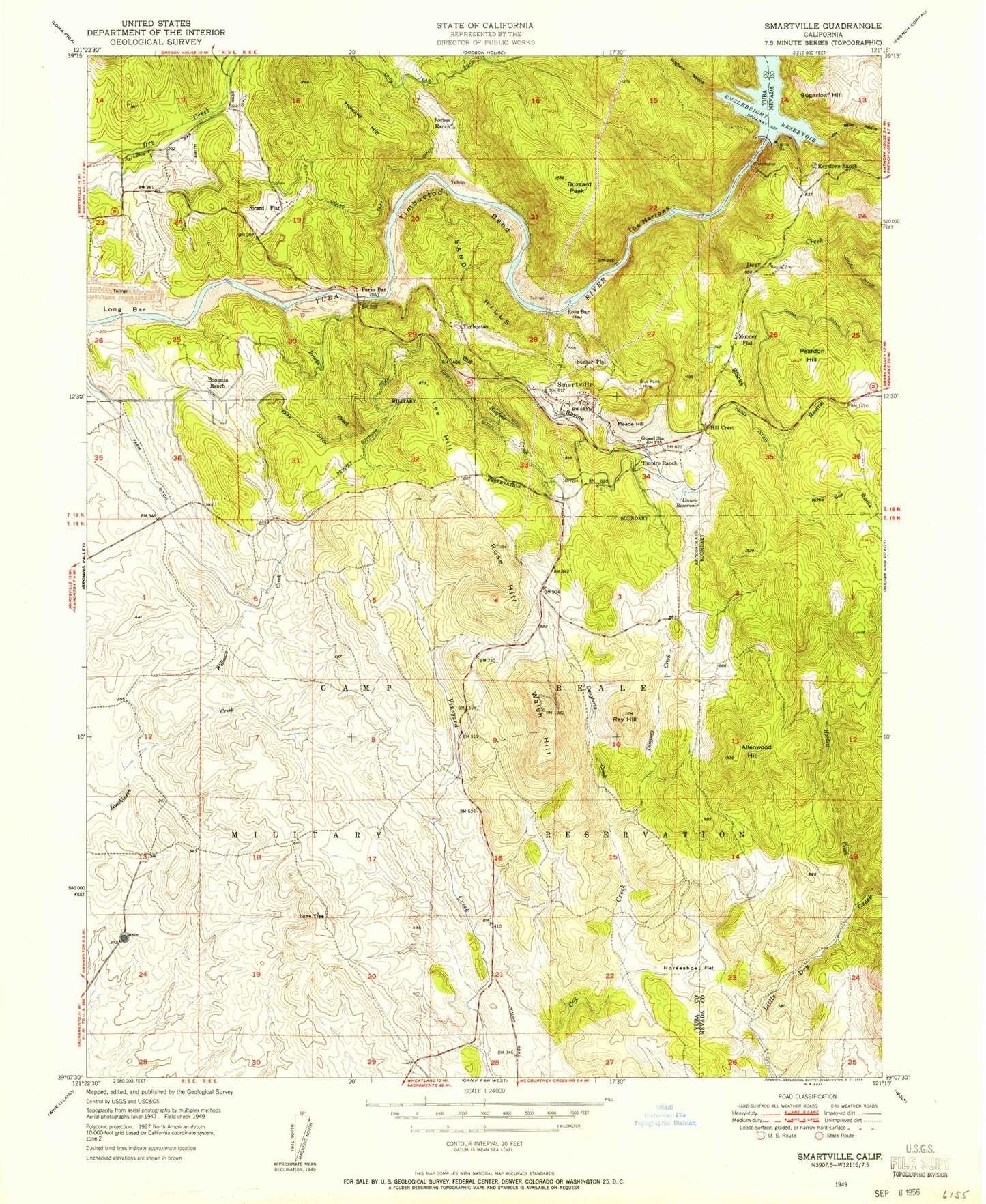
Classic USGS Smartsville California 7.5'x7.5' Topo Map
Couldn't load pickup availability
Historical USGS topographic quad map of Smartsville in the state of California. Map scale may vary for some years, but is generally around 1:24,000. Print size is approximately 24" x 27"
This quadrangle is in the following counties: Nevada, Yuba.
The map contains contour lines, roads, rivers, towns, and lakes. Printed on high-quality waterproof paper with UV fade-resistant inks, and shipped rolled.
Contains the following named places: Allenwood Hill, Big Oak Valley, Big Ravine, Blue Point Mine, Bonanza Ranch, Brady Ranch, Brooks Creek, Buzzard Peak, China Ditch, Daugherty Creek, Dempsey Creek, Empire Ranch, Farm Ditch, Forbes Ranch, Frisky Dam, Frisky Lake, Hackett Creek, Harry L Englebright Lake Dam, Harry L. Englebright Lake, Hill Crest, Hogback Ravine, Horseshoe Flat, Howard Hill, Joe Miller Ravine, Keystone Ranch, Lee Hill, Lone Tree, Long Bar, Meade Hill, Mooney Flat, Ousley Ditch, Parks Bar, Peardon Hill, Ray Hill, Riffle Box Ravine, Rose Bar, Rose Bar School, Rose Hill, Sand Hills, Sanford Creek, Sicard Flat, Sicard Flat Ditch, Slacks Ravine, Smartsville, Smartsville Catholic Cemetery, Smartsville Census Designated Place, Smartsville Fire Protection District, Smartsville Post Office, Smith Bar Ditch, Sucker Flat, Sugarloaf Hill, The Narrows, Timbuctoo, Timbuctoo Bend, Timbuctoo Cemetery, Toland Ranch, Union Reservoir, Walsh Hill, Wellman Creek, ZIP Code: 95977