MyTopo
Classic USGS Smith Center Kansas 7.5'x7.5' Topo Map
Couldn't load pickup availability
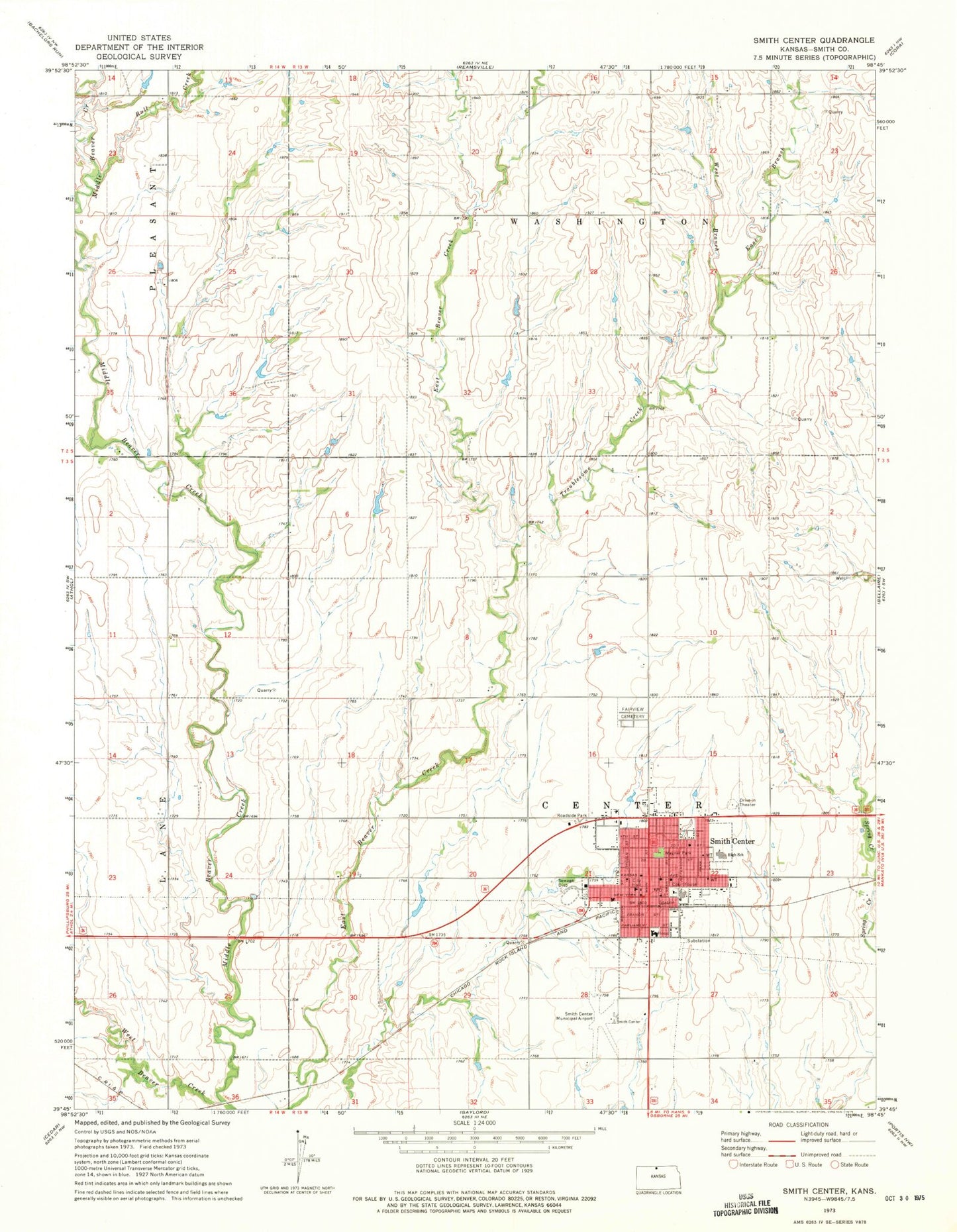
Historical USGS topographic quad map of Smith Center in the state of Kansas. Map scale may vary for some years, but is generally around 1:24,000. Print size is approximately 24" x 27"
This quadrangle is in the following counties: Smith.
The map contains contour lines, roads, rivers, towns, and lakes. Printed on high-quality waterproof paper with UV fade-resistant inks, and shipped rolled.
Contains the following named places: American Lutheran Church, Bull Creek, Calvary Gospel Church, Central Plains Co - Operative Grain Elevator Number 1, City of Smith Center, East Branch Troublesome Creek, Evangelical Free Church, Fairview Cemetery, First Christian Church, First Presbyterian Church, Grace Baptist Chruch, Hi-Plains Co - Operative Association Grain Elevator Number 2, Middle Beaver Creek, Saint Mary's Catholic Church, Smith Center, Smith Center Chamber of Commerce, Smith Center Church of the Nazarene, Smith Center City Hall, Smith Center Elementary School, Smith Center Fire Department, Smith Center Junior / Senior High School, Smith Center Municipal Airport, Smith Center Police Department, Smith Center Post Office, Smith Center Public Library, Smith Center United Methodist Church, Smith County, Smith County Courthouse, Smith County Emergency Medical Services, Smith County Fairgrounds, Smith County Health Department, Smith County Jail, Smith County Memorial Hospital, Smith County Sheriff's Office, Sonshine Christian Church, Township of Center, Township of Washington, Troublesome Creek, Uhl, Wagner Park, West Branch Troublesome Creek, ZIP Code: 66967