MyTopo
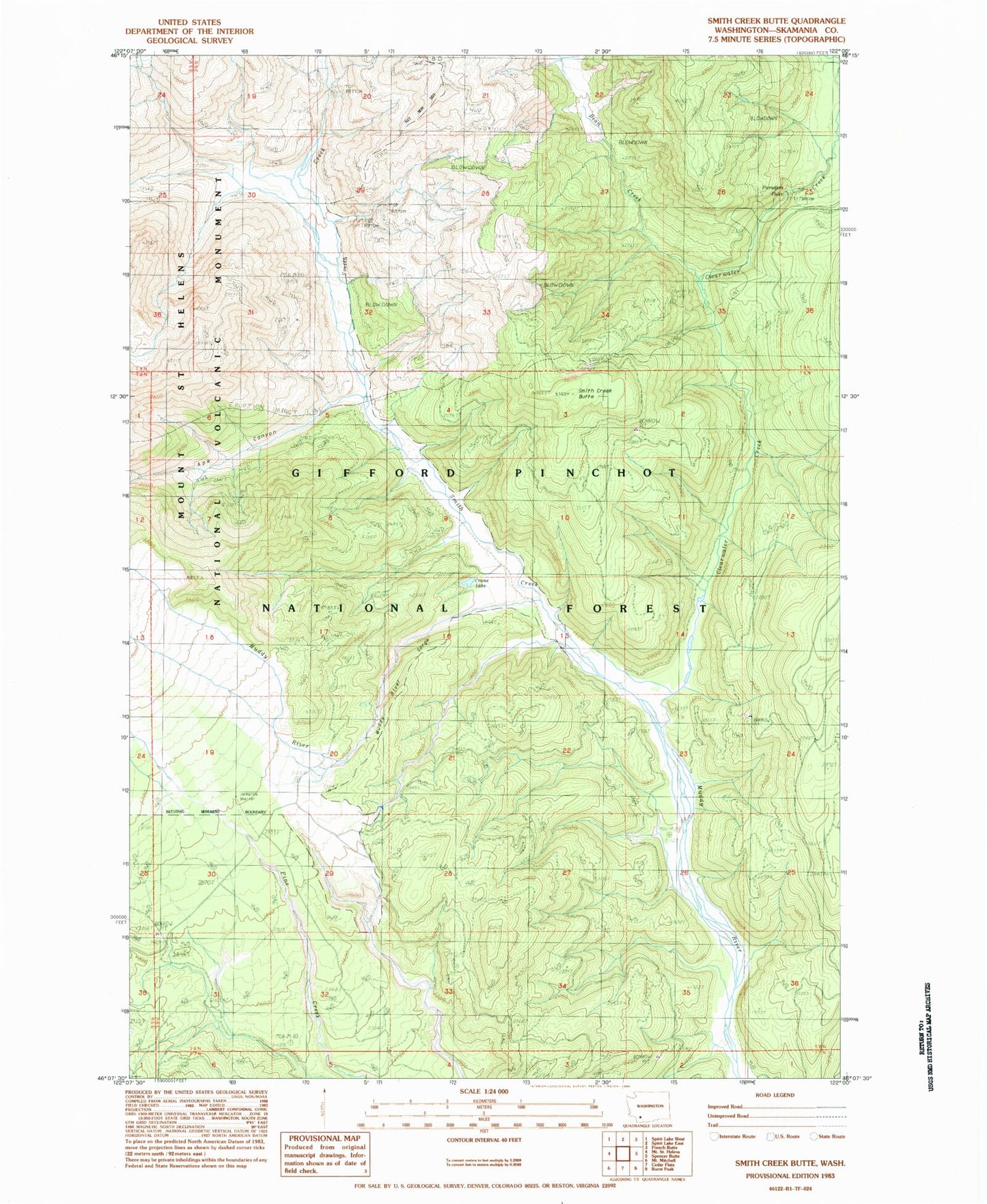
Classic USGS Smith Creek Butte Washington 7.5'x7.5' Topo Map
Couldn't load pickup availability
Historical USGS topographic quad map of Smith Creek Butte in the state of Washington. Typical map scale is 1:24,000, but may vary for certain years, if available. Print size: 24" x 27"
This quadrangle is in the following counties: Skamania.
The map contains contour lines, roads, rivers, towns, and lakes. Printed on high-quality waterproof paper with UV fade-resistant inks, and shipped rolled.
Contains the following named places: Ape Canyon, Bean Creek, Bean Creek Trail, Bear Lake (historical), Clearwater Creek, Crane Lake, Hoo Hoo Lake (historical), Jackpine Shelter (historical), Muddy River Trail, Paradise Falls, Smith Creek, Smith Creek Butte, Smith Creek Butte Trail, Smith Creek Trail, Muddy River Gorge, Lahar Viewpoint, Lava Canyon, Smith Creek Butte Lookout, Ape Canyon, Bean Creek, Bean Creek Trail, Bear Lake (historical), Clearwater Creek, Crane Lake, Hoo Hoo Lake (historical), Jackpine Shelter (historical), Muddy River Trail, Paradise Falls, Smith Creek, Smith Creek Butte, Smith Creek Butte Trail, Smith Creek Trail, Muddy River Gorge, Lahar Viewpoint, Lava Canyon, Smith Creek Butte Lookout