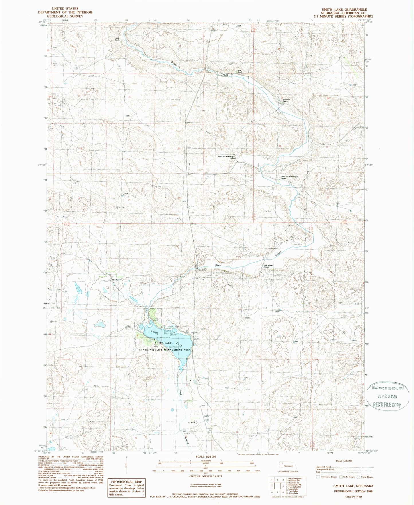
MyTopo
Classic USGS Smith Lake Nebraska 7.5'x7.5' Topo Map
Couldn't load pickup availability
Historical USGS topographic quad map of Smith Lake in the state of Nebraska. Map scale may vary for some years, but is generally around 1:24,000. Print size is approximately 24" x 27"
This quadrangle is in the following counties: Sheridan.
The map contains contour lines, roads, rivers, towns, and lakes. Printed on high-quality waterproof paper with UV fade-resistant inks, and shipped rolled.
Contains the following named places: Blaine and Blake Beguin Ranch, Bob Beguin Ranch, Boiling Springs Public School, Britt Ranch, Budd Ranch, Grayson, Grayson Post Office, Hinn Ranch, Orr Airport, Orr Ranch, Pine Creek Ranch, School Number 112, School Number 132, School Number 32, Smith Lake, Smith Lake Dam, Smith Lake State Wildlife Management Area