MyTopo
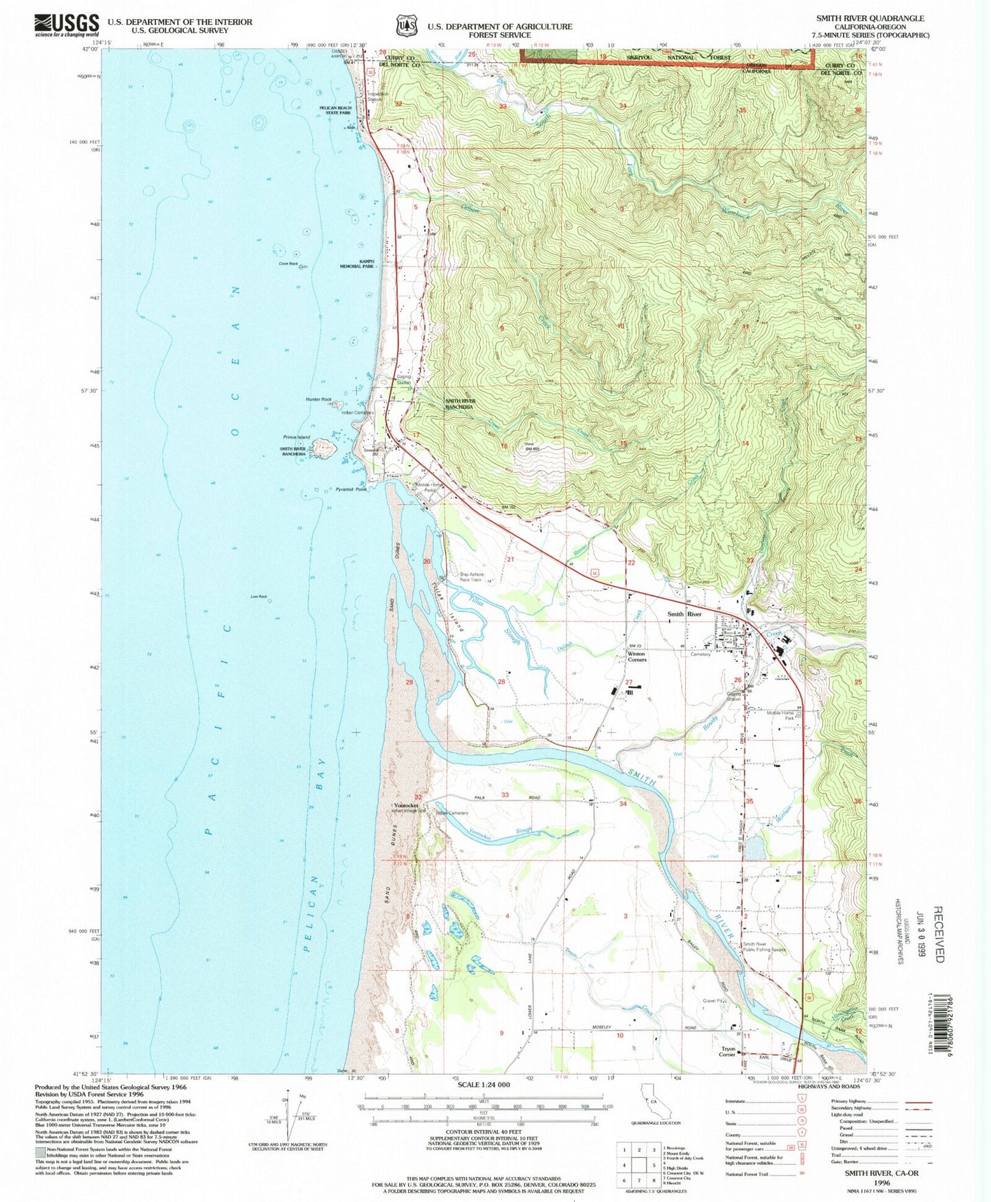
Classic USGS Smith River California 7.5'x7.5' Topo Map
Couldn't load pickup availability
Historical USGS topographic quad map of Smith River in the states of California, Oregon. Map scale may vary for some years, but is generally around 1:24,000. Print size is approximately 24" x 27"
This quadrangle is in the following counties: Curry, Del Norte.
The map contains contour lines, roads, rivers, towns, and lakes. Printed on high-quality waterproof paper with UV fade-resistant inks, and shipped rolled.
Contains the following named places: Cone Rock, Crissey Airport, Delilah Creek, Dominie Creek, Faith Tabernacle Assembly of God Church, Gilbert Creek, How - On - Quet Indian Cemetery, Hunter Rock, Hutsinpillar Creek, Indian Cemetery, Kamph Memorial Park, Khoonkhwuttunne, Lopez Creek, Low Rock, Morrison Creek, Pelican State Beach, Prince Island, Pyramid Point, Ritmer Creek, Rowdy Creek, Rowdy Creek School, Ship Ashore Landing Strip, Ship Ashore Race Track, Smith River, Smith River Baptist Church, Smith River Cemetery, Smith River Census Designated Place, Smith River Elementary School, Smith River Fire Protection District, Smith River Post Office, Smith River Public Fishing Access, Smith River Rancheria, Smith River United Methodist Church, South Fork Winchuck River, Tillas Island, Tillas Slough, Tryon Corner, Tryon Creek, Yontocket, Yontocket Indian Village Memorial Cemetery, Yontocket Slough