MyTopo
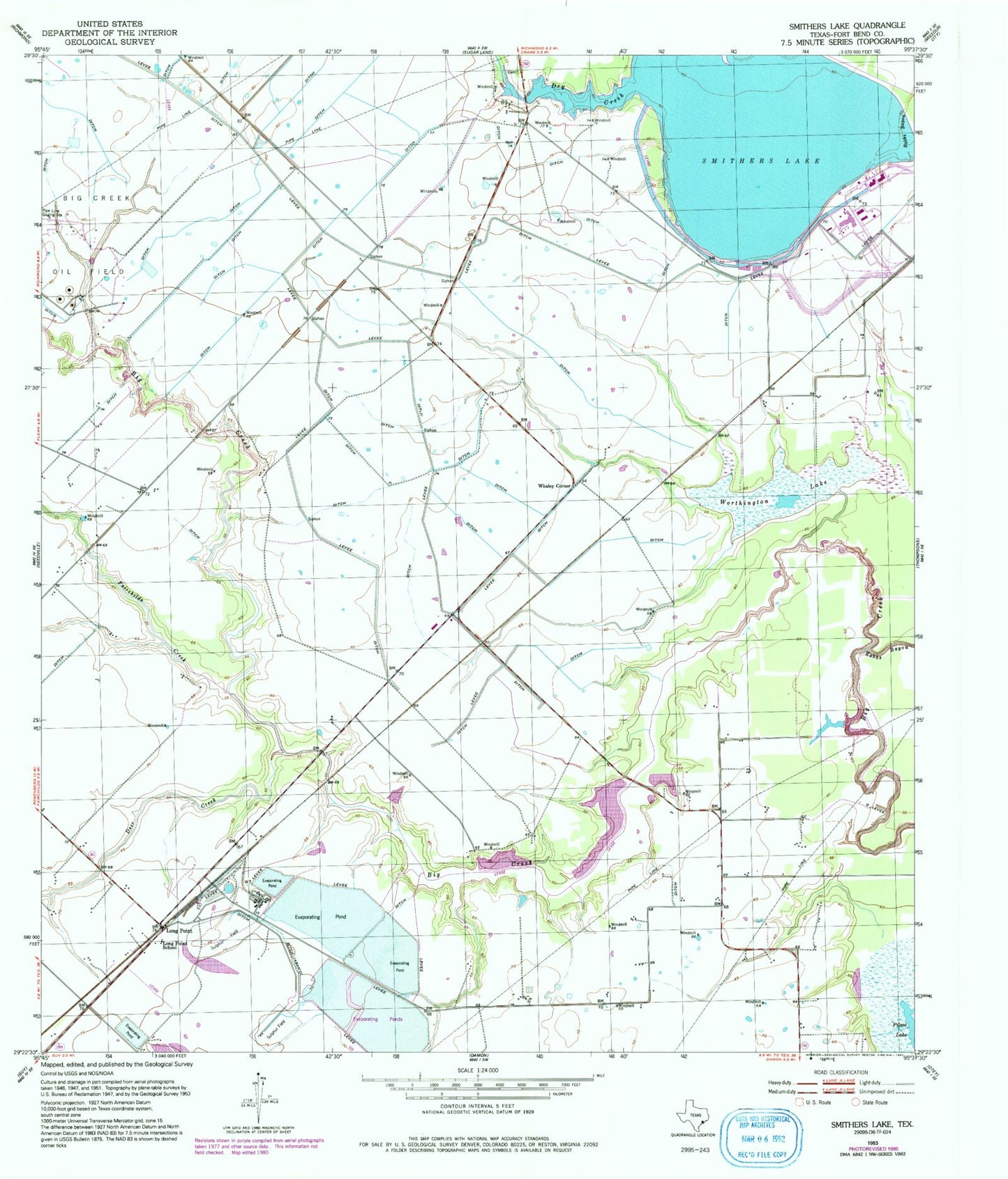
Classic USGS Smithers Lake Texas 7.5'x7.5' Topo Map
Couldn't load pickup availability
Historical USGS topographic quad map of Smithers Lake in the state of Texas. Map scale may vary for some years, but is generally around 1:24,000. Print size is approximately 24" x 27"
This quadrangle is in the following counties: Fort Bend.
The map contains contour lines, roads, rivers, towns, and lakes. Printed on high-quality waterproof paper with UV fade-resistant inks, and shipped rolled.
Contains the following named places: Big Creek Oil Field, Brown-Beard Cemetery, Deer Creek, Dry Creek, Fairchilds Creek, Flying C Ranch Airport, Joseph M Pound House Historical Museum, Lake George, Lake Paw Paw, Lake Paw Paw Dam, Long Point, Long Point School, Pilant Lake, Rabbs Bayou, Richmond Division, Rosenberg-Richmond Division, Smithers Lake, Smithers Lake Dam, Town of Thompsons, Whaley Corner, Worthington Lake, ZIP Code: 77469