
MyTopo
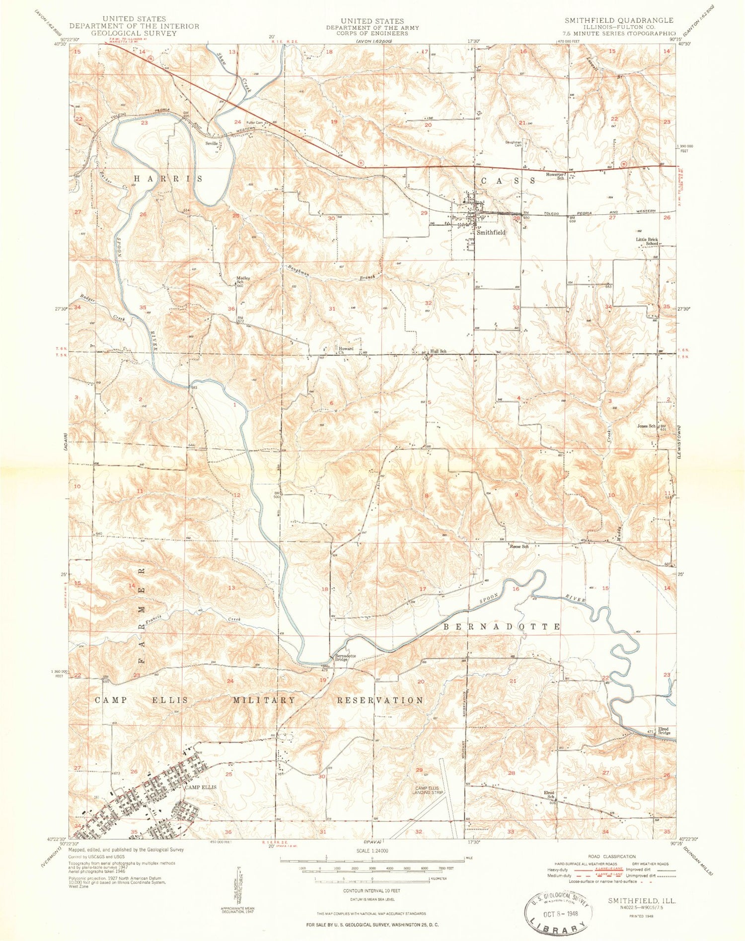
Classic USGS Smithfield Illinois 7.5'x7.5' Topo Map
Couldn't load pickup availability
Historical USGS topographic quad map of Smithfield in the state of Illinois. Map scale may vary for some years, but is generally around 1:24,000. Print size is approximately 24" x 27"
This quadrangle is in the following counties: Fulton.
The map contains contour lines, roads, rivers, towns, and lakes. Printed on high-quality waterproof paper with UV fade-resistant inks, and shipped rolled.
Contains the following named places: Badger Creek, Barker Creek, Baughman Branch, Baughman Cemetery, Bernadotte, Bernadotte Bridge, Brock School, Elrod Bridge, Elrod School, Francis Creek, Fuller Cemetery, Harper - Rector Woods Nature Preserve, Hawthorne School, Hickory Grove School, Howard Cemetery, Howard Church, Howerter School, Hull School, Humphreys Branch, Jones School, Little Brick School, Medley School, Muddy Creek, Poverty Ridge, Randall Cemetery, Reese School, Seville, Seville Bridge, Seville School, Shaw Creek, Smithfield, Smithfield Fire Protection District, Smithfield Post Office, Smithfield School, Stites Cemetery, Tartars Ferry Bridge, Township of Bernadotte, Township of Cass, Turner Farms, Village of Smithfield, Zoll Cemetery, ZIP Code: 61477


