MyTopo
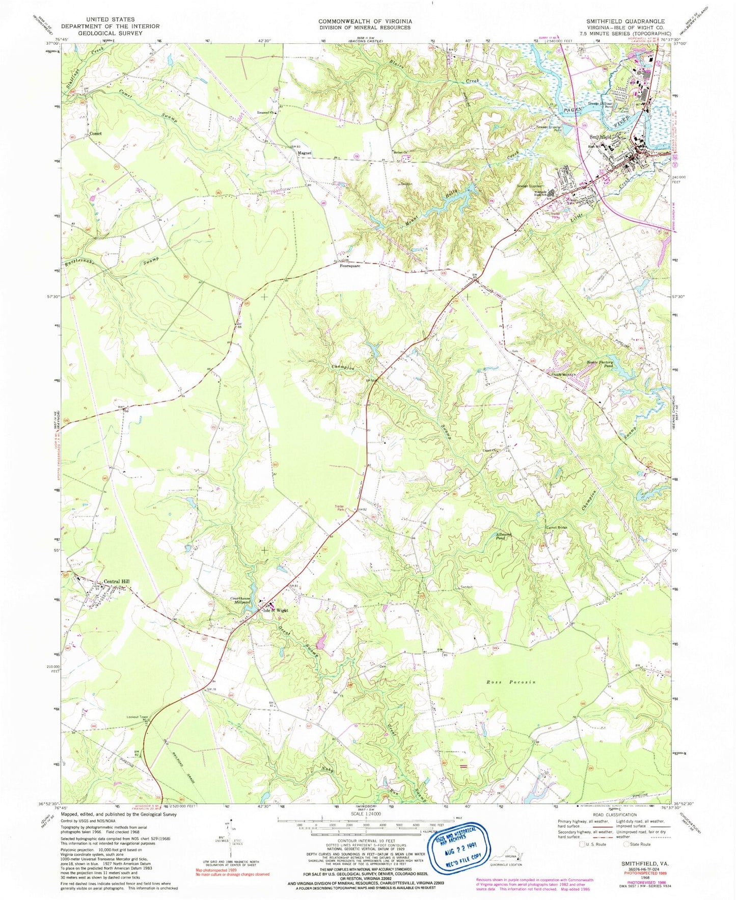
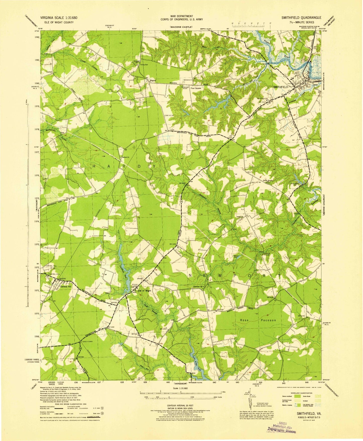
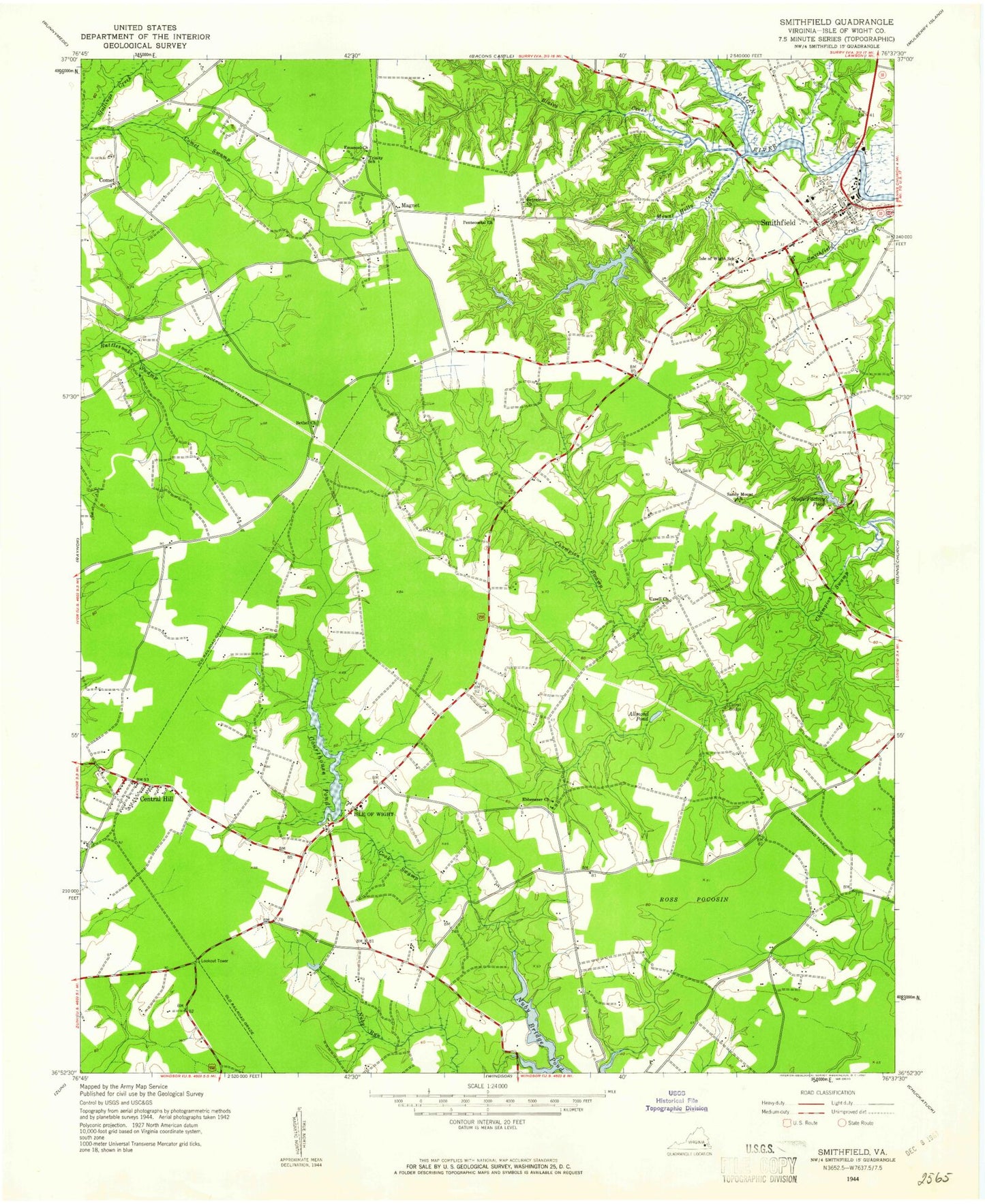
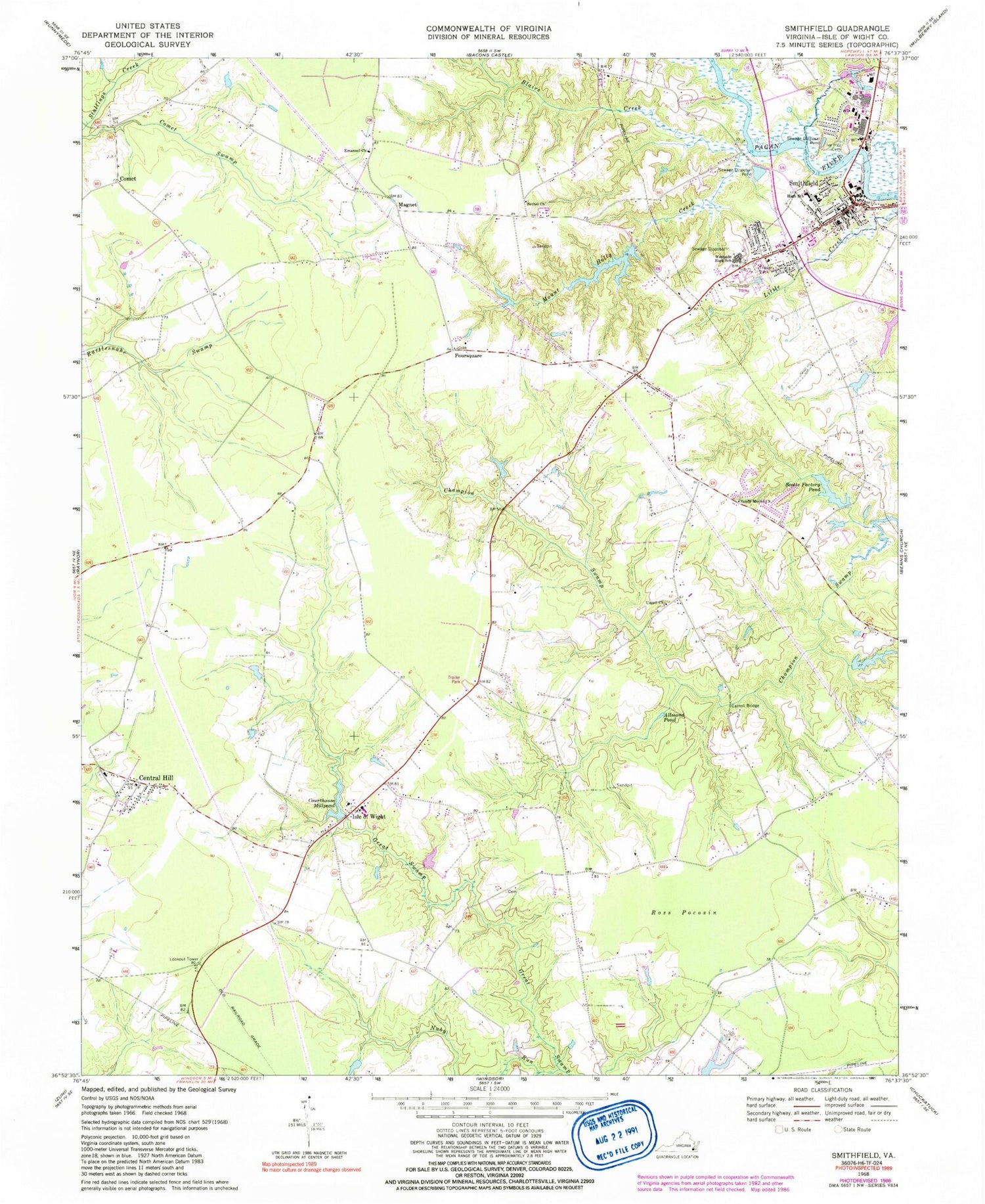
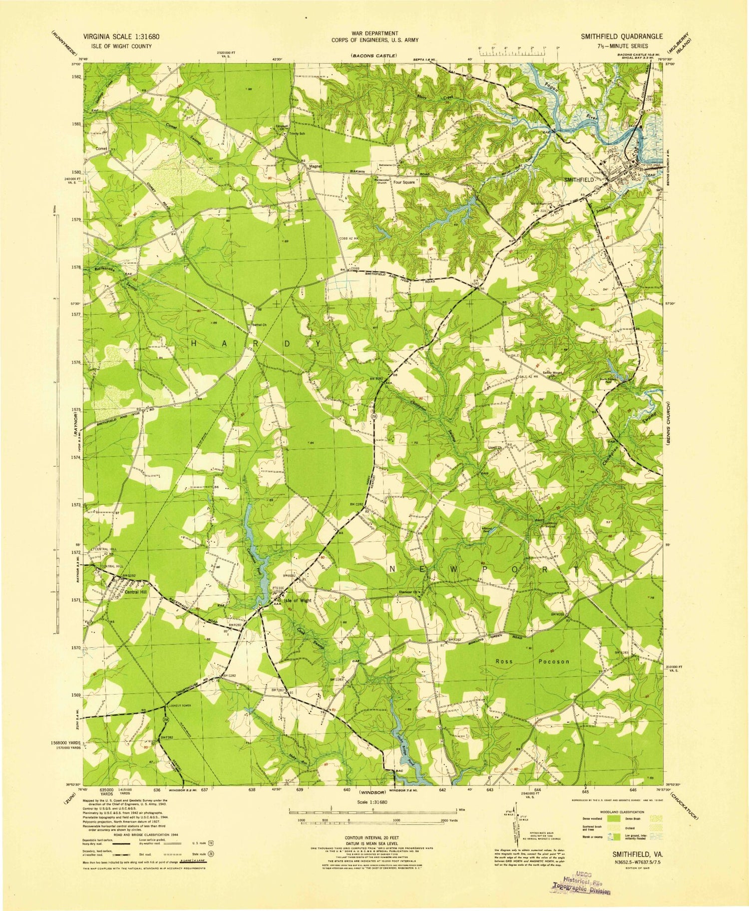
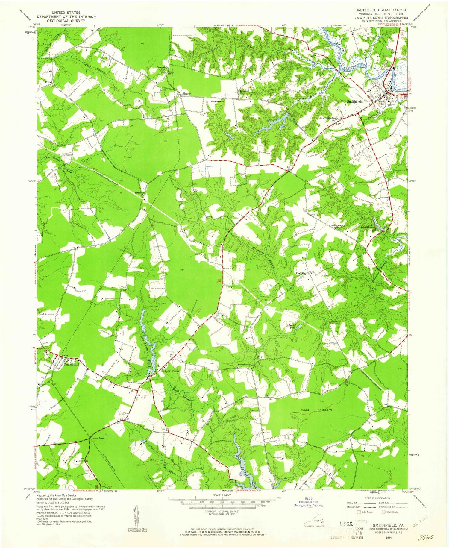
Classic USGS Smithfield Virginia 7.5'x7.5' Topo Map
Couldn't load pickup availability
Historical USGS topographic quad map of Smithfield in the state of Virginia. Typical map scale is 1:24,000, but may vary for certain years, if available. Print size: 24" x 27"
This quadrangle is in the following counties: Isle of Wight.
The map contains contour lines, roads, rivers, towns, and lakes. Printed on high-quality waterproof paper with UV fade-resistant inks, and shipped rolled.
Contains the following named places: Allmond Pond, Bethel Church, Blairs Creek, Carroll Bridge, Central Hill, Courthouse Millpond, Emmanuel Church, Mount Holly Creek, Nuby Run, Ross Pocosin, Sandy Mount Church, Scotts Factory Pond, Smithfield, Uzzell Church, Smithfield Middle School, Comet, Foursquare, Edwards Dam, Edwards Pond, Butlers Dam, Butlers Lake, Echo Dam, Smithfield Lake Dam, Smithfield Lake, WKGM-AM (Smithfield), Isle of Wight, Magnet, Isle of Wight County, Bethel Church, Browns African Methodist Episcopal Church, Central Hill Baptist Church, Christ Episcopal Church, Ebenezer Church (historical), Evergreen Cemetery, Isle of Wight County Courthouse, Isle of Wight County Public Library, Nuby Bridge Pond (historical), Pentecostal Church, Smithfield Baptist Church, Smithfield Grammar School, Smithfield Historic District, Smithfield Post Office, Smithfield Shopping Center, Trinity School (historical), Trinity United Methodist Church, Isle of Wight County Sheriff's Office, Isle of Wight County Department of Emergency Services, Isle of Wight Volunteer Rescue Squad, Isle of Wight County Sheriff's Office, Westside Elementary School, Isle of Wight Academy, Paul D Camp Community College - Smithfield Campus, Southeastern Public Service Authority Isle of Wight Transfer Station, Blairs Creek Mobile Home Park, Isle of Wight County County Health Center, Cypress Creek Golf Club, Boykins Tavern Museum, Isle of Wight Museum, Smithfield Town Hall, Isle of Wight Post Office, Allmond Pond, Bethel Church, Blairs Creek, Carroll Bridge, Central Hill, Courthouse Millpond, Emmanuel Church, Mount Holly Creek, Nuby Run, Ross Pocosin, Sandy Mount Church, Scotts Factory Pond, Smithfield, Uzzell Church, Smithfield Middle School, Comet, Foursquare, Edwards Dam, Edwards Pond, Butlers Dam, Butlers Lake, Echo Dam, Smithfield Lake Dam, Smithfield Lake, WKGM-AM (Smithfield), Isle of Wight, Magnet, Isle of Wight County, Bethel Church, Browns African Methodist Episcopal Church, Central Hill Baptist Church, Christ Episcopal Church, Ebenezer Church (historical), Evergreen Cemetery, Isle of Wight County Courthouse, Isle of Wight County Public Library, Nuby Bridge Pond (historical), Pentecostal Church, Smithfield Baptist Church, Smithfield Grammar School, Smithfield Historic District, Smithfield Post Office, Smithfield Shopping Center, Trinity School (historical), Trinity United Methodist Church, Isle of Wight County Sheriff's Office, Isle of Wight County Department of Emergency Services, Isle of Wight Volunteer Rescue Squad, Isle of Wight County Sheriff's Office, Westside Elementary School, Isle of Wight Academy, Paul D Camp Community College - Smithfield Campus, Southeastern Public Service Authority Isle of Wight Transfer Station, Blairs Creek Mobile Home Park, Isle of Wight County County Health Center, Cypress Creek Golf Club, Boykins Tavern Museum, Isle of Wight Museum, Smithfield Town Hall, Isle of Wight Post Office
