MyTopo
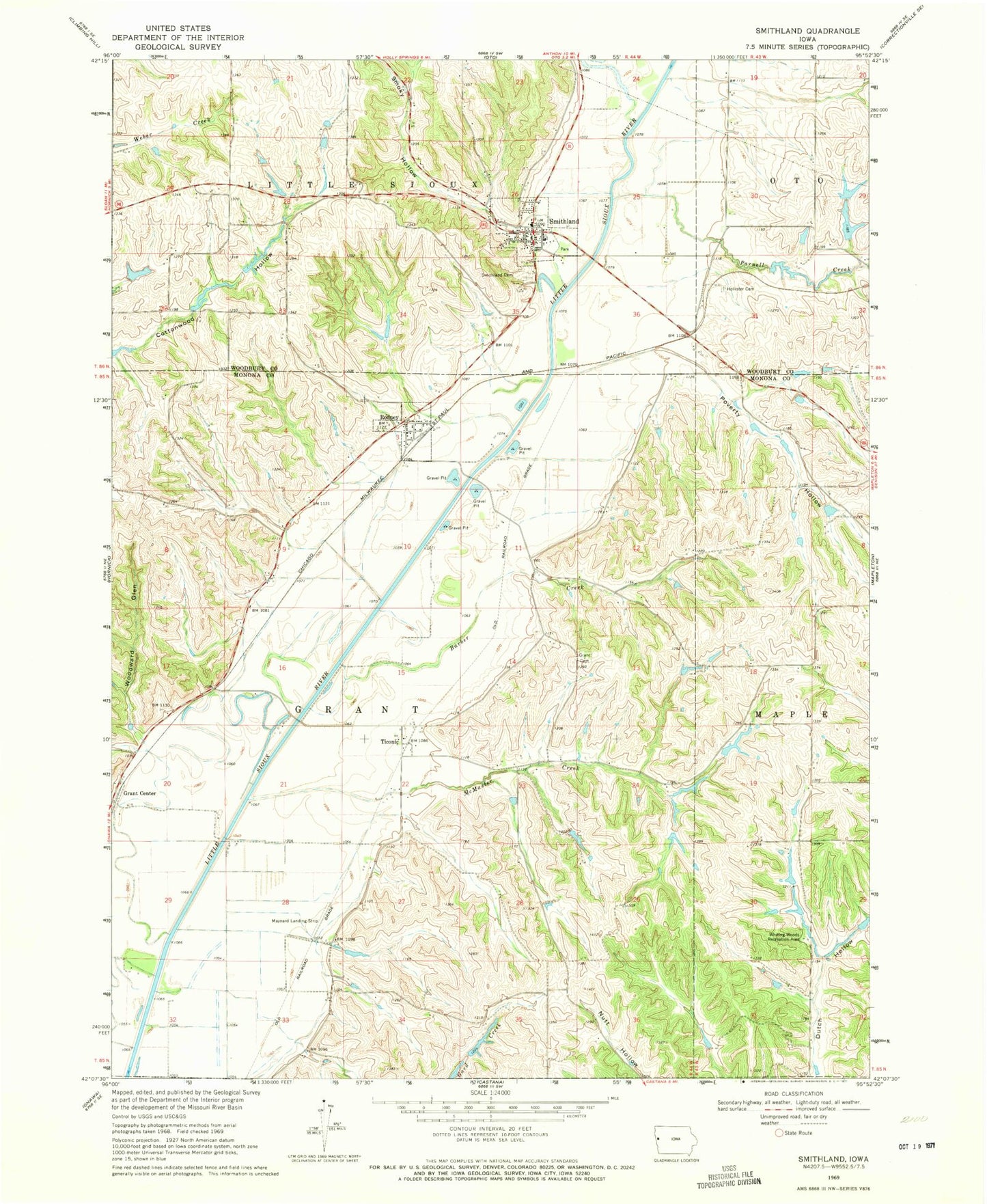
Classic USGS Smithland Iowa 7.5'x7.5' Topo Map
Couldn't load pickup availability
Historical USGS topographic quad map of Smithland in the state of Iowa. Map scale may vary for some years, but is generally around 1:24,000. Print size is approximately 24" x 27"
This quadrangle is in the following counties: Monona, Woodbury.
The map contains contour lines, roads, rivers, towns, and lakes. Printed on high-quality waterproof paper with UV fade-resistant inks, and shipped rolled.
Contains the following named places: Barber Creek, City of Rodney, City of Smithland, Grant Cemetery, Grant Center Post Office, Little Sioux Township Cemetery, Maynard Airport, McMaster Creek, Parnell Creek, Poverty Hollow, Rodney, Rodney City Hall, Rodney Pits Recreation Area, Rodney Post Office, Site of First School in Woodbury County Historical Marker, Smithland, Smithland City Hall, Smithland Fire Department, Smithland Post Office, Smoky Hollow, Ticonic, Ticonic Post Office, Township of Grant, United Church of Christ, United Methodist Church, Wellington Cemetery, Whiting Woods Recreation Area, Woodward Glen, ZIP Codes: 51051, 51056