MyTopo
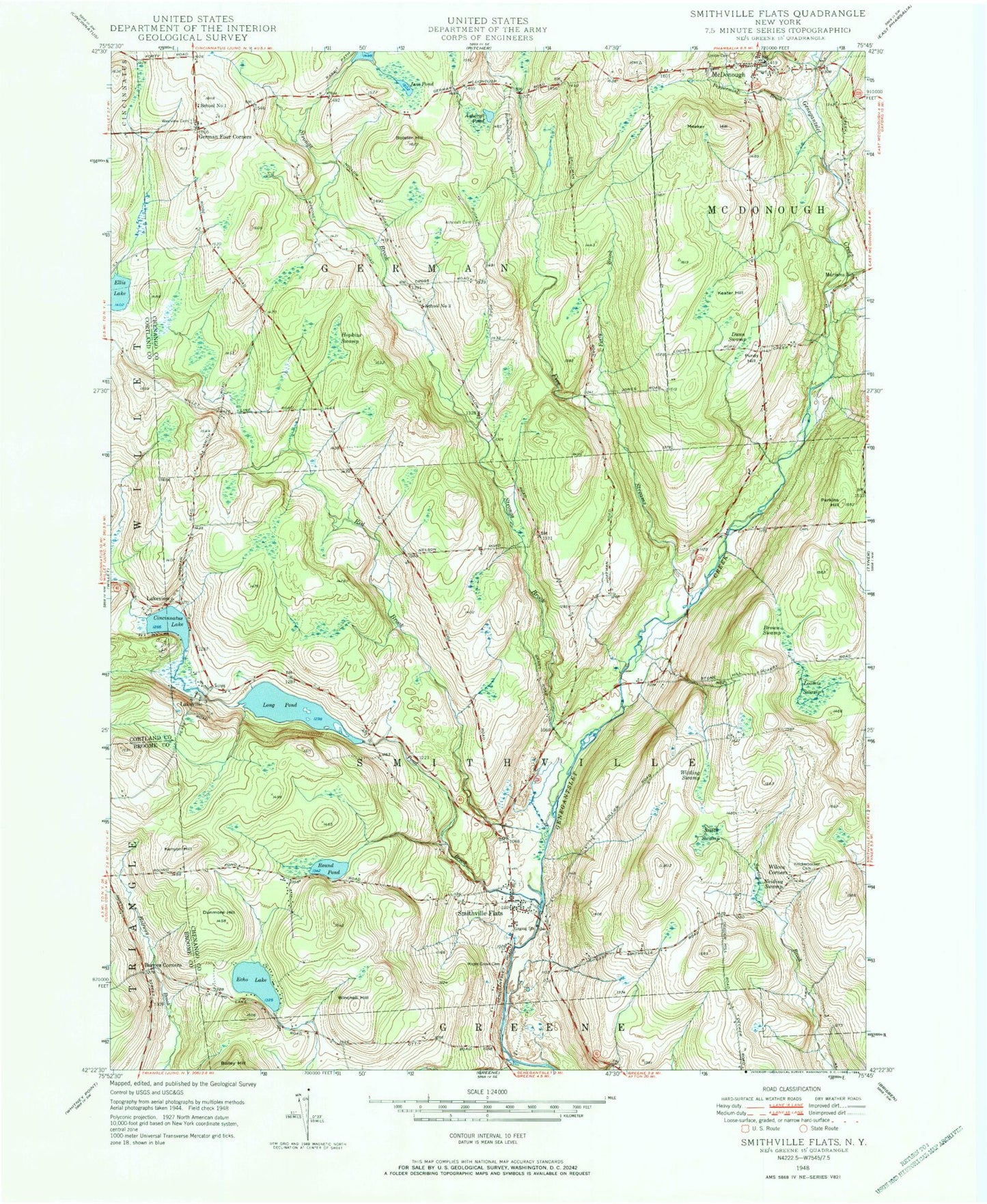
Classic USGS Smithville Flats New York 7.5'x7.5' Topo Map
Couldn't load pickup availability
Historical USGS topographic quad map of Smithville Flats in the state of New York. Map scale may vary for some years, but is generally around 1:24,000. Print size is approximately 24" x 27"
This quadrangle is in the following counties: Broome, Chenango, Cortland.
The map contains contour lines, roads, rivers, towns, and lakes. Printed on high-quality waterproof paper with UV fade-resistant inks, and shipped rolled.
Contains the following named places: Ashcraft Cemetery, Ashcraft Pond, Barnes Corners, Bolster Hill, Brown Swamp, Cincinnatus Lake, Dunmore Hill, Dunn Swamp, Echo Lake, Ellis Lake, Five Streams, Forty Brook, Genegantslet Volunteer Fire Company, German Four Corners, Hopkins Swamp, Jam Pond, Keater Hill, Kenyon Hill, Knickerbocker Cemetery, Lakeview, Lakeville, Long Pond, Loomis Swamp, Maple Grove Cemetery, Mariams School, McDonough, McDonough Fire Department, McDonough Post Office, Meeker Hill, Neiding Swamp, Peppermint Brook, Perkins Hill, Pond Brook, Purdy Hill, Red Brook, Round Pond, School Number 1, School Number 3, Smith Swamp, Smithville Flats, Smithville Flats Cemetery, Smithville Flats Census Designated Place, Smithville Flats Post Office, Strongs Brook, Town of German, Town of Smithville, Westview Cemetery, Wilcox Corners, Winchell Hill, Wittling Swamp, ZIP Code: 13841