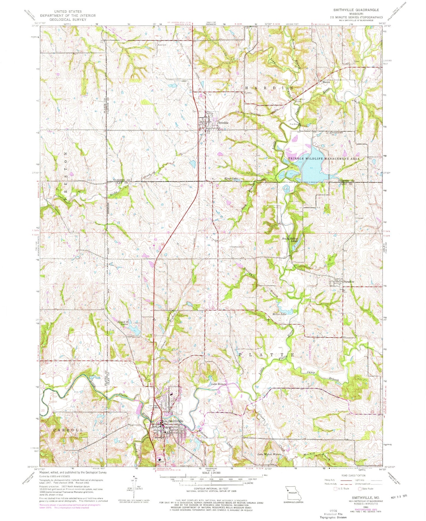
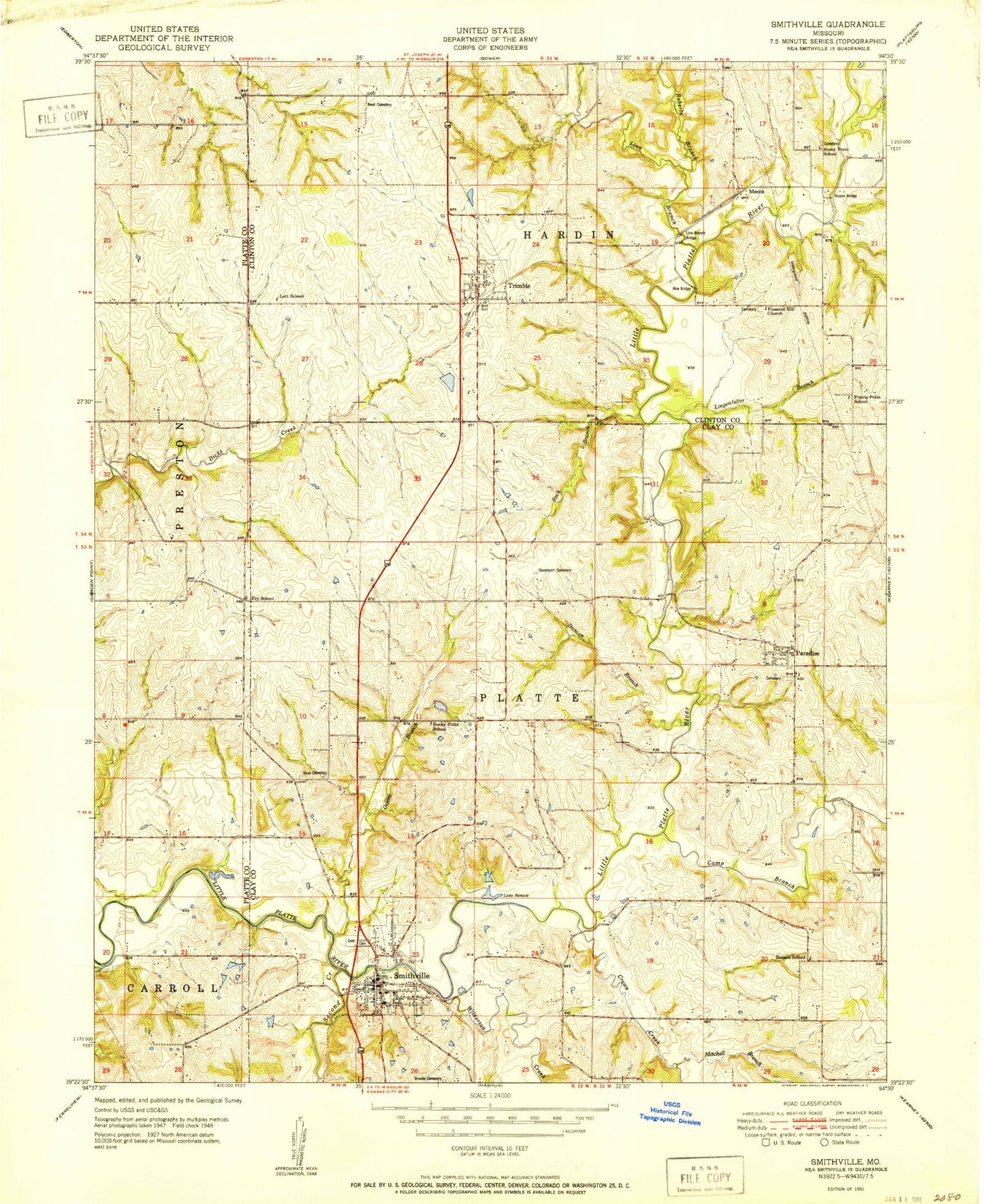
MyTopo
Classic USGS Smithville Missouri 7.5'x7.5' Topo Map
Couldn't load pickup availability
Historical USGS topographic quad map of Smithville in the state of Missouri. Map scale may vary for some years, but is generally around 1:24,000. Print size is approximately 24" x 27"
This quadrangle is in the following counties: Clay, Clinton, Platte.
The map contains contour lines, roads, rivers, towns, and lakes. Printed on high-quality waterproof paper with UV fade-resistant inks, and shipped rolled.
Contains the following named places: Bainbridge Lake Dam, Benson School, Brooks Cemetery, Camp Branch, City of Smithville, City of Trimble, Crows Creek, Davenport Cemetery, Duncan Branch, Edgerton - Trimble Fire Protection District Station 2, Fry School, Goss Cemetery, H and H Lake, H and H Lake Dam, H and H Lakes, Helvely Park Dam, Helvely Park Lake, Hixson Bridge, Hixson Mill, J C Ranch Lake, Johnson Dam, Kings Lake, Lake Remote, Lake Wahoo Waters, Lingenfelter Branch, Linn Branch, Linn Branch Bridge, Lott School, Mecca, Miller Lake, Mitchell Branch, Mononame 160 Reservoir, Mononame 162 Dam, Mononame 163 Dam, Norman Fann Farm Airport, Owens Branch, Paradise, Paradise Cemetery, Paradise Census Designated Place, Parks Field, Pleasant Hill Church, Prairie Point School, Reed Cemetery, Roberts Branch, Rock Branch, Rocky Point School, Ross Mills, Saint Luke's North Hospital - Smithville, Second Creek, Shady Hollow Dams Dam, Shady Hollow Lakes, Smithville, Smithville Area Fire Protection District Station 1, Smithville Dam, Smithville High School, Smithville Lake, Smithville Police Department, Smithville Primary Elementary School, Starr Airport, Stony Point School, Township of Hardin, Township of Platte, Trimble, Trimble Post Office, Trimble Wildlife Dam, Trimble Wildlife Lake, Trimble Wildlife Management Area, Wilkerson Creek, ZIP Codes: 64089, 64492