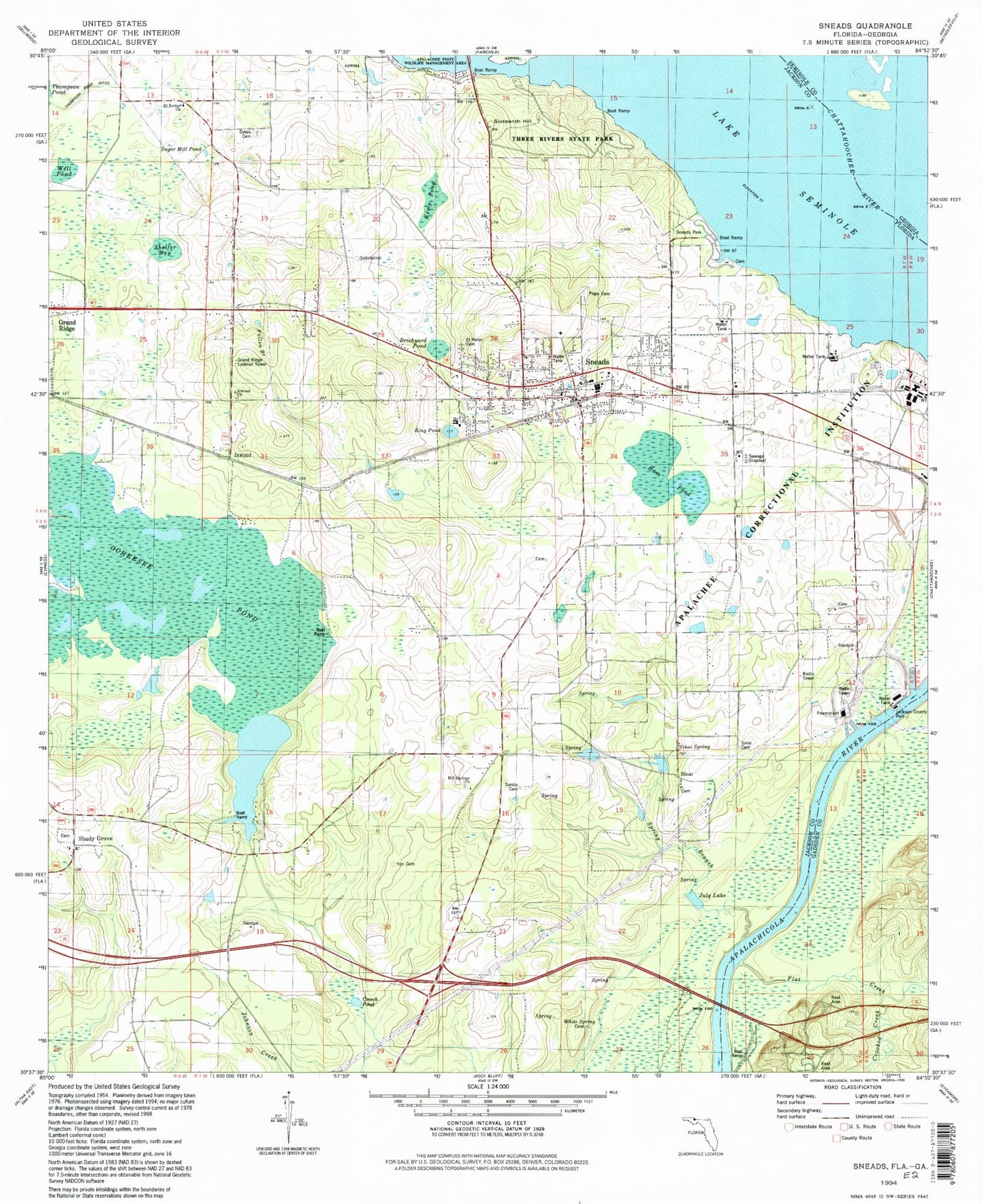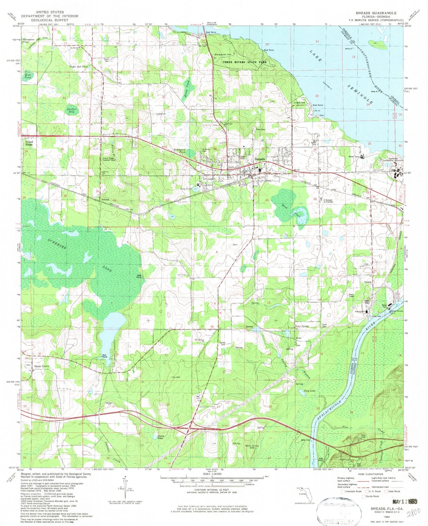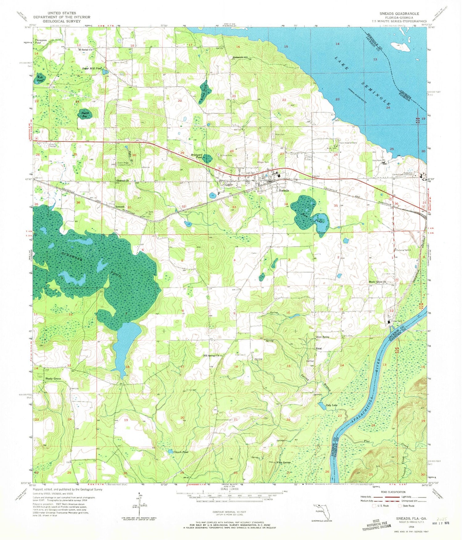
MyTopo
Classic USGS Sneads Florida 7.5'x7.5' Topo Map
Couldn't load pickup availability
Historical USGS topographic quad map of Sneads in the state of Florida. Map scale may vary for some years, but is generally around 1:24,000. Print size is approximately 24" x 27"
This quadrangle is in the following counties: Gadsden, Jackson, Seminole.
The map contains contour lines, roads, rivers, towns, and lakes. Printed on high-quality waterproof paper with UV fade-resistant inks, and shipped rolled.
Contains the following named places: Apalachee Correctional Institution, Apalachee Correctional Institution East Unit, Apalachee Correctional Institution West Unit, Boykin Railroad Station, Brickyard Pond, Copperhead Branch, Creech Pond, Crooked Creek, Dewey M Johnson Bridge, Dykes Cemetery, Earth Day Sinking Stream, El Bethel Church, Faith Baptist Church School, Fallen Branch, Flat Creek, Grand Ridge Lookout Tower, Ham Pond, Inwood, Inwood Church, Inwood Post Office, Jackson County Fire and Rescue Station 3, Judy Lake, July Lake, Kemp Pond, Kilpatrick Farm Airport, Mill Springs Church, Ocheesee Gardens, Osochi, Pope Cemetery, Shady Grove, Shady Grove Baptist Church, Shady Grove Church, Shelfer Bay, Sinai, Sinai Cemetery, Sinai Spring, Sixteenth Hill, Sneads, Sneads Division, Sneads Elementary School, Sneads High School, Sneads Police Department, Sneads Post Office, Sneads Volunteer Fire Department, Spring Branch, Sugar Mill Pond, Tamathli, Three Rivers State Park, Town of Sneads, Well Pond, White Springs, Yamassee, Yon Cemetery