MyTopo
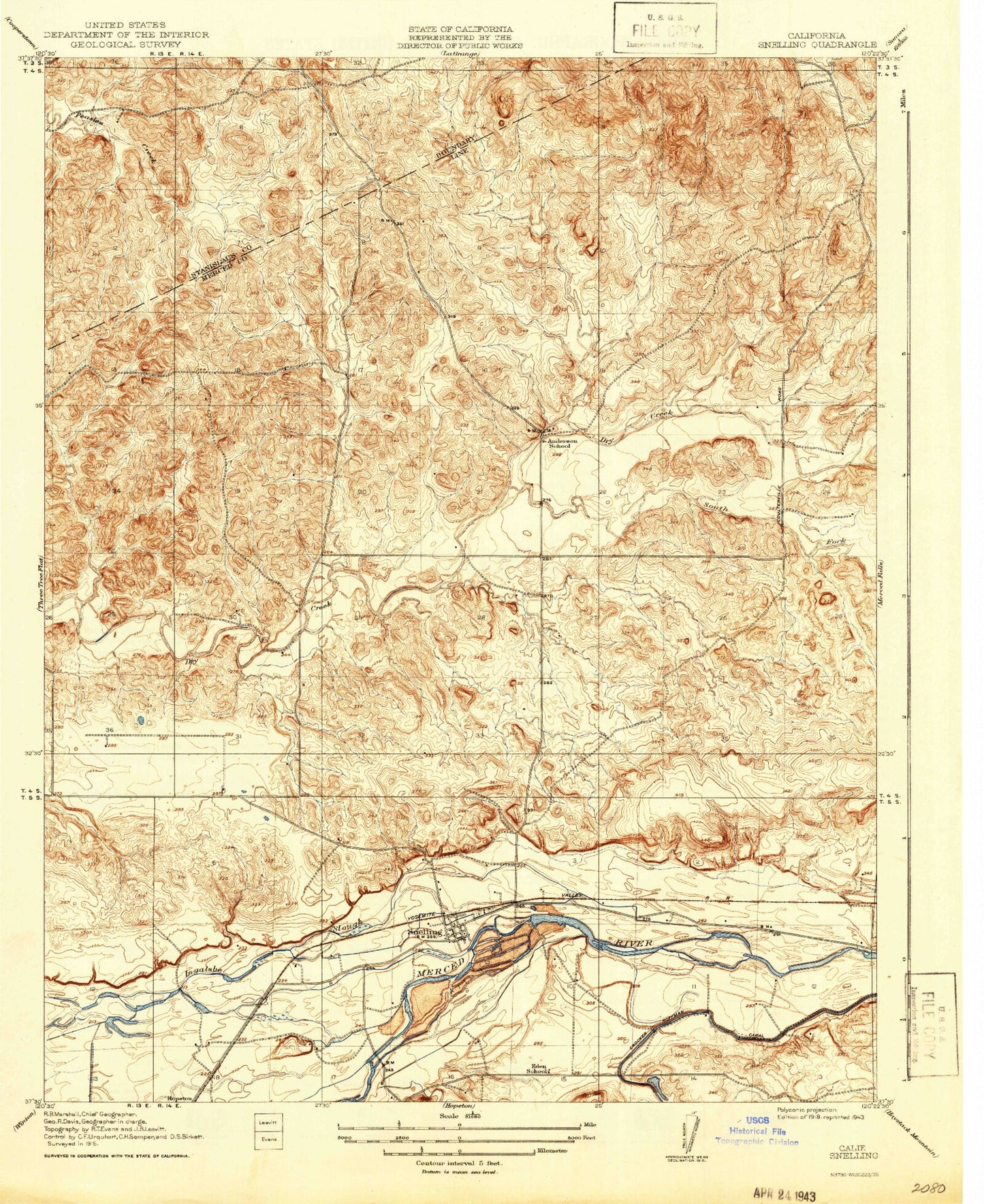
Classic USGS Snelling California 7.5'x7.5' Topo Map
Couldn't load pickup availability
Historical USGS topographic quad map of Snelling in the state of California. Map scale may vary for some years, but is generally around 1:24,000. Print size is approximately 24" x 27"
This quadrangle is in the following counties: Mariposa, Merced, Stanislaus.
The map contains contour lines, roads, rivers, towns, and lakes. Printed on high-quality waterproof paper with UV fade-resistant inks, and shipped rolled.
Contains the following named places: Anderson School, Bonanza Hills Airport, Eden School, Hayward Creek, Henderson Park, Merced County Fire Department Snelling Fire Station 65, Negro Hill, North Side Canal, Snelling, Snelling Census Designated Place, Snelling Division, Snelling Post Office, Snelling-Merced Falls Elementary School, South Fork Dry Creek, ZIP Code: 95369