MyTopo
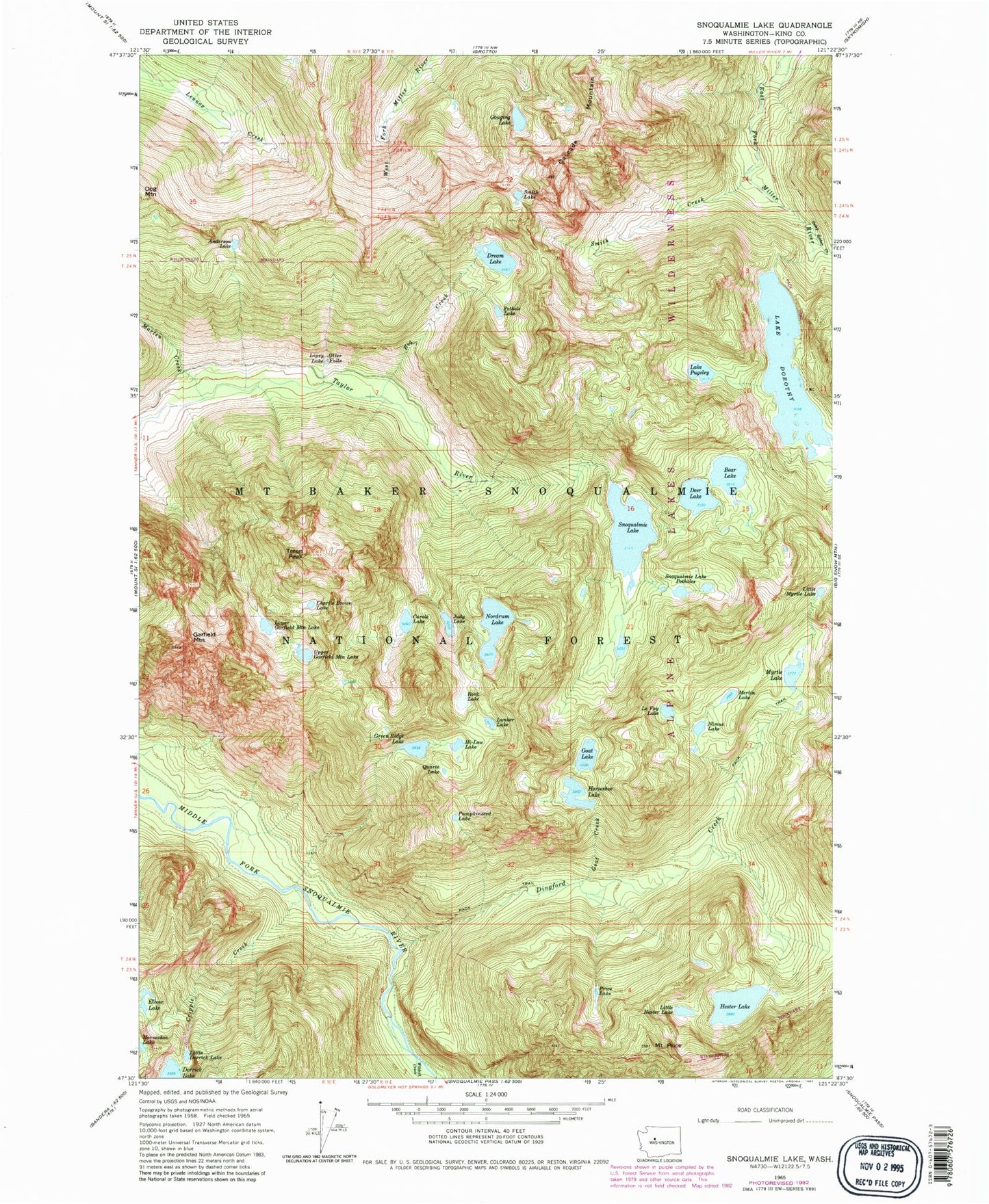
Classic USGS Snoqualmie Lake Washington 7.5'x7.5' Topo Map
Couldn't load pickup availability
Historical USGS topographic quad map of Snoqualmie Lake in the state of Washington. Typical map scale is 1:24,000, but may vary for certain years, if available. Print size: 24" x 27"
This quadrangle is in the following counties: King.
The map contains contour lines, roads, rivers, towns, and lakes. Printed on high-quality waterproof paper with UV fade-resistant inks, and shipped rolled.
Contains the following named places: Anderson Lake, Bear Lake, Big Creek, Camp Robber Creek, Carole Lake, Cascade Mountain, Charlie Brown Lake, Deer Lake, Dingford Creek, Lake Dorothy, Dream Lake, Garfield Mountain, Goat Creek, Goat Lake, Gouging Lake, Green Ridge Lake, Hester Lake, Hi-Low Lake, Horseshoe Lake, Judy Lake, Le Fay Lake, Lipsy Lake, Little Derrick Lake, Little Hester Lake, Little Myrtle Lake, Lower Garfield Mountain Lake, Lunker Lake, Marten Creek, Merlin Lake, Myrtle Lake, Nimue Lake, Nordrum Lake, Otter Falls, Pothole Lake, Price Lake, Mount Price, Lake Pugsley, Pumpkinseed Lake, Quartz Lake, Rock Lake, Smith Creek, Smith Lake, Snoqualmie Lake, Snoqualmie Lake Potholes, Treen Peak, Upper Garfield Mountain Lake, Wildcat Creek, Dingford Creek Falls, Florence Falls, Cripple Creek