MyTopo
Classic USGS Snoqualmie Pass Washington 7.5'x7.5' Topo Map
Couldn't load pickup availability
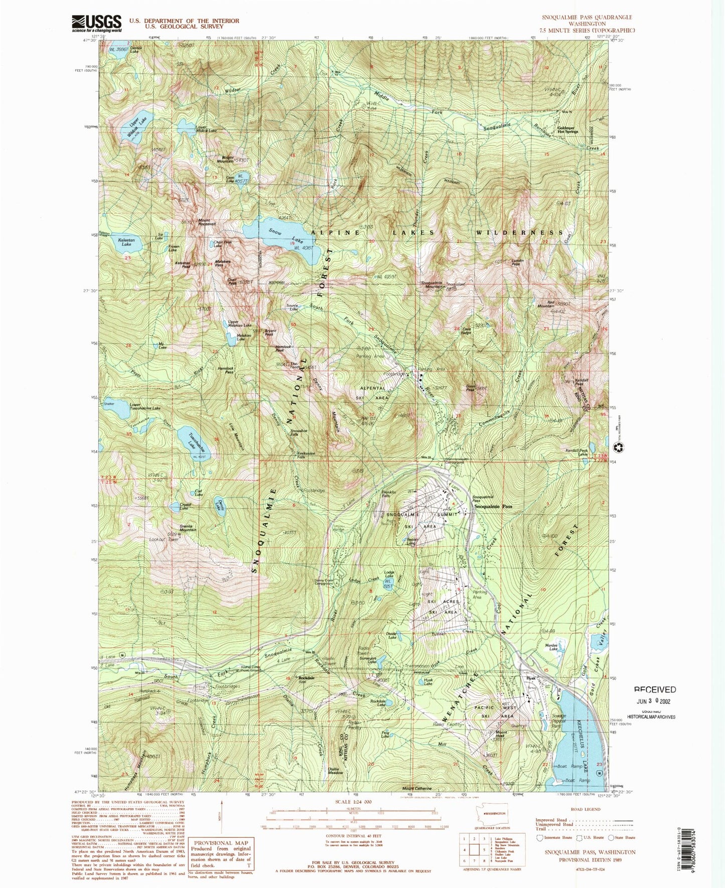
Historical USGS topographic quad map of Snoqualmie Pass in the state of Washington. Typical map scale is 1:24,000, but may vary for certain years, if available. Print size: 24" x 27"
This quadrangle is in the following counties: King, Kittitas.
The map contains contour lines, roads, rivers, towns, and lakes. Printed on high-quality waterproof paper with UV fade-resistant inks, and shipped rolled.
Contains the following named places: Beaver Lake, Bryant Peak, Burnboot Creek, Cave Ridge, Chair Peak, Chair Peak Lake, Coal Creek, Cad Lake, Commonwealth Creek, Commonwealth Campground, Crystal Lake, Curtis Forest Camp, Denny Creek, Denny Creek, Denny Lake, Derrick Lake, Divide Lake, Franklin Falls, Frog Lake, Frozen Lake, Gem Lake, Goat Creek, Gold Creek, Gold Creek Valley, Goldmyer Hot Springs, Granite Mountain, Guye Peak, Hemlock Pass, Humpback Creek, Hyak, Hyak Creek, Hyak Lake, Mount Hyak, Ice Lake, Kaleetan Lake, Kaleetan Peak, Keekwulee Falls, Kendall Peak, Kendall Peak Lakes, Lodge Lake, Low Mountain, Lower Tuscohatchie Lake, Lower Wildcat Lake, Lundin Peak, Mardee Lake, Melakwa Lake, Melakwa Pass, Middle Fork Trail, My Lake, Olallie Creek, Olallie Meadow, Red Mountain, Rock Creek, Rock Creek Shelter, Rockdale, Rockdale Lake, Mount Roosevelt, Snoqualmie Mountain, Snoqualmie Pass, Snoqualmie Tunnel, Snow Lake, Snowshoe Falls, Source Lake, Surveyors Lake, The Tooth, Thunder Creek, Tunnel Creek, Tuscohatchie Lake, Upper Melakwa Lake, Upper Wildcat Lake, Wright Mountain, Lodge Creek, Rockdale Creek, Keechelus Boat Launch, Alpental Ski Area, Denny Creek Trailhead, Snoqualmie Summit Ski Area, Ski Acres Ski Area, Wagonroad Trail, Pacific West Ski Area, Pacific Crest Trailhead, Pratt Creek Trailhead, Granite Mountain Lookout, Cad Lake, Granite Mountain Lakes, Asahel Curtis Picnic Ground, Denny Mountain, Snoqualmie Pass Recreation Area, Snoqualmie Pass, Snoqualmie Pass Census Designated Place, Snoqualmie Pass Fire and Rescue, Middle Fork Snoqualmie Wild and Scenic River