MyTopo
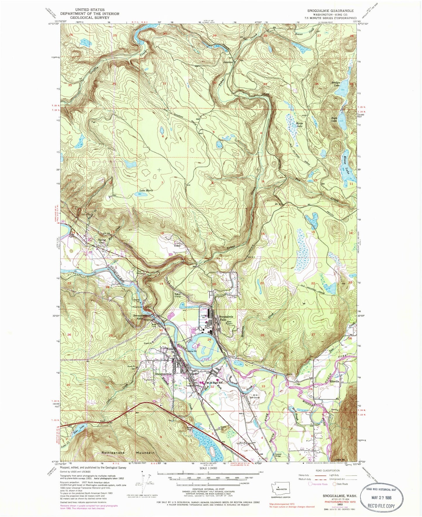
Classic USGS Snoqualmie Washington 7.5'x7.5' Topo Map
Couldn't load pickup availability
Historical USGS topographic quad map of Snoqualmie in the state of Washington. Typical map scale is 1:24,000, but may vary for certain years, if available. Print size: 24" x 27"
This quadrangle is in the following counties: King.
The map contains contour lines, roads, rivers, towns, and lakes. Printed on high-quality waterproof paper with UV fade-resistant inks, and shipped rolled.
Contains the following named places: Boyle Lake, Bridges Lake, Brockway Creek, Coal Creek, East Fork Kimball Creek, Echo Lake, Ellisville, Junction, Kimball Creek, Kings Lake, Klaus Lake, Lake Marie, Meadowbrook Slough, Middle Fork Snoqualmie River, Mount Si High School, Mud Creek, North Fork Snoqualmie River, Reid Slough, Skunk Creek, Snoqualmie, Snoqualmie Falls, Snoqualmie Falls, South Fork Snoqualmie River, Spring Glen, Tate Creek, Ten Creek, Tokul, Tokul, Tokul Creek, Borst Lake, Kimball Creek Swamp, Snoqualmie Diversion Dam, Snoqualmie Mill Pond Dam, Snoqualmie Mill Pond, Echo Lake Dam, Mount Si Golf Course, Snoqualmie Middle School, Snoqualmie Elementary School, Fall City Airport, City of Snoqualmie, Snoqualmie Reservation, Snoqualmie Middle School, Mountain View School, Snoqualmie Valley School District Office, Snoqualmie Valley Christian School, Spring Glen Mobile Home Park, Snoqualmie River Bridge, Snoqualmie Ridge Golf Course, Snoqualmie Sewage Treatment Plant, Snoqualmie Fire Department, North Bend Police, King County Sheriff North Bend, Snoqualmie Post Office