MyTopo
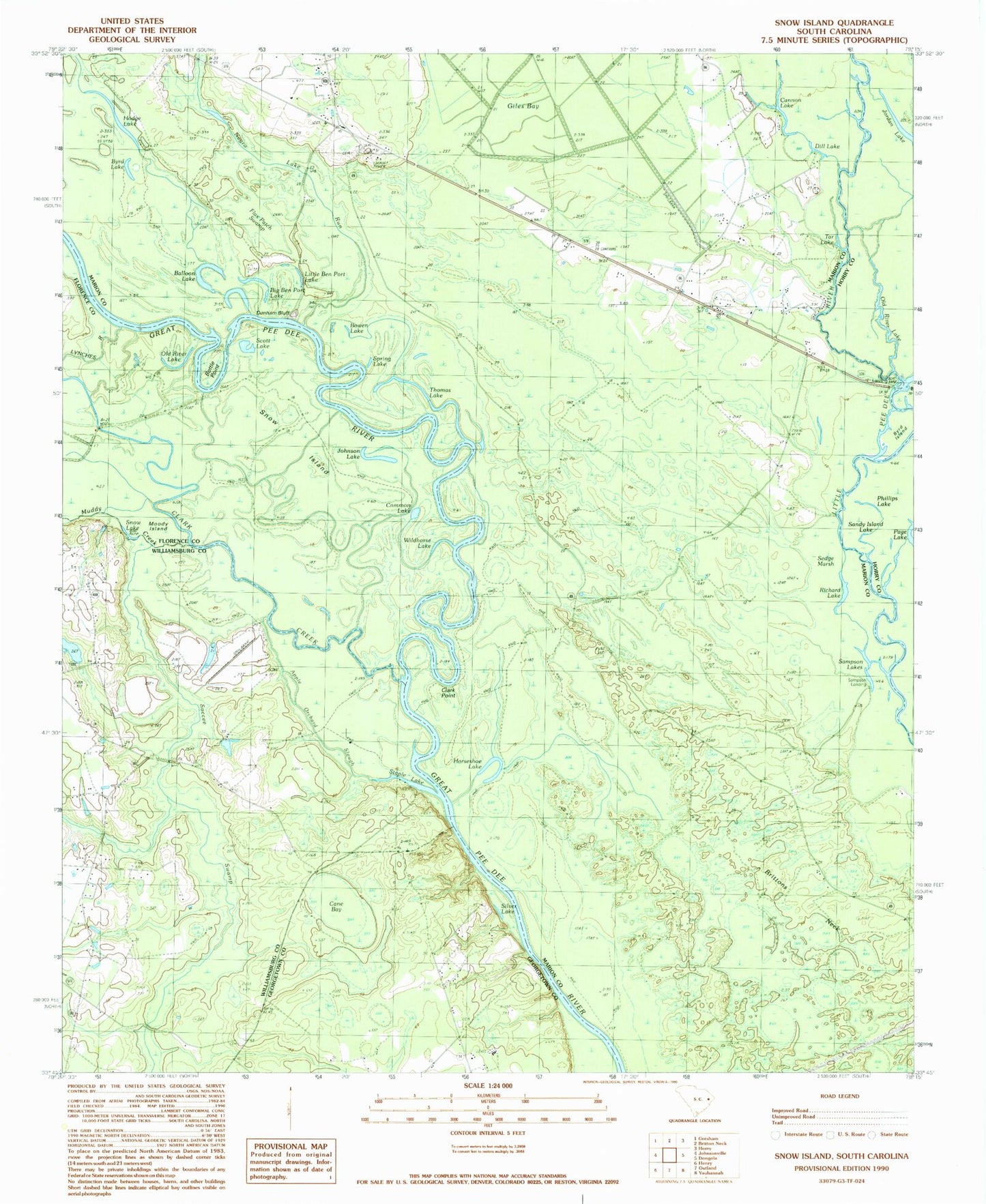
Classic USGS Snow Island South Carolina 7.5'x7.5' Topo Map
Couldn't load pickup availability
Historical USGS topographic quad map of Snow Island in the state of South Carolina. Map scale may vary for some years, but is generally around 1:24,000. Print size is approximately 24" x 27"
This quadrangle is in the following counties: Florence, Georgetown, Horry, Marion, Williamsburg.
The map contains contour lines, roads, rivers, towns, and lakes. Printed on high-quality waterproof paper with UV fade-resistant inks, and shipped rolled.
Contains the following named places: Apple Orchard Slough, Balloon Lake, Big Ben Port Lake, Bottle Point, Bowen Lake, Bradley and Britton Ferry, Brittons Neck Division, Brittons Neck Lookout Tower, Byrd Island, Byrd Lake, Cane Bay, Cane Bay School, Cannon Lake, Clark Creek, Clark Point, Common Lake, Dill Lake, Dunham Bluff, Flax Patch Swamp, Hodge Lake, Horseshoe Lake, Johnson Lake, Jordan Lake, Little Ben Port Lake, Lone Pine Lake, Lone Pine Lake Run, Lynches River, Muddy Creek, Nurse Chapel, Old Ark Church, Old River Lake, Palmetto Swamp, Phillips Lake, Pine Bluff Cemetery, Pine Bluff Church, Piney Grove Baptist Church, Pitch Landing, Potatoe Bed Ferry Bridge, Richard Lake, Sampson Lakes, Sampson Landing, Scott Lake, Silver Lake, Snow Island, Snow Lake, Soccee Swamp, Spring Lake, Staple Lake, Tar Lake, Thomas Lake, Wildhorse Lake, Woodbury Rod and Gun Club