
MyTopo
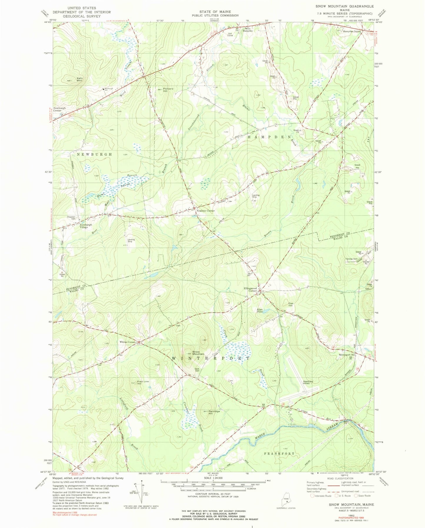
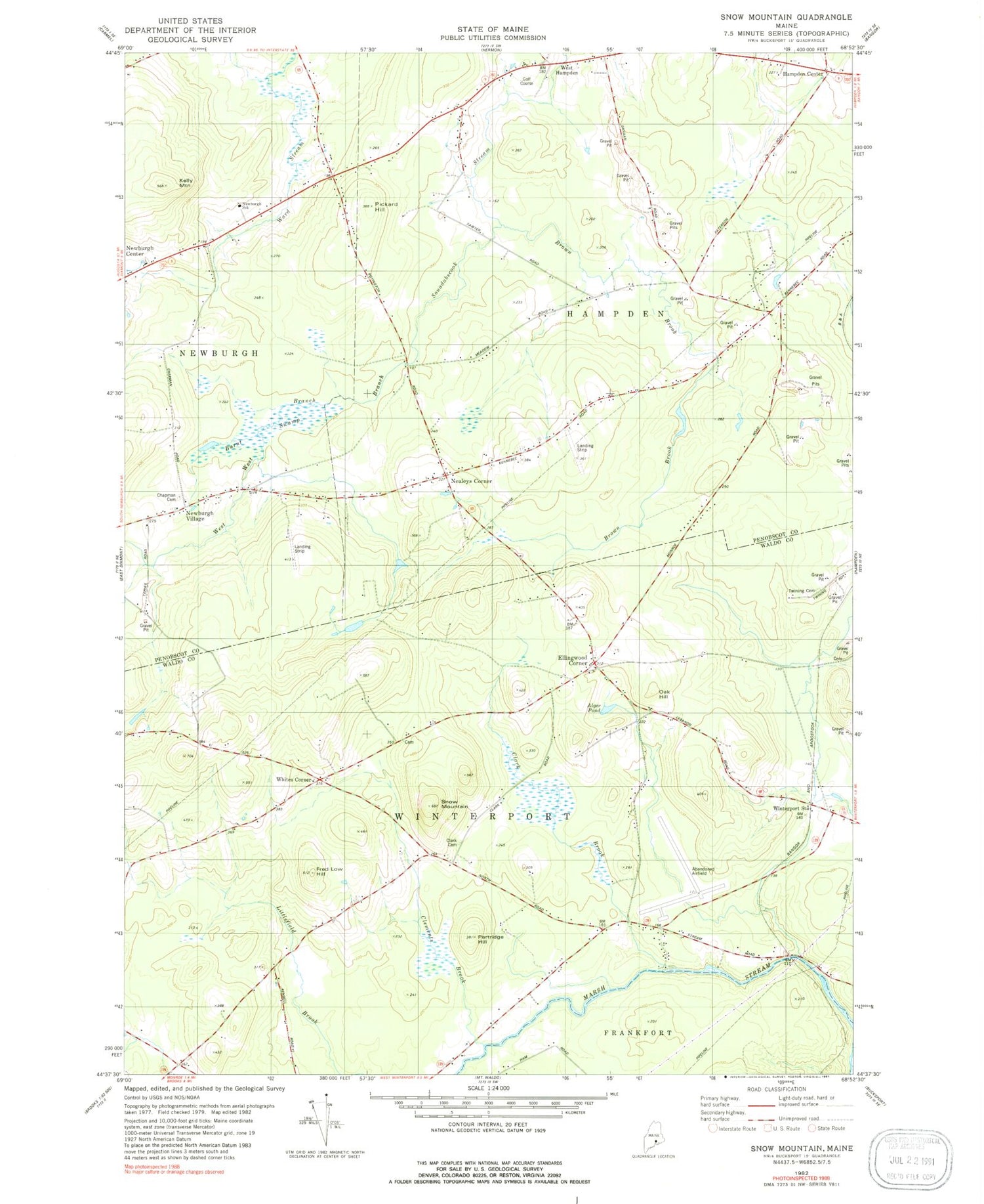
Classic USGS Snow Mountain Maine 7.5'x7.5' Topo Map
Couldn't load pickup availability
Historical USGS topographic quad map of Snow Mountain in the state of Maine. Typical map scale is 1:24,000, but may vary for certain years, if available. Print size: 24" x 27"
This quadrangle is in the following counties: Penobscot, Waldo.
The map contains contour lines, roads, rivers, towns, and lakes. Printed on high-quality waterproof paper with UV fade-resistant inks, and shipped rolled.
Contains the following named places: Alger Pond, Brown Brook, Burnt Swamp, Chapman Cemetery, Clark Brook, Clark Cemetery, Clements Brook, Fred Low Hill, Kelly Mountain, Longfellow School, Oak Hill, Partridge Hill, Pickard Hill, Snow Mountain, Twining Cemetery, Newburgh Elementary School, Whites Corner, Winterport Station, Ellingwood Corner, Hampden Center, Nealeys Corner, Newburgh Village, West Hampden, Town of Hampden, Town of Winterport, Hampden Country Club, Neallys Corner Cemetery, Neallys Corner Methodist Church, West Hampden Baptist Church, Newburgh Volunteer Fire Station, Ellingwood Corner Cemetery, Perkins Cemetery, Newburgh Community Library