MyTopo
Classic USGS Snow Peak Oregon 7.5'x7.5' Topo Map
Regular price
$16.95
Regular price
Sale price
$16.95
Unit price
per
Couldn't load pickup availability
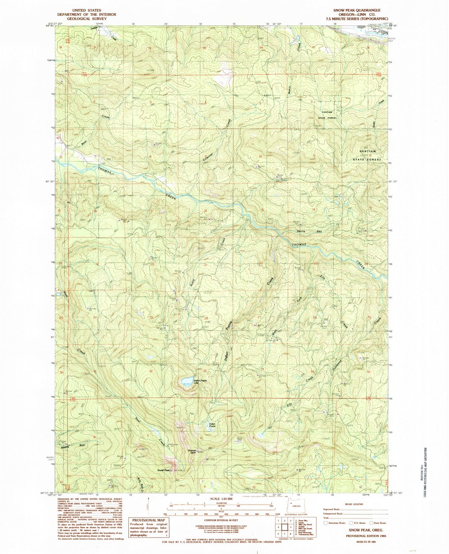
Historical USGS topographic quad map of Snow Peak in the state of Oregon. Map scale may vary for some years, but is generally around 1:24,000. Print size is approximately 24" x 27"
This quadrangle is in the following counties: Linn, Marion.
The map contains contour lines, roads, rivers, towns, and lakes. Printed on high-quality waterproof paper with UV fade-resistant inks, and shipped rolled.
Contains the following named places: Avery Creek, Bradshaw Creek, Crabtree Lake Trail, Criminal Creek, Devils Den, Ella Creek, Hortense Creek, Indian Prairie, Indian Prairie Creek, Indian Prairie Lake, Potter, Snow Peak, Snow Peak Mill City Trail, Thomas Cairn, West Fork Ella Creek