MyTopo
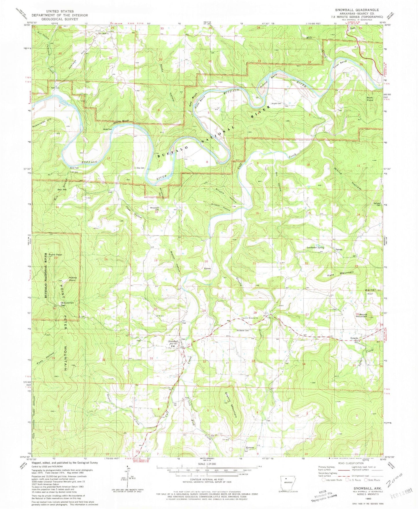
Classic USGS Snowball Arkansas 7.5'x7.5' Topo Map
Couldn't load pickup availability
Historical USGS topographic quad map of Snowball in the state of Arkansas. Typical map scale is 1:24,000, but may vary for certain years, if available. Print size: 24" x 27"
This quadrangle is in the following counties: Searcy.
The map contains contour lines, roads, rivers, towns, and lakes. Printed on high-quality waterproof paper with UV fade-resistant inks, and shipped rolled.
Contains the following named places: DePriest Cemetery, Rollins Point, Whisenant Cemetery, Garrett Memorial Church, Buroak, Township of Calf Creek, Township of Saint Joe, Slicker (historical), Snowball Baptist Church, Zeb (historical), Abbey Cemetery, Arnold Bend, Arnold Cemetery, Ben Branch, Ben Hill, Bend Ford, Blanco Hollow, Blanco School, Brown School, Buck Point, Bull Hollow, Buroak School, Cash Bend, Dongola, Gin Hollow, Gourd Creek, Granny Creek, Granny Mountain, Hage Hollow, Jamison Hill, Leadbetter Spring, Lick Fork Creek, Manes Town School, Marsena, McCutchen Gap, Mill Creek, Pate Mountain, Peter Cave, Point Peter, Red Bluff, Robertson Hill, Rocky Hollow, Point Peter Mountain, Round Mountain, Shady Grove School, Sinyard Hollow, Slay Cemetery, Slicker School, Tyler Bend, Whisenant Hollow, White Bluff, White Ford, White Hollow, Wildcat Hollow, Pine Bluff Church, Blanco, Calf Creek, Jamison Creek, Pine Bluff Church, McDaniel Cemetery, Snowball, Rollins Point, Cambell Hollow, Snowball Post Office (historical), Snowball Fire Station, Christy Cemetery, Lawrence Cemetery, Old Arnold Cemetery, White / Mays Cemetery