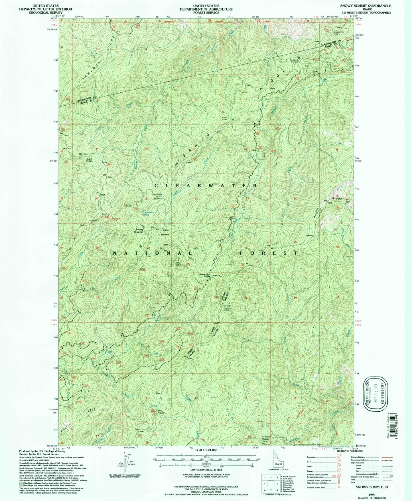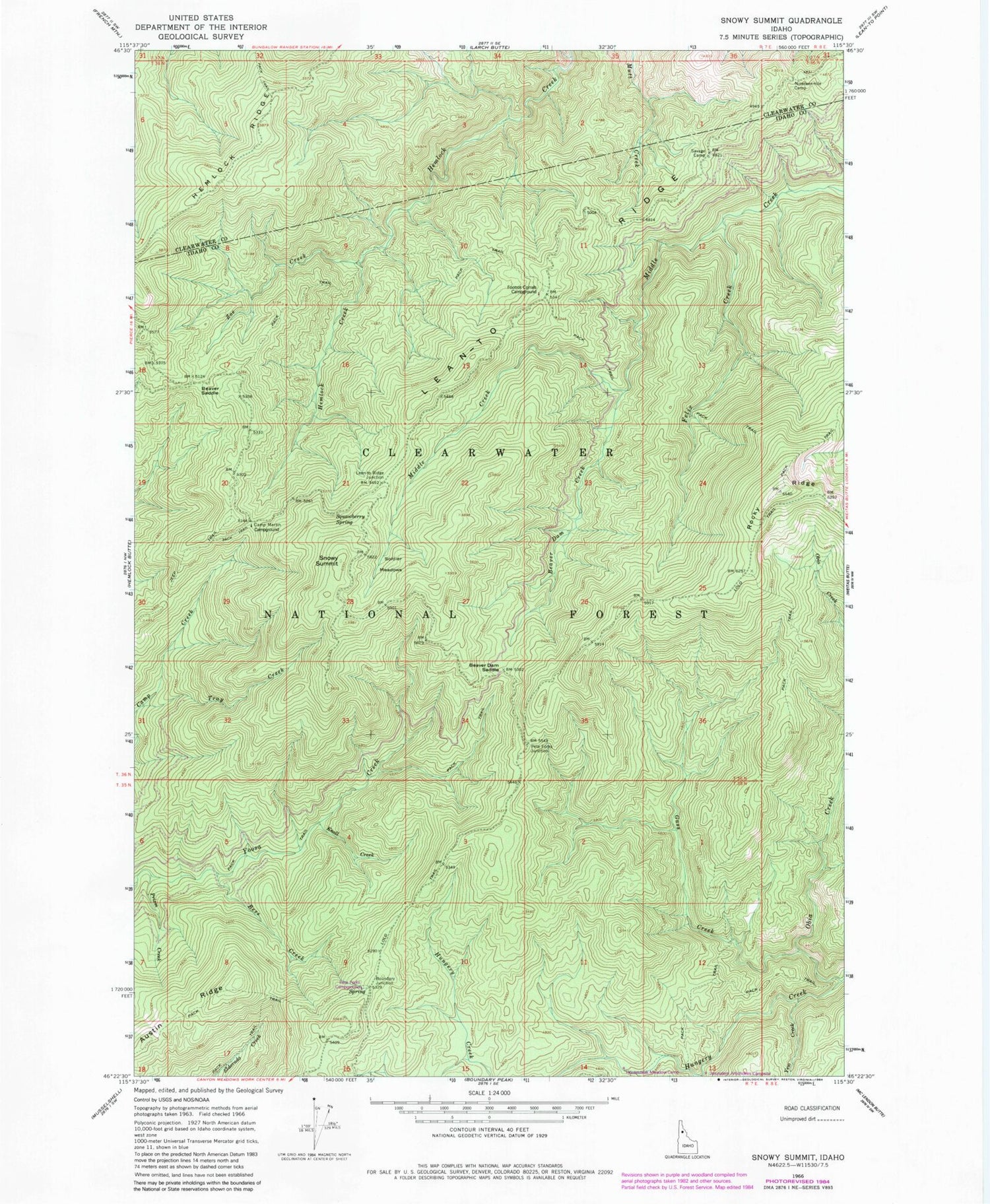
MyTopo
Classic USGS Snowy Summit Idaho 7.5'x7.5' Topo Map
Couldn't load pickup availability
Historical USGS topographic quad map of Snowy Summit in the state of Idaho. Map scale may vary for some years, but is generally around 1:24,000. Print size is approximately 24" x 27"
This quadrangle is in the following counties: Clearwater, Idaho.
The map contains contour lines, roads, rivers, towns, and lakes. Printed on high-quality waterproof paper with UV fade-resistant inks, and shipped rolled.
Contains the following named places: Austin Ridge, Beaver Dam Creek, Beaver Dam Saddle, Beaver Saddle, Bess Creek, Camp Martin, Felix Creek, Footrot Corrals, Footrot Corrals Campground, Gass Creek, Hemlock Ridge, Horsesteak Meadow Camp, Jerusalem Artichokes Campsite, Knoll Creek, Lean-To Ridge, Nineteenmile Camp, Obia Creek, Pete Forks Campground, Prism Creek, Rocky Ridge, Savage Camp, Snowy Summit, Soldier Meadows, Squawberry Spring, Tray Creek, Yew Creek, Zoe Creek