MyTopo
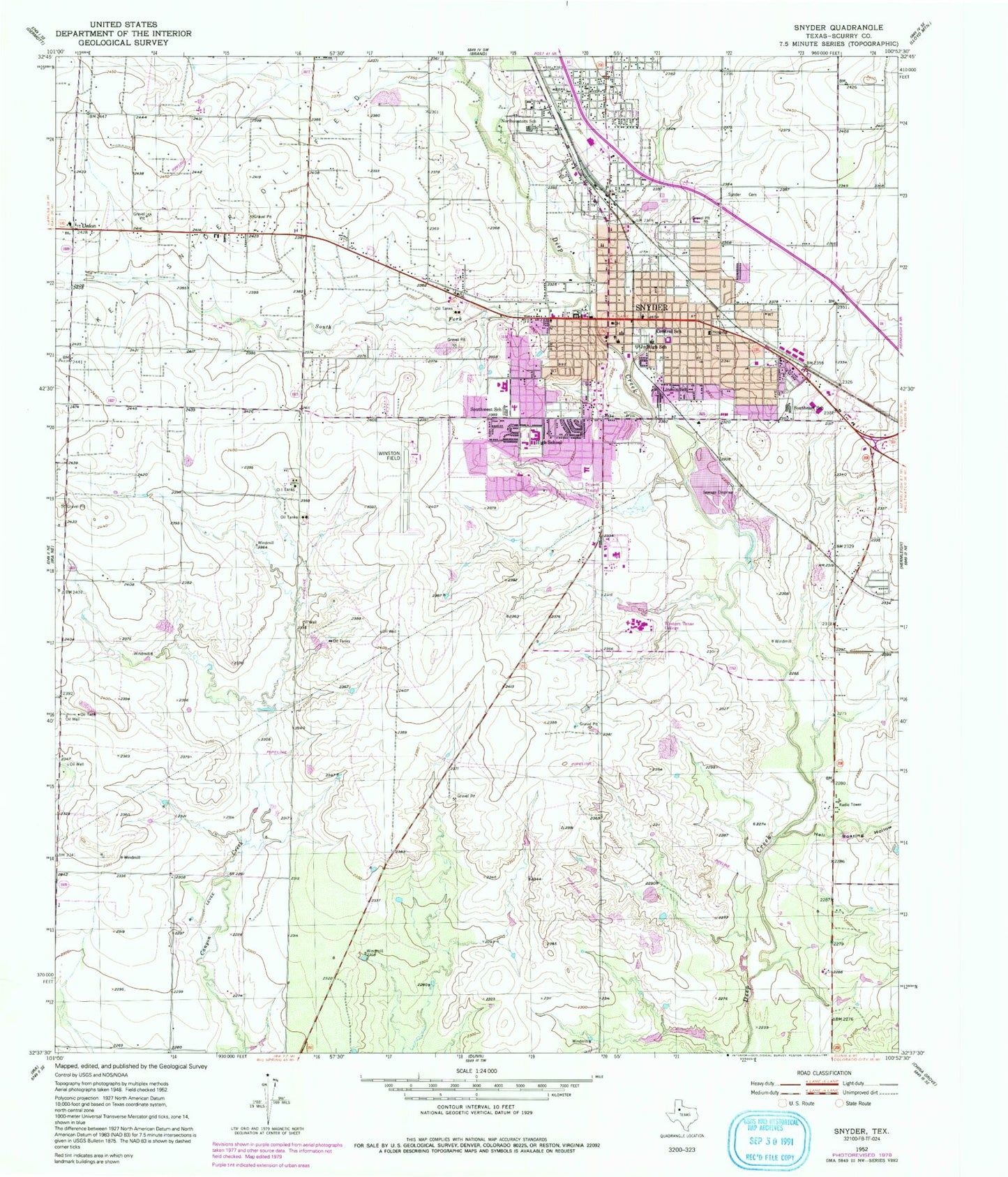
Classic USGS Snyder Texas 7.5'x7.5' Topo Map
Couldn't load pickup availability
Historical USGS topographic quad map of Snyder in the state of Texas. Map scale may vary for some years, but is generally around 1:24,000. Print size is approximately 24" x 27"
This quadrangle is in the following counties: Scurry.
The map contains contour lines, roads, rivers, towns, and lakes. Printed on high-quality waterproof paper with UV fade-resistant inks, and shipped rolled.
Contains the following named places: Apostolic Faith Church, Bautista Primera Iglesia Church, Central Elementary School, Church of God, City of Snyder, Cogdell Memorial Hospital, Colonial Hill Baptistchurch, East Elementary School, Faith Baptist Church, First Baptist Church, First Presbyterian Church, Grace Lutheran Church, Hell Roaring Hollow, KSNY-AM (Snyder), Lincoln School, Morningside Baptist Church, Mount Olive Baptist Church, New Hope Baptist Church, North College Avenue Baptist Church, North East Park, Northeast Elementary School, Northwest School, Primitive Baptist Church, Scurry County, Scurry County Courthouse, Scurry County Emergency Medical Service, Scurry County Jail, Scurry County Museum, Scurry County Sheriff's Office, Snyder, Snyder Cemetery, Snyder City Hall, Snyder Fire Department, Snyder Fire Department Administration, Snyder High School, Snyder Junior High School, Snyder Police Department, Snyder Post Office, South Fork Deep Creek, Southeast School, Southwest Medical Evacuation Snyder Base, Southwest School, Spanish Church of Christ, Stanfield Elementary School, The Church of Jesus Christ of Latter Day Saints, Tiger Stadium, Trinity United Methodist Church, Union, West Elementary School, Winston Field, Winston Park