MyTopo
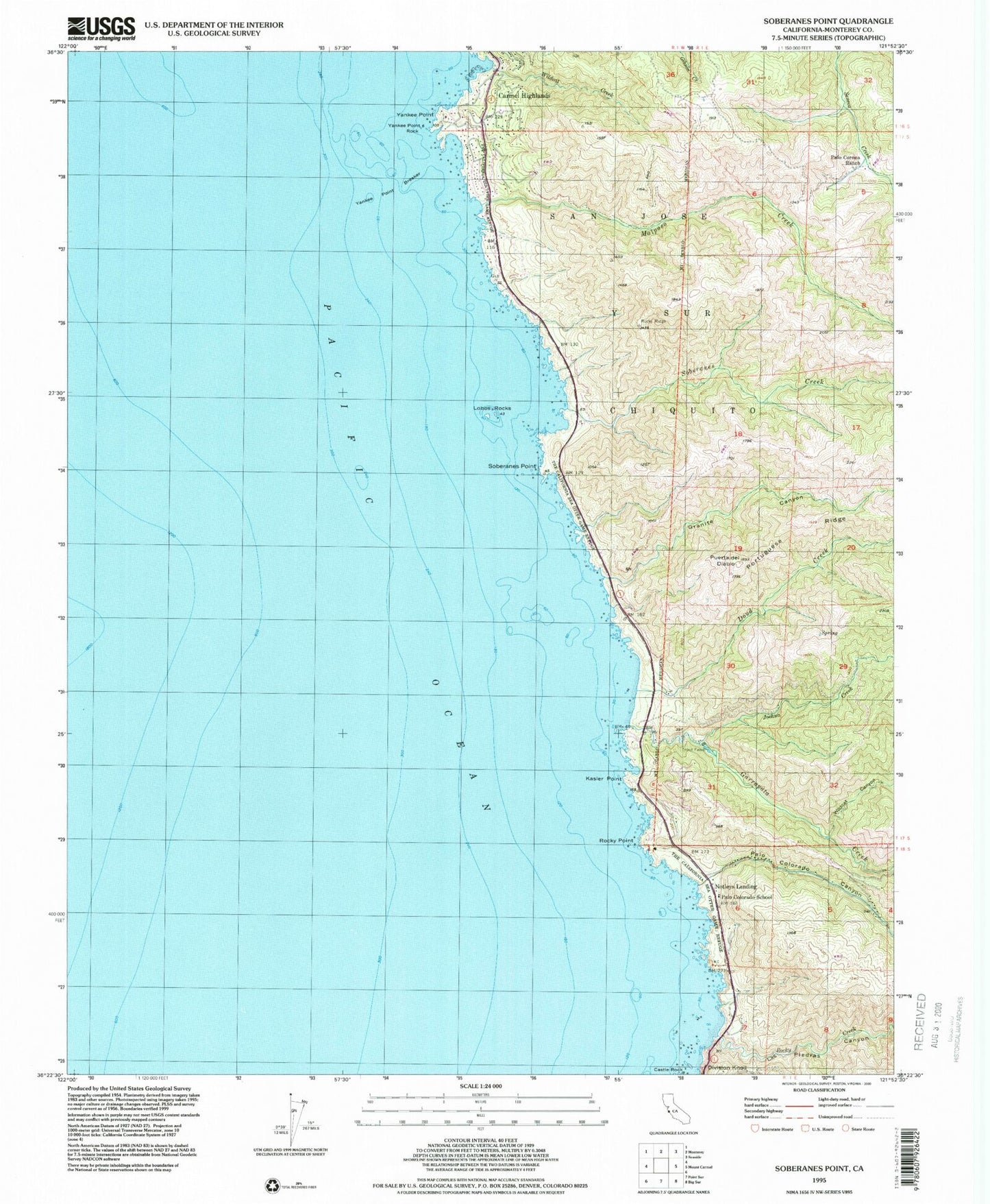
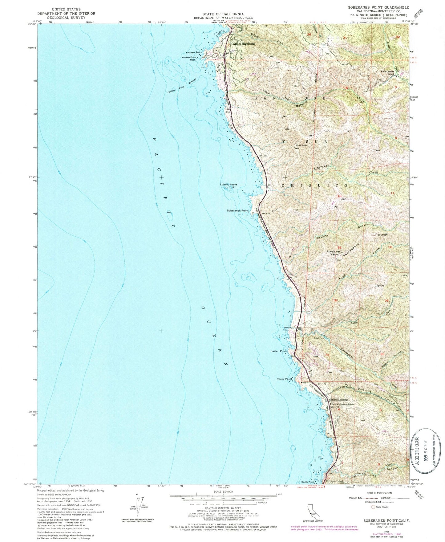
Classic USGS Soberanes Point California 7.5'x7.5' Topo Map
Couldn't load pickup availability
Historical USGS topographic quad map of Soberanes Point in the state of California. Map scale may vary for some years, but is generally around 1:24,000. Print size is approximately 24" x 27"
This quadrangle is in the following counties: Monterey.
The map contains contour lines, roads, rivers, towns, and lakes. Printed on high-quality waterproof paper with UV fade-resistant inks, and shipped rolled.
Contains the following named places: Cushing Mountain, Doud Creek, Garrapata Creek, Garrapata State Park, Granite Canyon, Joshua Creek, Kasler Point, Las Piedras Canyon, Lobos Rocks, Malpaso Creek, Notleys Landing, Palo Colorado Canyon, Palo Colorado School, Palo Corona Ranch, Portuguese Ridge, Puerta del Diablo, Rocky Creek, Rocky Point, Rocky Ridge Trail, San Jose Y Sur Chiquito, Soberanes Canyon Trail, Soberanes Creek, Soberanes Point, Whale Peak, Wildcat Canyon, Wildcat Creek, Yankee Point, Yankee Point Breaker, Yankee Point Rock