
MyTopo
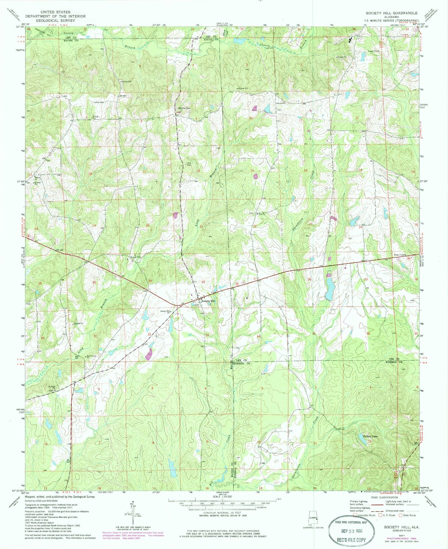
Classic USGS Society Hill Alabama 7.5'x7.5' Topo Map
Couldn't load pickup availability
Historical USGS topographic quad map of Society Hill in the state of Alabama. Map scale may vary for some years, but is generally around 1:24,000. Print size is approximately 24" x 27"
This quadrangle is in the following counties: Lee, Macon, Russell.
The map contains contour lines, roads, rivers, towns, and lakes. Printed on high-quality waterproof paper with UV fade-resistant inks, and shipped rolled.
Contains the following named places: Ag Engineering Farm Pond, Agricultural Engineering Unit Auburn University, Ailey Branch, Beauregard Volunteer Fire Department Station 3, Bennett Branch, Bethel Church, Brownville Number One School, Brownville Number Two School, Brownville Volunteer Fire Department, Cobbs Cemetery, Crump Chapel Church, Engineering Farm Pond, Groce Lake, Holt Cemetery, Huskeys Dam, Huskeys Pond, J P Groce Dam, Jacobs Dam, Kelly Pond Number Two, Kellys Pond Number One, Lake Jacobs, Mullins School, Odom Creek, Providence Church, Reese Chapel, Saint Paul Cemetery, Saint Pauls Church, Samford School, Sand Creek Church, Sanford High School, Sanford Middle School, Shiloh Church, Society Hill, Society Hill Cemetery, Society Hill Church, Strawberry Branch, T U Kelly Number 1 Dam, T U Kelly Number 2 Dam, Talbert Dam, Talbert Lake, Tsinia Wildlife Viewing Area, Whatley Cemetery, Whatley School, Wright Cemetery, Zion Church


