MyTopo
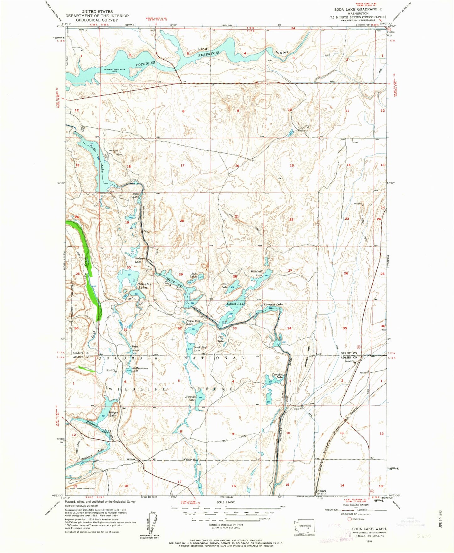
Classic USGS Soda Lake Washington 7.5'x7.5' Topo Map
Couldn't load pickup availability
Historical USGS topographic quad map of Soda Lake in the state of Washington. Typical map scale is 1:24,000, but may vary for certain years, if available. Print size: 24" x 27"
This quadrangle is in the following counties: Adams, Grant.
The map contains contour lines, roads, rivers, towns, and lakes. Printed on high-quality waterproof paper with UV fade-resistant inks, and shipped rolled.
Contains the following named places: Campbell Lake, Canal Lake, Crescent Lake, Halfmoon Lake, Heart Lake, Herman Lake, Long Lake, McMannaman Lake, Morgan Lake, North Teal Lake, Para Lake, Pillar Lake, Pit Lakes, Sage Lakes, Soda Lake, South Teal Lake, Windmill Lake, Novara, Jackass Mountain, Widgeon Lake, Deadman Lake, Soda Lake Dike Dam, Rock Check IV-14 Dam, Hampton Lake, Grant County Fire District 4 Station 3, Bar E Dairy