MyTopo
Classic USGS Soda Spring Coulee Montana 7.5'x7.5' Topo Map
Regular price
$16.95
Regular price
Sale price
$16.95
Unit price
per
Couldn't load pickup availability
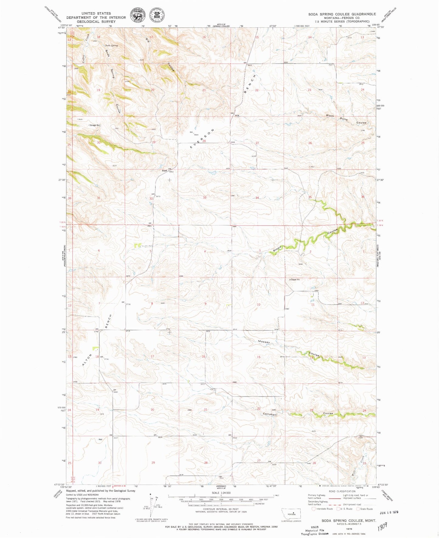
Historical USGS topographic quad map of Soda Spring Coulee in the state of Montana. Map scale may vary for some years, but is generally around 1:24,000. Print size is approximately 24" x 27"
This quadrangle is in the following counties: Fergus.
The map contains contour lines, roads, rivers, towns, and lakes. Printed on high-quality waterproof paper with UV fade-resistant inks, and shipped rolled.
Contains the following named places: 19N15E05BDB_01 Well, 19N15E08DCC_01 Well, 19N15E09DAA_01 Well, 19N15E11ACC_01 Well, 19N15E18BDD_01 Well, 59430, Alton Post Office, Alton School, Denton Division, Illinois School, Soda Spring, Soda Spring Coulee, Sunnyside School, Thompson School