
MyTopo
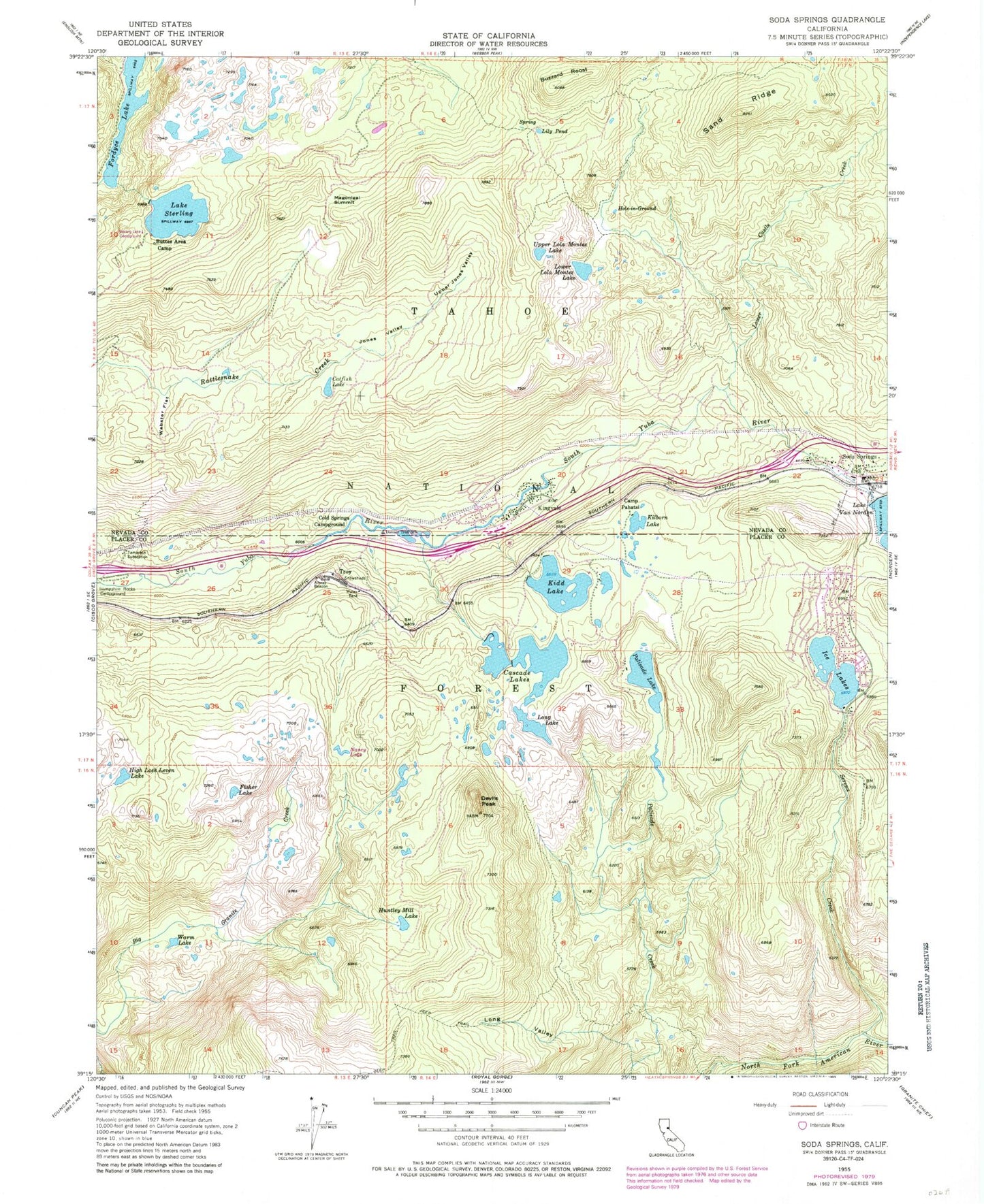
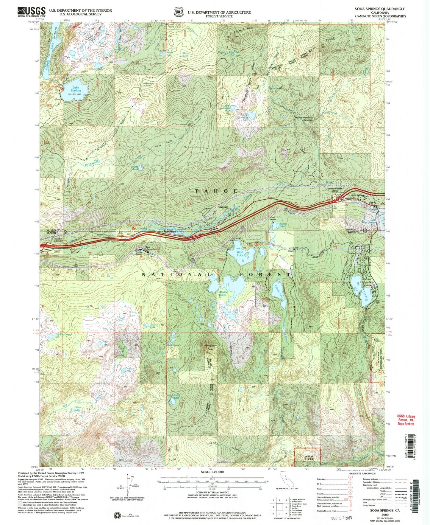
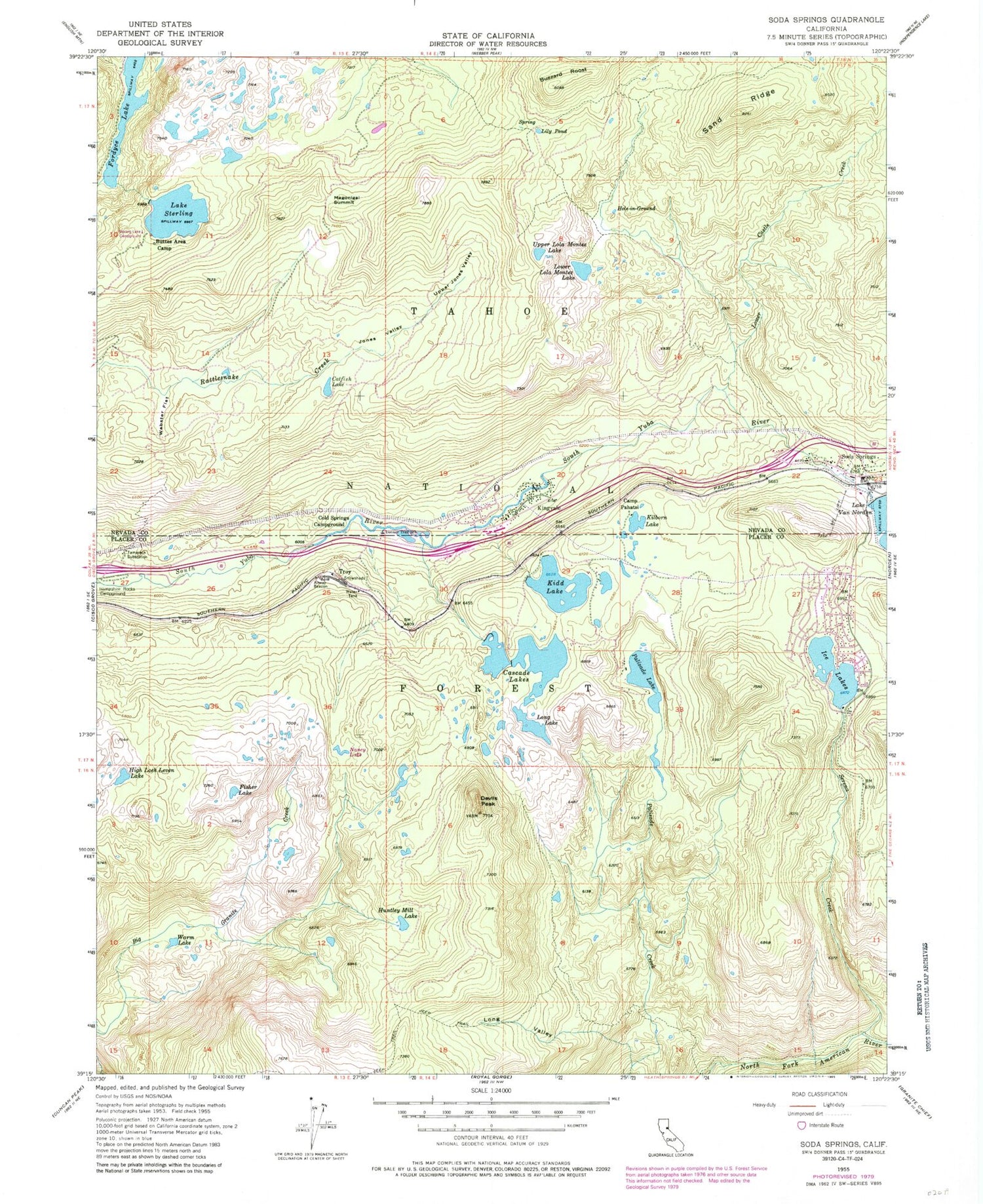
USGS Classic Soda Springs California 7.5'x7.5' Topo Map
Couldn't load pickup availability
Historical USGS topographic quad map of Soda Springs in the state of California. Scale: 1:24000. Print size: 24" x 27"
This quadrangle is in the following counties: Nevada, Placer.
The map contains contour lines, roads, rivers, towns, lakes, and grids including latitude / longitude and UTM / MGRS. Printed on high-quality waterproof paper with UV fade-resistant inks.
Contains the following named places: Buttes Area Camp, Buzzard Roost, Camp Pahatsi, Cascade Lakes, Catfish Lake, Cold Springs Campground, Devils Peak, Donner Trail Elementary School, Fisher Lake, Hampshire Rocks Campground, High Loch Leven Lake, Hole-In-Ground, Huntley Mill Lake, Jerry Lake, Jones Valley, Kidd Lake, Kilborn Lake, Kingvale, Lily Pond, Long Lake, Long Valley, Lower Castle Creek, Lower Lola Montez Lake, Magonigal Camp, Nancy Lake, Palisade Lake, Sand Ridge, Serena Creek, Soda Springs, Lake Sterling, Upper Jones Valley, Upper Lola Montez Lake, Warm Lake, Webster Flat, Ice Lakes, Mossy Pond West Trail, Glacier Lakes Trail, Derry Lake, Donner Summit, Lola Montez Trail, Glacier Trails Boy Scouts of America Camp, Heath Falls Overlook Trail, Kidd Lake Campgrond, Long Valley Trail, Tamarack Substation, Mount Marliave, Palisades Creek Trail, Mossy Pond East Trail, Magonigal Summit, Troy, Soda Springs Ski Area, Natalie Lake, Kidd Lake 97-025 Dam, Lake Sterling 97-030 Dam, Lower Peak Lake 97-037 Dam, Upper Peak Lake 97-047 Dam, Ice Lakes 1324 Dam, Sterling Lake Campground, Soda Springs Post Office, Van Norden Campground, Dulzura Lake, Serena Lake, Spruce (historical), Tamarack (historical), Truckee Fire Protection District Station 98 Serene Lakes, Truckee Fire Protection District Station 97, Kingvale Census Designated Place, Soda Springs Census Designated Place, Tamarack (historical)