MyTopo
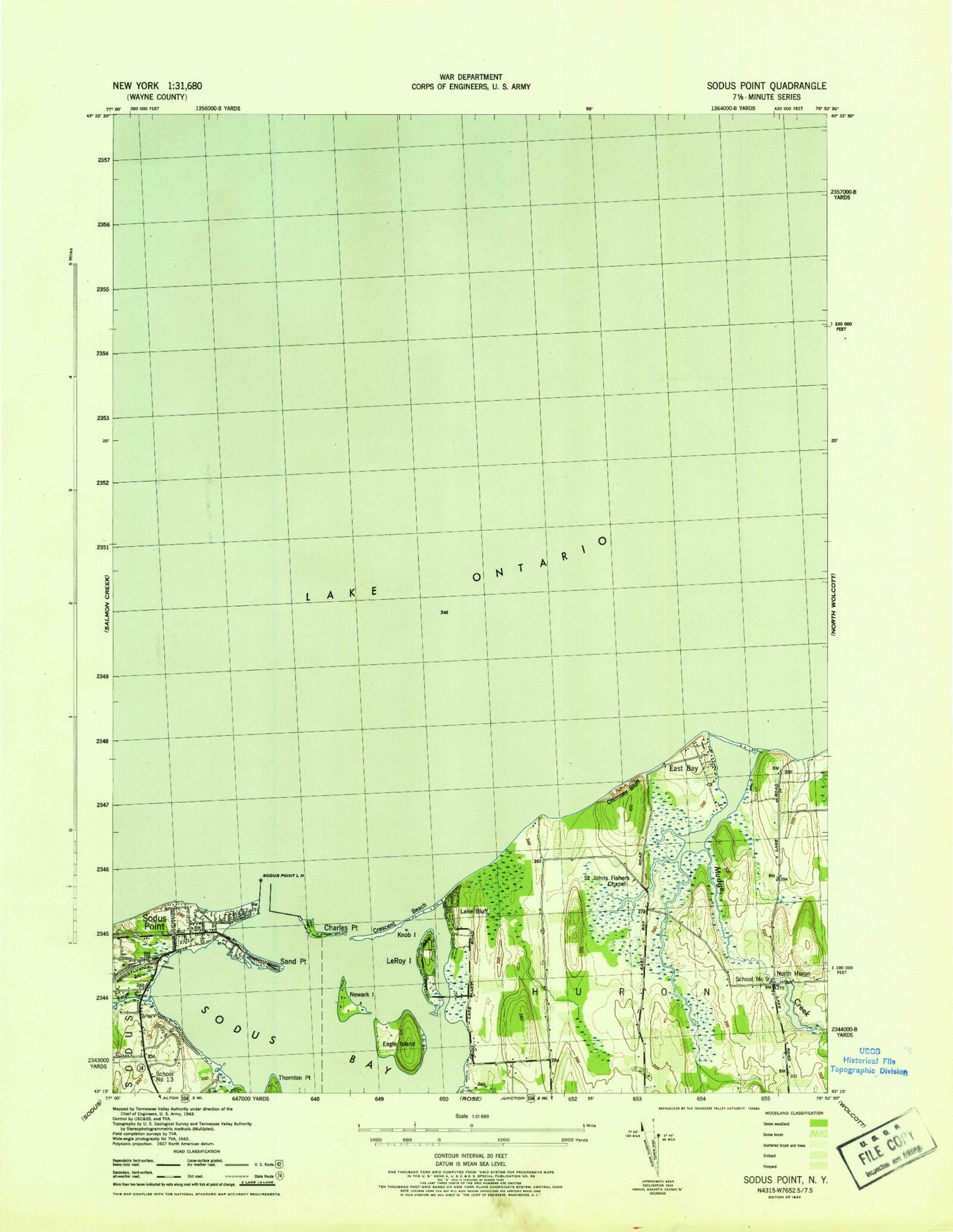
Classic USGS Sodus Point New York 7.5'x7.5' Topo Map
Couldn't load pickup availability
Historical USGS topographic quad map of Sodus Point in the state of New York. Map scale may vary for some years, but is generally around 1:24,000. Print size is approximately 24" x 27"
This quadrangle is in the following counties: Wayne.
The map contains contour lines, roads, rivers, towns, and lakes. Printed on high-quality waterproof paper with UV fade-resistant inks, and shipped rolled.
Contains the following named places: Arneys Marina, Charles Point, Chimney Bluff, Connellys Cove, Crescent Beach, Eagle Island, East Bay, East Bay Park, East Pier Light, First Creek, Hog Island, Knob Island, Lake Bluff, Lake Bluff Campground, Le Roy Island, Mudge Creek, Newark Island, North Huron, Root Swamp, Saint Johns Chapel, Sand Point, School Number 13, School Number 9, Sills Marina, Skippers Landing Marina, Sodus Bay, Sodus Bay Marina, Sodus Bay Yacht Club, Sodus Outer Light, Sodus Point, Sodus Point Fire Department, Sodus Point Lighthouse, Sodus Point Post Office, Thornton Point, Thorpe Vineyard, Village of Sodus Point, ZIP Code: 14555