MyTopo
Classic USGS Solano New Mexico 7.5'x7.5' Topo Map
Couldn't load pickup availability
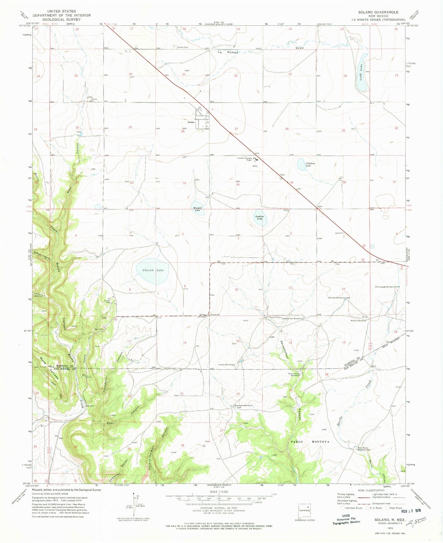
Historical USGS topographic quad map of Solano in the state of New Mexico. Map scale may vary for some years, but is generally around 1:24,000. Print size is approximately 24" x 27"
This quadrangle is in the following counties: Harding, San Miguel.
The map contains contour lines, roads, rivers, towns, and lakes. Printed on high-quality waterproof paper with UV fade-resistant inks, and shipped rolled.
Contains the following named places: Barn Point Windmill, Bowmann Windmill, Bradley and Upton, Burro Canyon, Callahan Lake, Canada Bonita, Canon Vigas, Church Lake, Deer Canyon, Goodhue Lake, Harding County Fire District 1 Burro Hill Substation, Harding County Fire District 1 Solano Substation, Heafner, Herton Windmill, Johnson Windmill, La Pompa Draw, Ladd Lake, Leatherman Windmill, McNeil Windmill, Mesa Cortada, Ross Canyon, Seventyfour Windmill, Solano, Solano Cemetery, Solano Post Office, Solano Weather Station, Steinbaugh Windmill, Thompson Canyon, Trujillo Camp, Westfall Lake, ZIP Code: 87746