MyTopo
Classic USGS Soledad Mountain California 7.5'x7.5' Topo Map
Regular price
$16.95
Regular price
Sale price
$16.95
Unit price
per
Couldn't load pickup availability
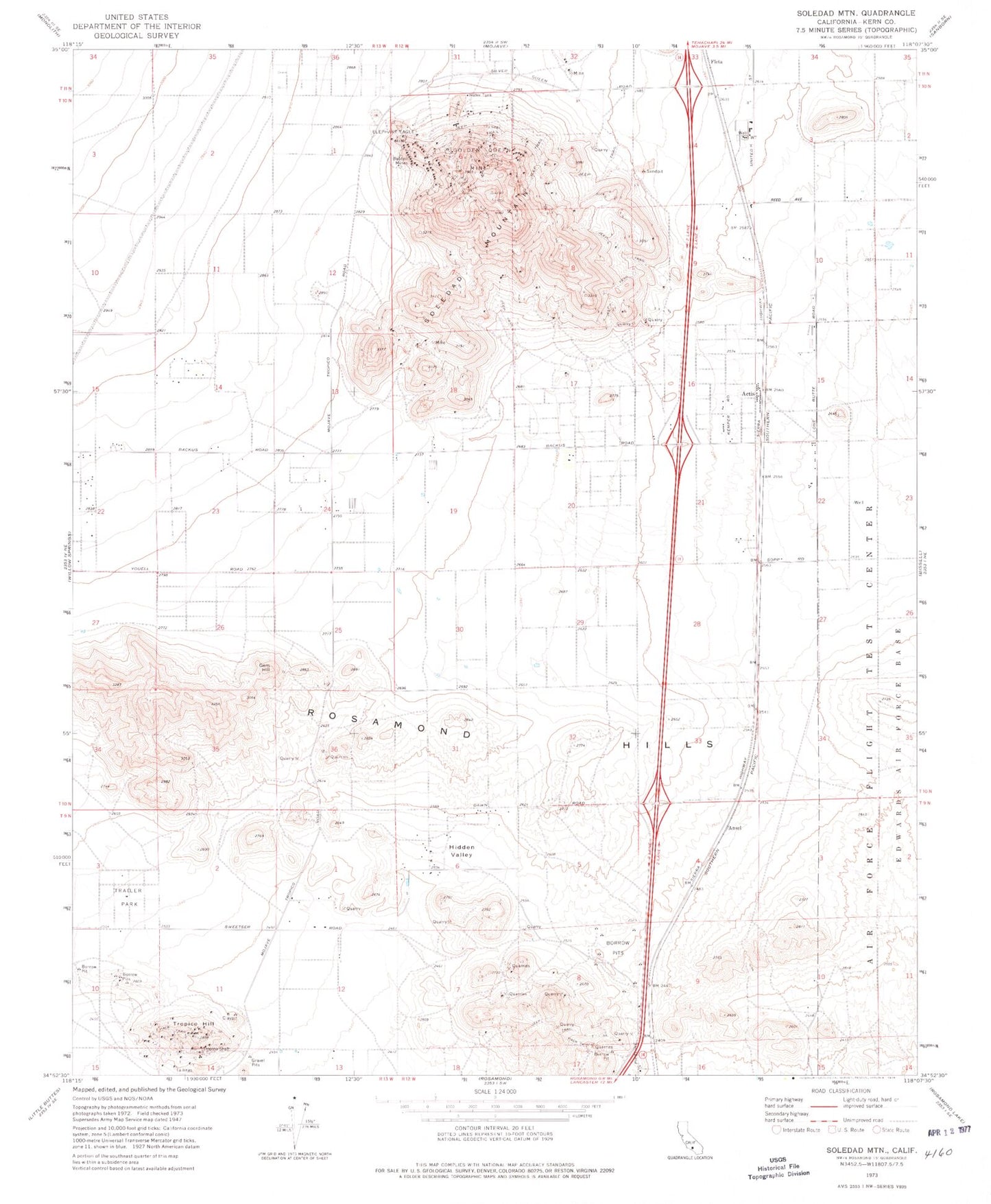
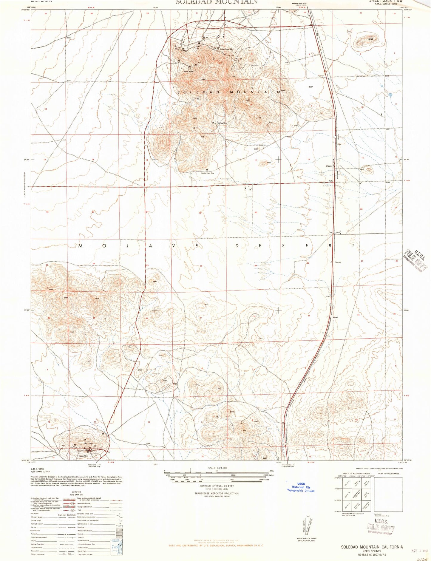
Historical USGS topographic quad map of Soledad Mountain in the state of California. Map scale may vary for some years, but is generally around 1:24,000. Print size is approximately 24" x 27"
This quadrangle is in the following counties: Kern.
The map contains contour lines, roads, rivers, towns, and lakes. Printed on high-quality waterproof paper with UV fade-resistant inks, and shipped rolled.
Contains the following named places: Actis, Ansel, Bobtail Mines, Double Eagle Mine, Eaires, Elephant Eagle Mine, Fiss Hill, Gem Hill, Gloster, Golden Queen Mine, Hidden Valley, KHXT-FM (Mojave), Pontious Airport, Rosamond Hills, Soledad Mountain, Tip Top Mine, Tropico Hill, Tropico Shaft